Grove, Virginia facts for kids
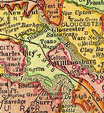
Grove is a small community in the southeastern part of James City County, Virginia. It's located in the middle of the "Historic Triangle" of Colonial Virginia. This area includes famous places like Jamestown, Williamsburg, and Yorktown. These historic sites are connected by the Colonial Parkway, making the area a very popular spot for tourists.
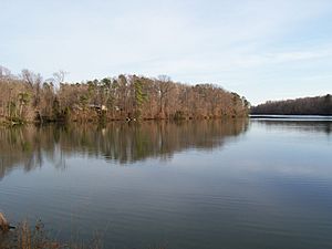
Grove is about 7 miles (11 km) east of Williamsburg, along U.S. Route 60. The James River borders Grove to the south. Skiffe's Creek separates Grove from the city of Newport News near Lee Hall.
Important historical sites in Grove include Wolstenholme Towne. This was an early English settlement that was rediscovered in 1976. It's located on the grounds of Carter's Grove Plantation, a beautiful old house built in 1755. Carter's Grove was open to the public for many years but is now privately owned.
Grove's modern story began after the American Civil War. Many freedmen (formerly enslaved African Americans) from Carter's Grove and other plantations settled here. The population was small until the 1900s. During the two World Wars, Grove grew a lot. This was partly because many African Americans, who had to leave their homes due to new military bases nearby, moved to Grove. These bases included the Naval Weapons Station Yorktown, Cheatham Annex, and Camp Peary.
Today, Grove continues to grow with new homes and businesses. Areas near the James River and Skiffe's Creek are set aside for industrial businesses. This makes Grove an attractive place for new companies.
Contents
Exploring Grove's Landscape
Grove is in a narrow part of James City County. It has the James River to the south and York County to the north. Most of Grove was once covered in thick forests, and much of it still is today.
Grove Creek and Skiffe's Creek are two streams that flow into the James River, helping to drain the land. Skiffe's Creek also forms the eastern border of Grove. This border is where James City County meets the Lee Hall area of Newport News.
The old Chesapeake and Ohio Railway (C&O) tracks run along the northern edge of Grove. These tracks are now part of CSX Transportation's rail system.
Early Days: 1600s to 1800s
Native American History
For thousands of years, different groups of indigenous peoples lived along the waterways in this area. Before Europeans arrived, these groups were mostly hunter-gatherers. The Kiskiack Indian village, called Chiskiack, was located a few miles north of Grove. The Kiskiack were one of many Algonquian-speaking tribes when the English first came.
When English settlers founded Jamestown in 1607, the powerful Powhatan Chiefdom controlled most of the local tribes. Their leader, also called the Powhatan, had created a large empire called Tenakomakah. Its capital, Werowocomoco, was about 15 miles (24 km) from Grove, on the York River.
By the mid-1600s, the English had forced most Native Americans onto reservations north of the York River. Some Native Americans also blended into the general population, living and working alongside European colonists and freed African people.
Martin's Hundred and Wolstenholme Towne
The first English settlers arrived in Virginia in 1607 and established Jamestown. After a few tough years, the colony began to grow. Settlers started plantations along the James River, mainly to grow tobacco. This crop became very successful for export in 1612, thanks to colonist John Rolfe.
The Grove area was first settled by English colonists in 1618. It was part of a large plantation called Martin's Hundred, which covered over 20,000 acres (80 sq km). This plantation was run by a London-based investment group. The administrative center for Martin's Hundred was a new settlement called Wolstenholme Towne.
Sadly, many people in Wolstenholme Towne were killed in the Indian Massacre of 1622. This was one of the biggest losses of life for Virginia settlers during the colonial period. The settlers rebuilt the town a few years later. However, they abandoned Wolstenholme Towne around 1643 when Williamsburg became the capital. The site was lost until it was rediscovered in 1976.
From Colony to County
In 1624, the Virginia Company lost its charter, and Virginia became a royal colony, directly controlled by the English king. In 1634, the English Crown created eight "shires" (like counties) in the colony. James City Shire was named after King James I. Around 1642–43, its name was changed to James City County.
Slavery and Freedom
The first enslaved Africans were brought to Virginia in 1619. At first, some Africans came as indentured servants, who could earn their freedom after a set time. But by the late 1600s, the system became much harsher, creating a racial system of slavery for African workers and their families. Dutch and British ships brought many enslaved people from Africa to Virginia. On tobacco plantations, enslaved people replaced indentured laborers.
Some enslaved people gained their freedom early on. Some were freed by their owners, others earned money to buy their freedom, and some escaped. Many free African American families in Virginia during colonial times were formed when white working-class women and African men married or had children. Their children were free because, by law, they inherited the status of their white mother.
These free African Americans were known as "free Negroes" or "free people of color". Some stayed in the area, while others moved to cities or frontier areas where rules about race were less strict.
During the American Civil War (1861–1865), many enslaved people gained their freedom. Even though Virginia left the Union, the U.S. Army held Fort Monroe at the end of the Virginia Peninsula. This fort became a safe place for enslaved people seeking freedom. By 1863, many heard President Lincoln's Emancipation Proclamation read under the Emancipation Oak, which is now at Hampton University.
After the war, many freedmen settled in the Peninsula's inland areas. They became landowners, tenant farmers, or workers. While large plantations covered the southern side of the peninsula, the northern side along the York River was less developed. Many freedmen moved here, creating strong communities in mixed towns and in towns mainly settled by Black people, like Lackey and Magruder.
Carter's Grove Plantation
More than 100 years after Wolstenholme Towne was abandoned, Carter's Grove Plantation was built on part of the Martin's Hundred land. The beautiful plantation house was finished in 1755. Over the years, different owners made changes to the mansion.
The Colonial Williamsburg Foundation (CW) owned Carter's Grove from 1969 to 2007. They furnished the mansion with period pieces and opened it to the public for tours. Visitors could also see reconstructed slave quarters. However, public access ended in 2003.
In 1976, CW archaeologists rediscovered the lost site of Wolstenholme Towne near the river. They explored the site, and parts of Wolstenholme Towne were rebuilt for public tours.
In 2003, CW decided to focus on attractions closer to downtown Williamsburg. They closed Carter's Grove to the public, which reduced tourist interest in the Grove community. CW sold Carter's Grove to private owners in 2007. The property has been closed to the public since 2003.
Grove's Beginnings
The Grove Community is about a mile inland from the river, next to the large Carter's Grove plantation. It was formed by freedmen after the Civil War and named after nearby Grove Creek. Many freedmen likely continued to work at the plantation as farmers after the war. Until 1918, Grove was a small community of farmers and fishermen. In 1895, Grove had 37 people and its own post office. Today, it stretches about 4 miles (6 km) along U.S. Route 60, also known as the Pocahontas Trail.
Grove Station and the Railroad
Nearby, Grove Station was built by the Chesapeake and Ohio Railway (C&O). In 1881, the C&O extended its railway through the area to reach the coal piers and the new city of Newport News. The main goal of the railroad was to transport coal.
Local train stations were built in James City County, including one at Grove. While Grove Station is no longer there, other former C&O stations like the one in Williamsburg still exist. The Williamsburg station serves Amtrak passenger trains today.
Grove in the 20th Century and Today
In the first half of the 1900s, Grove grew quickly during the World Wars. Many African American residents moved here after the U.S. Navy took their land for military bases in nearby York County. With the money they received, these new residents built homes in Grove that had modern features like electricity and running water.
Today, Grove has homes, churches, local shops, a nursing home, day care centers, and a modern community center. It also has a special school that is part of the Williamsburg-James City County Public Schools.
Moving from "the Reservation"
Before World War I, many African Americans lived near Lackey in York County. They had bought land or rented it after the Civil War, creating a close-knit community.
In 1917, the U.S. Navy decided to build a large supply and munitions base near Yorktown. The Navy took a lot of land, displacing about 600 residents, mostly African Americans who were farmers and fishermen. Many of these families moved to Grove in James City County.
A notable person from this time was John Tack Roberts. Born into slavery around 1860, he became a farmer and a self-taught magistrate (a type of judge). He was known as "Judge Roberts" and helped families displaced from "the Reservation" get fair payment from the government. The Grove area is now part of the Roberts Magisterial District, possibly named in his honor.
Camp Wallace and New Developments
During World War I, Camp Abraham Eustis was established in 1918. A satellite facility, Camp Wallace, was also set up in Grove for artillery training. This camp later became Fort Eustis. During World War II, when racial segregation laws were still in place, many Black U.S. Army personnel at Fort Eustis had to live in separate housing in the Grove Community.
In 1971, the U.S. Army traded the former Camp Wallace land with Anheuser-Busch. This land, along with land sold by Colonial Williamsburg, became part of a huge private development. The Busch Gardens Williamsburg theme park opened in 1975, along with a large brewery and the Kingsmill Resort.
Road Improvements
With more cars on the road in the early 1900s, improving highways became important. In the 1920s, the new U.S. Route 60 was built through Grove from Williamsburg. This road displaced some homes and businesses. It crossed Skiffe's Creek into Warwick County to Lee Hall.
U.S. Route 60 is still the main road through Grove's residential and business areas. It runs parallel to the four-lane State Route 143 and Interstate 64.
Moving from Magruder
During World War II, the U.S. Navy acquired another small town called Magruder, located north of Williamsburg. This land was used to build Camp Peary, a base for Seabee training. Like Grove, Magruder was mostly home to African American residents.
Many residents from Magruder moved to Grove. For example, the Mt. Gilead Baptist Church relocated from Magruder to Grove, building a new church along U.S. 60 in 1943. Magruder Avenue in Grove was likely named after the many new residents from the former town of Magruder.
A small, historic part of northwestern Grove is actually in York County.
Grove Today
The Grove community is home to about 1,100 families. It has schools, churches, and local businesses. It uses a rural postal delivery route and shares the mailing address of Williamsburg, Virginia.
Between Williamsburg and Grove, you'll find Anheuser-Busch facilities, including their brewery, Busch Gardens Williamsburg theme park, and the Kingsmill resort. Grove has also attracted industrial businesses that support regional companies.
Homes in Grove
Grove is mostly a "bedroom community", meaning many people live here and commute to work elsewhere. Housing in Grove is often more affordable than in other parts of James City County. Many families have lived here for generations. Homes include older detached houses, many from the World War periods, and newer houses in both old and new neighborhoods. There are also condominium projects and mobile home parks.
Community Services
James River Elementary School and the Abram Frink Community Center are located together in a modern complex. The elementary school is a special "magnet school" that offers the International Baccalaureate Primary Years Programme.
Grove has five churches, two nursing homes, two day-care centers, and a fire station. The Grove Christian Outreach Center (GCOC) helps families in need and connects them with community resources like the local food bank.
Businesses and Industry
Near Grove's eastern edge, there's the James River Enterprise Zone. This area is planned for industrial uses and offers state and local benefits to businesses that move there, invest, and create jobs.
Since 1996, this zone has attracted businesses like a Ball Manufacturing plant, which makes aluminum cans for the Anheuser-Busch brewery. A Wal-Mart distribution center and a Haynes furniture warehouse are also located here. Other companies, like a masonry supply firm and a Volvo equipment rental facility, have also opened in Grove.
Improving Roads
For several years, James City County has worked to improve U.S. Route 60 between Grove and Newport News. The goal is to make it easier for trucks from Grove's industrial areas to reach Interstate 64. This would also reduce heavy truck traffic on the current two-lane road that goes through residential areas and past schools.
In 2007, Virginia approved funding for a project to move parts of U.S. Route 60. The new road will bypass the two-lane section through the historic Lee Hall community. This plan aims to keep the quiet, two-lane feel of Route 60 through Grove and Lee Hall.
Getting Around
Grove has few tourist jobs, especially since Carter's Grove Plantation closed in 2003. Many residents use the Williamsburg Area Transit Authority (WATA) public bus system to get to work, shopping, and other places. They can also connect to other bus routes at the Williamsburg Transportation Center. Amtrak trains, Greyhound Lines buses, and taxicabs are also available in Williamsburg.
The WATA bus route serving Grove runs along U.S. Route 60 through the entire community. It connects Grove to the Wal-Mart distribution center and the growing industrial park. It also provides a connection to the larger Hampton Roads Transit (HRT) system at Lee Hall in Newport News.
Famous People and Places
- Dr. J. Blaine "Jim" Blayton (1905–2002) was an important African American doctor in the Williamsburg area.
- Ron Springs was a former Dallas Cowboys football player.
- In the mid-1970s, the Busch Gardens Williamsburg theme park, a large brewery, and the Kingsmill planned community and resort were developed by Anheuser-Busch.
 | Calvin Brent |
 | Walter T. Bailey |
 | Martha Cassell Thompson |
 | Alberta Jeannette Cassell |


