Hampton Roads facts for kids
Quick facts for kids
Hampton Roads
|
||
|---|---|---|
| Virginia Beach–Norfolk–Newport News, VA–NC, Metropolitan Statistical Area | ||
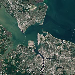
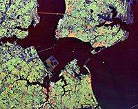
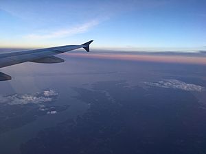
Satellite view of Hampton Roads with the Hampton Roads channel at center. (City urban centers visible, clockwise from top: Newport News, Hampton, Norfolk, Portsmouth)
|
||
|
||
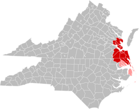
Jurisdictions in the Hampton Roads MSA are colored in red. Jurisdictions in the CSA, but not the MSA, are colored in pink.
|
||
| Country | United States | |
| State | Virginia North Carolina |
|
| Independent cities | - Virginia Beach - Norfolk - Chesapeake - Newport News - Hampton - Portsmouth - Suffolk - Williamsburg - Franklin - Poquoson |
|
| Counties | - James City County - York County - Isle of Wight County - Southampton County - Gloucester County - Mathews County - Camden (N.C.) County - Currituck (N.C.) County - Gates (N.C.) County |
|
| Settled | 1607 | |
| Area | ||
| • Metropolitan area | 3,729.76 sq mi (9,660.0 km2) | |
| • Land | 2,889.16 sq mi (7,482.9 km2) | |
| • Water | 840.6 sq mi (2,177 km2) | |
| • Urban | 527 sq mi (1,360 km2) | |
| Elevation | 0–144 ft (0–34 m) | |
| Population
(2020)
|
||
| • Metropolitan area | 1,799,674 | |
| • Density | 463.50/sq mi (178.96/km2) | |
| • CSA | 1,890,162 | |
| GDP | ||
| • MSA | $116.686 billion (2022) | |
| Time zone | EST | |
| • Summer (DST) | EDT | |
| Zip Codes |
VA:230xx,231xx,233xx,234xx,
235xx,236xx,237xx,238xx NC: 279xx |
|
| Area codes | 757, 804, 948, 252 | |
Hampton Roads is a special name for two things in the United States. First, it's a wide water channel where the James, Nansemond, and Elizabeth rivers meet. This channel is near where the Chesapeake Bay flows into the Atlantic Ocean. Second, "Hampton Roads" also refers to the large group of cities and counties around this water area. This region is mostly in southeastern Virginia and a small part of northeastern North Carolina.
The Hampton Roads area is famous for its big military bases and a harbor that never freezes. It also has many shipyards, places where coal is loaded onto ships, and lots of beautiful beaches. All these things help make the region's economy strong and diverse.
The water area of Hampton Roads is one of the world's largest natural harbors. It's like a safe parking spot for ships. Many rivers flow into it before reaching the Chesapeake Bay and the Atlantic Ocean.
The land area includes many cities and counties. Some areas further from the main harbor might also be considered part of "Hampton Roads." For example, the Hampton Roads metropolitan area includes parts of North Carolina. In 2022, about 1.8 million people lived here, making it one of the largest metropolitan areas in the U.S.
This area has many historical sites. The harbor was key to its growth, both on land and for water activities. While the waterways were great for travel, they also made it hard to build roads and bridges. Building and keeping up with transportation has always been a big challenge. Huge tunnels like the Hampton Roads Bridge–Tunnel (HRBT) and the Monitor–Merrimac Memorial Bridge–Tunnel (MMMBT) help people cross the water.
Contents
- What's in a Name? The Story of Hampton Roads
- Defining Hampton Roads: Cities and Counties
- Geography: Land and Water
- History: From Early Settlers to Modern Times
- Economy: A Hub of Activity
- Getting Around: Transportation in Hampton Roads
- Culture: Unique Identity and Fun Places
- Education: Learning in Hampton Roads
- Media: News and Entertainment
- Sports: Teams and Events
- See also
What's in a Name? The Story of Hampton Roads
The name "Hampton Roads" is very old, going back almost 400 years to when the English first settled here.
The name "Hampton" honors Henry Wriothesley, 3rd Earl of Southampton. He helped start the Virginia Company of London and supported the new colony. The first main town was called "Elizabeth Cittie," named after Princess Elizabeth, King James I's daughter. The town became known as "Hampton," and a nearby waterway was called Hampton Creek.
The word "Roads" means a safe place for ships to anchor near the shore. It's like a sheltered parking lot for boats. Other places around the world also use "Roads" in their names, like Castle Roads in Bermuda.
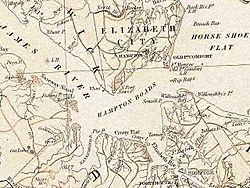
In 1755, the Virginia General Assembly officially recorded "Hampton Roads" as the name for the channel connecting the James, Elizabeth, and Nansemond rivers with the Chesapeake Bay.
Hampton Roads is one of the world's largest natural harbors. It's the biggest port on the East Coast of the U.S. that stays ice-free all year. This is very important for ships! Over time, the whole region became known as "Hampton Roads." The U.S. Postal Service even changed the area's postmark to "Hampton Roads, Virginia" in 1983.
Defining Hampton Roads: Cities and Counties
The U.S. Census Bureau defines the "Virginia Beach–Norfolk–Newport News, VA–NC, Metropolitan Statistical Area" (MSA). This area includes many cities and counties in Virginia and North Carolina. Even though the exact borders might be a bit different, "Hampton Roads" is the name most people use for this large metropolitan area.
In 2022, the population of this MSA was about 1.8 million people.
Virginia's Cities and Counties
In Virginia, cities are "independent cities," meaning they are not part of any county. The U.S. government treats these cities like counties for population counting.
Here are the cities and counties in Virginia that are part of the Hampton Roads area:
Counties
North Carolina's Counties
The Hampton Roads area also includes these counties in North Carolina:
How Hampton Roads Grew
The Hampton Roads metropolitan area was first defined in 1950. Over the years, more cities and counties joined the official metropolitan area as the region grew. For example, Virginia Beach and Chesapeake became part of it in the 1960s.
In 1983, the areas around Newport News and Hampton joined with the Norfolk-Virginia Beach-Portsmouth area. This created the larger "Norfolk–Virginia Beach–Newport News MSA" we know today.
Geography: Land and Water
The Hampton Roads area is part of the Tidewater region. This is a low-lying flat area in southeastern Virginia and northeastern North Carolina.
The water area of Hampton Roads is a wide channel. Here, the James River, Nansemond River, and Elizabeth River flow into the Chesapeake Bay and then the Atlantic Ocean. This channel is between Old Point Comfort to the north and Sewell's Point to the south.
The Hampton Roads region is experiencing the effects of sea-level rise more quickly than many other U.S. coastal areas. This is partly due to the Chesapeake Bay impact crater, a giant ancient meteor impact site.
The region has many beautiful natural spots. There are miles of beaches along the Atlantic Ocean and Chesapeake Bay. You can also find the Great Dismal Swamp, scenic rivers, state parks, and botanical gardens. Lake Drummond, one of Virginia's only two natural lakes, is also here.
The land area of Hampton Roads is usually split into two parts: the eastern Virginia Peninsula and South Hampton Roads (also called "the Southside"). The main harbor separates these two areas. Most people agree that the seven major cities, two smaller ones, and three counties in these two areas are part of Hampton Roads.
The Hampton Roads area has nine independent cities. Chesapeake, Norfolk, Portsmouth, Suffolk, and Virginia Beach are on the Southside. Hampton, Newport News, Poquoson, and Williamsburg are on the Peninsula.
The metro area also includes counties in Virginia and one in North Carolina. These include Isle of Wight and Surry on the Southside. On the Virginia Peninsula, there are James City and York. Gloucester and Mathews are on the Middle Peninsula. Currituck County is in North Carolina.
History: From Early Settlers to Modern Times
Early Beginnings (17th–19th Centuries)
The first English colonists arrived in 1607. Captain Christopher Newport landed at Cape Henry, which is now Virginia Beach. This event is called the "First Landing." They then moved up the James River to find a safer spot. On May 14, 1607, they started the first successful English colony in the New World at Jamestown Island.
The harbor and rivers of Hampton Roads were quickly seen as great places for trade, building ships, and military bases. Forts were built as early as 1610 at Old Point Comfort. The Gosport Navy Yard (now Norfolk Naval Shipyard) started in 1767.
During the American Civil War (1861–1865), a famous naval battle happened here in 1862. It was the Battle of Hampton Roads between the first American ironclad warships, the USS Monitor and the CSS Virginia. Later, Union forces took control of Hampton Roads. In 1865, President Abraham Lincoln even met with Confederate leaders here to try and make peace, but it didn't work.
Many formerly enslaved people found freedom near Fort Monroe. One of them was Booker T. Washington, who went to a local school that later became Hampton University.
The 20th Century and Beyond
In 1907, a big event called the Jamestown Exposition was held at Sewell's Point to celebrate 300 years since Jamestown was founded. Many important people visited, and the U.S. Great White Fleet showed off its ships. Navy leaders noticed how perfect the harbor was.
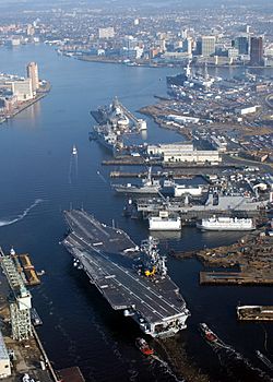
Because of this, in 1917, the Naval Station Norfolk was built at Sewell's Point. It grew to become the largest Naval Base in the world!
During World War I and World War II, large areas of land were taken for military use. This created places like the U.S. Naval Weapons Station Yorktown. Many communities were moved to make way for these bases.
Colonial Williamsburg: A Step Back in Time
After a big fire, Williamsburg became the capital of Virginia in 1699, taking over from Jamestown. It was the capital until 1780. Over time, Williamsburg became a quiet town.
An Episcopal priest named Dr. W.A.R. Goodwin had a dream to save the old buildings. He wanted to turn Williamsburg into the world's largest living museum. With help from John D. Rockefeller Jr., they restored many old buildings and created Colonial Williamsburg.
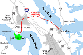
By the 1930s, Colonial Williamsburg became the heart of the Historic Triangle of Colonial Virginia. This triangle includes Jamestown (where the colony began), Williamsburg (the capital), and Yorktown (where America won its independence). These three spots are connected by the beautiful National Park Service's Colonial Parkway. The Historic Triangle is now a huge tourist attraction in Virginia.
Economy: A Hub of Activity
Hampton Roads is home to two very large companies: Dollar Tree (retail) and Huntington Ingalls Industries (shipbuilding).
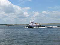
Hampton Roads is known as the "world's greatest natural harbor." The port is very deep and never freezes, making it perfect for ships. It's a top port in the U.S. for foreign trade and is number one for exporting coal. The port can load over 65 million tons of coal each year!
Because of this, the region's economy relies a lot on the port. This includes shipbuilding, ship repair, naval bases, and handling cargo. Many people also work for the federal government here, especially in the military.
The harbor is a busy highway for trade, especially for the cities of Norfolk, Portsmouth, and Newport News.
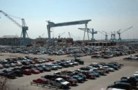
Huntington Ingalls Industries is the world's largest shipyard and is located in Newport News. In Portsmouth, you'll find the historic Norfolk Naval Shipyard. There are also many smaller shipyards and docks.
Big coal piers were built here long ago by railway companies. Today, Norfolk Southern Railway still exports coal from Lambert's Point in Norfolk.
Federal Government's Big Role
Almost 80% of the region's economy comes from federal sources. This means a huge military presence, plus NASA and other government offices.
Hampton Roads has the largest number of military bases in the world. Nearly a quarter of all active-duty military personnel in the U.S. are stationed here! All five military services have operations here. The Naval Station Norfolk is the biggest naval base in the world. Langley Air Force Base is also a major Air Force command center.
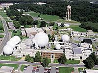
NASA's Langley Research Center in Hampton is where scientists do aerospace research. The Thomas Jefferson National Accelerator Facility (Jefferson Lab) in Newport News is also a major science center.
Shopping and Growth
The area has a long history with shopping centers. In 1918, Afton Square in Portsmouth was the first planned shopping center in the U.S.
After World War II, Hampton Roads grew a lot. In 1959, the JANAF Shopping Center opened in Norfolk, becoming one of the largest on the East Coast. Later, indoor shopping malls like Pembroke Mall (1966) and Coliseum Mall (1973) became popular.
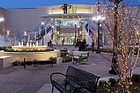
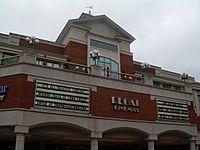
Today, Lynnhaven Mall in Virginia Beach is the region's largest shopping center. MacArthur Center in downtown Norfolk is also a popular shopping spot.
Some older malls have been updated or torn down to make way for new "lifestyle centers" with outdoor shops and restaurants.
| Shopping mall | Location | Number of stores | Area | Year opened |
|---|---|---|---|---|
| Lynnhaven Mall | Virginia Beach | 180 | 1,400,000 sq ft (130,000 m2) | 1981 |
| MacArthur Center | Norfolk | 140 | 1,100,000 sq ft (100,000 m2) | 1999 |
| Chesapeake Square Mall | Chesapeake | 130 | 800,000 sq ft (70,000 m2) | 1989 |
| Greenbrier Mall | Chesapeake | 120 | 809,017 sq ft (75,160 m2) | 1981 |
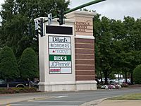
| Patrick Henry Mall | Newport News | 120+ | 714,310 sq ft (66,400 m2) | 1987 |
America's First Region
In 2006, a group called the Hampton Roads Partnership started calling the area "America's First Region." This is because the first English settlers landed here in 1607 at Cape Henry (Virginia Beach) before settling in Jamestown Island. The boundaries of the region haven't changed much since then.
Getting Around: Transportation in Hampton Roads
Historically, the harbor was key to how Hampton Roads grew. Waterways were important for travel, but they also made it hard to build roads across the water.
Today, the region faces challenges with traffic. The existing bridges and tunnels are getting old, and more are needed. In 2007, a new group was formed to find money for big transportation projects, like another crossing over the harbor.
There are two main airports: Newport News/Williamsburg International Airport and Norfolk International Airport. They serve passengers from all over Hampton Roads.
Amtrak trains connect the region to cities like Richmond, Washington, D.C., and Boston. Buses also help people get around locally.
In 2011, a light rail service called The Tide started in Norfolk. It was the first light rail in Virginia!
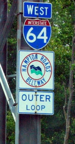
The Hampton Roads area has many Interstate Highways, like Interstate 64. The Hampton Roads Beltway is a 56-mile loop that crosses the harbor using two toll-free bridge–tunnels: the Hampton Roads Bridge–Tunnel and the Monitor–Merrimac Memorial Bridge–Tunnel.
Other important crossings include the Midtown Tunnel and the Downtown Tunnel between Portsmouth and Norfolk. The Chesapeake Bay Bridge-Tunnel is a 17-mile toll facility that connects the region to Virginia's Eastern Shore.
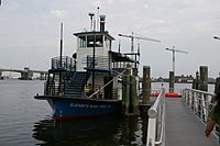
The region also has two types of public ferries. A passenger ferry runs between downtown Norfolk and Portsmouth. The Jamestown Ferry carries cars and people across the James River between Jamestown and Surry County. It's free and runs 24 hours a day!
Culture: Unique Identity and Fun Places
The Hampton Roads area is part of the larger American South. People who grew up here often have a special "Tidewater accent" that sounds a bit different from other Southern accents.
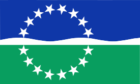
Flag of Hampton Roads
In 1998, the Hampton Roads region got its own flag. A sixteen-year-old student named Andrew J. Wall designed it.
The flag has a lot of meaning:
- The 16 white stars stand for the cities and counties in the region.
- The blue top part represents the sea and sky. It reminds us of the first settlers, important naval battles, shipbuilding, trade, fishing, and military bases.
- The green bottom part shows agriculture, nature, tourism, and a good quality of life.
- The wavy white band in the middle with three crests represents the past, present, and future. It also looks like ocean waves and sand dunes. Water is the main theme, connecting everything in the region.
Fun Places to Visit
Parks and Outdoor Fun
- The Norfolk Botanical Garden, opened in 1939, is a huge 155-acre garden with plants and trees.
- The Virginia Zoological Park has hundreds of animals, including rare Siberian tigers.
- First Landing State Park and False Cape State Park in Virginia Beach offer camping, cabins, and nature tours.
- Newport News Park is a large park with trails, a golf course, camping, and even an archery range.
The region also has fun amusement parks!
- Atlantic Fun Park in Virginia Beach has rides.
- Ocean Breeze Waterpark has water slides and pools.
- Busch Gardens Williamsburg and Water Country USA are major theme parks in Williamsburg.
Historic Triangle: A Trip Through Time
The Historic Triangle is on the Virginia Peninsula. It includes Jamestown, Williamsburg, and Yorktown. The National Park Service's Colonial Parkway connects these historic spots.
- Jamestown was the first permanent English settlement in America, started in 1607. You can visit Historic Jamestowne to see old ruins or Jamestown Settlement for a living history experience.
- Williamsburg was Virginia's capital from 1699 to 1780. The College of William & Mary, founded in 1693, is the second-oldest college in the U.S. Colonial Williamsburg lets you explore the restored historic city.
- Yorktown is famous as the place where the British surrendered to George Washington in 1781, ending the American Revolutionary War.
Museums on the Peninsula
- The Mariners' Museum in Newport News is all about maritime history. It has artifacts from the famous USS Monitor ironclad ship.
- The Virginia War Museum covers American military history with weapons, vehicles, and uniforms.
- The Virginia Living Museum combines a wildlife park, science museum, aquarium, and planetarium.
- The Peninsula Fine Arts Center has changing art exhibits and a "Hands on For Kids" gallery.
- The Hampton University museum is the oldest African American museum in the U.S.
- The Casemate Museum at Fort Monroe shows where Confederate President Jefferson Davis was held prisoner.
- The Virginia Air and Space Center in Hampton teaches about aviation and space, including the history of NASA's Langley Research Center.
Museums in South Hampton Roads
- The Chrysler Museum of Art in Norfolk is the region's main art museum, known for its glass collection.
- Nauticus, the National Maritime Center, in Norfolk has hands-on exhibits and is home to the battleship USS Wisconsin.
- The Douglas MacArthur Memorial in Norfolk is a museum about the famous General.
- The Children's Museum of Virginia in Portsmouth has a huge collection of model electric trains.
- The Norfolk Naval Shipyard in Portsmouth is one of the oldest shipyards.
- Rivers Casino Portsmouth offers games and entertainment.
- The Great Dismal Swamp National Wildlife Refuge in Suffolk and Chesapeake is a large natural area.
Music and Entertainment
Hampton Roads has a lively music scene with many clubs and festivals. Famous musicians from the area include Ella Fitzgerald (jazz) and Pharrell Williams (hip hop).
Large venues for live music and shows include:
- Veterans United Home Loans Amphitheater in Virginia Beach (20,000 seats)
- Norfolk Scope Arena in Norfolk (13,800 seats)
- Hampton Coliseum in Hampton (13,800 seats)
- Ferguson Center for the Arts in Newport News
Education: Learning in Hampton Roads
Each city and county in Hampton Roads manages its own K-12 public schools. There are also many private and religious schools.
The area has many colleges and universities. Some offer two-year degrees, while others offer advanced degrees like doctorates.
Colleges and Universities
Public Universities:
- College of William & Mary in Williamsburg: Founded in 1693, it's the second-oldest college in the U.S.
- Old Dominion University in Norfolk: Offers many undergraduate and graduate programs.
- Eastern Virginia Medical School in Norfolk: Known for its medical research.
- Norfolk State University in Norfolk: A large historically Black university.
- Christopher Newport University in Newport News: A public university.
Private Universities:
- Regent University in Virginia Beach: A private Christian university.
- Virginia Wesleyan University in Norfolk/Virginia Beach: A small private college.
- Hampton University in Hampton: A private historically Black university.
Two-Year Colleges:
- Tidewater Community College (campuses in Norfolk, Virginia Beach, Chesapeake, Portsmouth)
- Paul D. Camp Community College (Suffolk, Franklin, Smithfield)
- Virginia Peninsula Community College (Hampton, Williamsburg)
These colleges offer affordable two-year degrees and special training programs.
Media: News and Entertainment
Newspapers
Hampton Roads has three daily newspapers:
- The Virginian-Pilot (Southside)
- Daily Press (Peninsula)
- Suffolk News-Herald (Suffolk and Franklin)
Other local papers include the Virginia Gazette (Williamsburg), New Journal and Guide, and Inside Business (business news).
Magazines
- Coastal Virginia Magazine covers the region's lifestyle.
- Hampton Roads Times is an online magazine.
- Suffolk Living Magazine covers the City of Suffolk.
Television
The Hampton Roads area has many TV channels. Major networks like CBS, NBC, ABC, Fox, and PBS all have local stations. Cable TV is provided by Cox Communications and Verizon Fios.
Radio
Many radio stations serve Norfolk and the surrounding areas. They offer different types of music, news, talk shows, and sports.
Sports: Teams and Events
The Hampton Roads area is one of the largest in the U.S. without a major professional sports team (like in the NFL, MLB, NBA, NHL, or MLS).
Team Sports
- The Norfolk Tides are a professional baseball team in the International League. They play at Harbor Park.
- The Norfolk Admirals are a professional hockey team in the ECHL. They play at the Norfolk Scope arena.
- Lionsbridge FC is a pre-professional men's soccer team that plays at Christopher Newport University.
- The Peninsula Pilots are a summer baseball team that plays in Hampton.
On the college level, four Division I teams play here:
- Old Dominion Monarchs (Norfolk)
- Norfolk State Spartans (Norfolk)
- William & Mary Tribe (Williamsburg)
- Hampton Pirates (Hampton)
The Virginia Beach Sportsplex is a large stadium that has hosted soccer and field hockey events.
Individual Sports
- The Hampton Coliseum hosts wrestling events and the annual Hampton Jazz Festival.
- Virginia Beach hosts the East Coast Surfing Championships every year, a big surfing contest.
- Langley Speedway in Hampton has stock car races.
- The Kingsmill Championship, a professional golf tournament for women, is held annually near Williamsburg.
The Hampton Roads Sports Commission has also hosted the AAU Junior Olympics multiple times.
Professional Wrestling
Hampton Roads has been a popular spot for professional wrestling events. The Norfolk Scope and Hampton Coliseum have hosted many big shows from WWE and other wrestling companies.
See also
 In Spanish: Área metropolitana de Virginia Beach-Norfolk-Newport News para niños
 | Tommie Smith |
 | Simone Manuel |
 | Shani Davis |
 | Simone Biles |
 | Alice Coachman |


