
Gloucester County, Virginia facts for kids
Quick facts for kids
Gloucester County
|
||
|---|---|---|

Gloucester County Courthouse Square, historic district
|
||
|
||

Location within the U.S. state of Virginia
|
||
 Virginia's location within the U.S. |
||
| Country | ||
| State | ||
| Founded | 1651 | |
| Named for | Henry Stuart, Duke of Gloucester | |
| Seat | Gloucester Courthouse | |
| Largest community | Gloucester Point | |
| Area | ||
| • Total | 288 sq mi (750 km2) | |
| • Land | 218 sq mi (560 km2) | |
| • Water | 70 sq mi (200 km2) 24.4% | |
| Population
(2020)
|
||
| • Total | 38,711 | |
| • Density | 134.41/sq mi (51.90/km2) | |
| Time zone | UTC−5 (Eastern) | |
| • Summer (DST) | UTC−4 (EDT) | |
| Congressional district | 1st | |

Gloucester County (/ˈɡlɒstər/ GLOST-ər) is a county in the state of Virginia. In 2020, about 38,711 people lived here. Its main town, or county seat, is Gloucester Courthouse. The county was started in 1651 when Virginia was still a colony. It was named after Henry Stuart, Duke of Gloucester, who was the third son of King Charles I of England.
Gloucester County is part of the larger Hampton Roads area, which includes cities like Virginia Beach and Norfolk. It is located on the eastern side of the Middle Peninsula. The York River borders it to the south, and the Chesapeake Bay is to the east. These waterways were very important for its growth. Gloucester County is about 60 miles (97 km) east of Richmond, Virginia's capital.
Long ago, Werowocomoco, the main village of the powerful Powhatan Confederacy, was located here. This confederacy was a group of about 30 Native American tribes. In 2003, archaeologists found proof that a large village existed at this spot from the 1200s until the early 1600s.
When European colonists arrived, they mostly developed the county for growing tobacco. This crop was grown using the forced labor of enslaved Africans. Tobacco was one of the first important crops, but fishing also became a big industry. Many important families and leaders lived in Gloucester County before the American Revolutionary War. Thomas Jefferson even wrote some of his early works for Virginia while staying at Rosewell Plantation. This was the home of his close friend, John Page.
Today, Gloucester County still has a lot of farmland. Its fishing industry is also very important to Virginia. The main shopping area is around Gloucester Courthouse. Gloucester County is connected to York County by the George P. Coleman Memorial Bridge. This bridge crosses the York River and carries U.S. Route 17. Gloucester County is known as the "Daffodil Capital of the World." It holds a yearly daffodil festival, parade, and flower show.
Contents
Exploring Gloucester's Past
Ancient History
This area has been home to Native American groups for thousands of years. They were hunter-gatherers, meaning they hunted animals and gathered plants for food. Tools found here show people lived here at least since the late Woodland Period, around 1000 AD.
A very important village called Werowocomoco was settled around 1200 AD. It was home to Algonquian-speaking people. By the late 1500s, the Powhatan Confederacy was formed. This group included about 30 tribes in the coastal area. They spoke similar languages and were led by a powerful chief, known as the Powhatan. The Powhatan Confederacy had about 12,000 to 15,000 people in what is now Virginia. Werowocomoco was their main village and capital. It was on the north side of the York River, in what is now Gloucester.
These people had a complex society. Women grew crops like maize (corn), beans, and squash. They grew enough food to support many people in different settlements. Men hunted and fished. People also gathered nuts, berries, and other local foods.
Early European Visitors
Around 1570, Spanish Jesuit missionaries tried to start a mission called the Ajacan Mission. It was on the south side of the York River, across from Gloucester. However, Native Americans led by a Christian convert named Don Luis killed them. This happened near a village called Chiskiack.
When English settlers started Jamestown in 1607, they soon had conflicts with the local tribes. The English wanted land and resources. The two cultures had different ideas about owning land.
In late 1607, John Smith was captured. He was taken to Chief Powhatan at Werowocomoco. A famous story says Powhatan's daughter, Pocahontas, saved John Smith from being killed. Some historians wonder if this story is completely true. Smith visited Powhatan again later with other Englishmen.
Finding Werowocomoco Again
After 1609, Chief Powhatan moved his capital to a safer place inland. The original Werowocomoco village was abandoned, and its exact location was forgotten. Researchers later tried to find it using John Smith's old writings.
In 1977, archaeologist Daniel Mouer thought a site on Purtan Bay might be Werowocomoco. It was also about 12 miles (19 km) from Jamestown, matching Smith's notes. He found old pottery pieces from the Late Woodland Period.
More than 20 years later, a new landowner allowed digging. From 2002 to 2003, the Werowocomoco Research Group dug at the site. This group included the College of William and Mary, the Virginia Department of Historic Resources, and local tribes. They dug many test holes and found thousands of items. These included a blue bead that might have come from Europe. These finds, along with old descriptions, made researchers believe this was the ancient capital.
Archaeologists Thane Harpole and David Brown have worked at the site since 2002. They found that a spread-out village was here from 1200 AD to the early 1600s. They found pottery, stone tools, and remains of plants and animals. They also found English trade goods like glass and copper from Jamestown. The early colonists wrote that Powhatan was very interested in getting English items, especially copper.
This project is special because researchers worked closely with local Native American tribes. These tribes, like the Mattaponi and Pamunkey, are descendants of the Powhatan Confederacy. Such sites often have burials and sacred items important to these tribes.
Gloucester County celebrates Werowocomoco and other Powhatan sites as part of its history. In the Algonquian language, the chief's "village" meant the lands where he lived, not just one small spot. Powhatan tribes often moved their villages to let the land recover or find better water and hunting.
English Settlement and Growth
In 1619, the Virginia Company divided its settled areas into four "citties." Most of what became Gloucester County was part of "James Cittie." In 1634, King Charles I of England divided the colony into eight shires. York County was first called Charles River Shire.
The colonial government started giving out land grants here in 1639. But it wasn't until after 1644 that Gloucester was safe for settlers. By then, many Algonquian people had died from new diseases brought by Europeans. They had no protection against these illnesses. George Washington's great-grandfather received a land grant in Gloucester County in 1650.
County Changes Over Time
In 1651, Gloucester County was created from York County. It had four church areas called parishes: Abingdon, Kingston, Petsworth, and Ware. It was named after Henry Stuart, Duke of Gloucester. After the American Revolutionary War, Kingston parish became Mathews County in 1791. The other three parishes stayed in Gloucester.
Historic Plantations and Forts
During the 1600s and 1700s, Gloucester became a major tobacco-growing area. Tobacco was the main crop and made many planters wealthy. Many old plantations are still here.
The tip of land going into the York River was named Tyndall's Point by Robert Tyndall, a mapmaker for Captain John Smith. In 1667, colonists built forts there, at what was called Gloucester Point. These forts were rebuilt many times, from colonial times through the American Civil War. This spot is also famous for the "Second Surrender." General Charles Lord Cornwallis surrendered to General George Washington at Yorktown, and British forces in Gloucester surrendered an hour later.

The Guinea Area
One part of Gloucester County is called Guinea. It includes small towns like Achilles, Bena, Severn, and Big Island. This area, near Gloucester Point, has been the center of the county's seafood industry. Many families, like the Shackelford, Rowe, and West families, have worked in fishing here. Even though the industry has changed, it's still a big part of the community. The fishermen are known as "Guineamen." They speak a special way of Southern English.
No one is completely sure where the name "Guinea" came from. People have called this area "Guinea" since at least 1730. It might have been named after the Guinea region in Africa, as it was likely a place where enslaved people from that area were brought.
Some thought the name came from the American Revolutionary War. They believed Loyalists paid Hessian soldiers one guinea (an old coin) per day here. These soldiers might have been part of Cornwallis's army. Cornwallis sent British troops to Gloucester in October 1781 because it was important for controlling the York River.
Daffodil Capital
The history of the daffodil in Gloucester County is almost as old as the county itself. When Gloucester was formed in 1651, early settlers brought daffodil bulbs from England. They soon found that the soil and weather were perfect for them. The bulbs were shared among neighbors and grew wild by the early 1900s. The daffodil industry grew in the 1930s and 1940s, earning the county the title "Daffodil Capital of America." The county still holds a yearly daffodil festival.
_-_25.jpg)
Gloucester Today
Gloucester is a growing county and an important part of the Hampton Roads area. Growth in the Peninsula area has led to more development in Gloucester Point and Gloucester Courthouse. Main Street and U.S. Route 17 are key areas for businesses and community growth. Between 1970 and 2000, the county's population grew by over 60%. This brought more businesses and homes. Now, Gloucester is an important business center for the Middle Peninsula and nearby areas.
Companies like Canon Virginia have a recycling center here. They process old printer cartridges to reuse parts. Peace Frogs, a clothing brand with frog designs, is also based near Gloucester Courthouse.
The Virginia Institute of Marine Science (VIMS) is located in Gloucester Point. VIMS is the graduate school for marine science at the College of William and Mary.
Even with new development, Gloucester still has a lot of rural land and farms. This keeps its strong farming tradition alive.
Fun in Gloucester: Parks and Recreation
Gloucester County has many parks with different activities for everyone.
Abingdon Park
Abingdon Park is a small park next to Abingdon Elementary in Hayes. It has picnic areas, a soccer field, a softball field, a picnic shelter, and restrooms.
Ark Park
Ark Park is a medium-sized park off US Route 17 near the community of Ark. You can find a basketball court, playground, soccer field, softball field, and restrooms here.
Beaverdam Park

Beaverdam Park is a large park with many trails around a reservoir. You can go hiking, biking, boating, fishing, horseback riding, and picnicking. The Whitcomb Lodge can be rented for special events. The park also has many geocaches hidden near the trails. You can rent small boats, and you can launch your own non-gasoline boats for a small fee.
-

Near sunset.
-
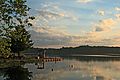
Another shot near sunset.


Brown Park
Brown Park is a small skate park on Foster Road near Gloucester Courthouse. It currently only has skateboarding areas. The Parks and Rec department hopes to add disc golf and a dog park in the future.
Gloucester Point Beach Park
Gloucester Point Beach Park is on the York River, next to the VIMS campus. It's a small park with a beach, a fishing dock, a playground, and a boat landing. There are also restrooms and a snack stand open in the summer.
Tyndall's Point Park
Tyndall's Point Park is in Gloucester Point. It was the site of a fort built by the English in the 1660s to protect the area. This spot was also used as a fort during the Revolutionary War and the Civil War.
Woodville Park
Woodville Park is a large park with walking trails, sports fields, and a memorial garden. It has soccer fields, sand soccer, sand volleyball, a community garden, and a pond. Woodville is the newest park in Gloucester County, and some parts are still being built.
Visiting Gloucester
Battle of the Hook Reenactment
In October 2008, about 2,000 people dressed as Revolutionary War soldiers gathered at Warner Hall. They reenacted the Battle of the Hook. This battle helped cut off supplies for General Cornwallis, forcing him to surrender at Yorktown on October 19, 1781. British and Hessian forces in Gloucester surrendered an hour later.
Daffodil Festival
The Gloucester Daffodil Festival is held every year. It celebrates the county's famous daffodils.
Many visitors also enjoy Gloucester's local ice cream shop and Antique Mall.
Historic Places to See
- Warner Hall: This was the home of Mildred Gale, the grandmother of George Washington. Today, it is a bed and breakfast.
- Rosewell: This was the home of John Page, a friend of Thomas Jefferson.
Virginia Institute of Marine Science (VIMS)

The Virginia Institute of Marine Science (VIMS) is a graduate school for marine science. It is part of the College of William and Mary, which is one of the oldest universities in the country. VIMS is located at Gloucester Point, right on the county's waterfront. They collect samples and measurements for the Chesapeake Bay here and have exhibits for visitors. Their yearly Marine Science Day attracts many people.
Learning in Gloucester: Education
Gloucester County Public Schools is the public school system for the county. It has nine public schools: five elementary schools (Kindergarten to 5th grade), two middle schools (6th-7th grade and 8th grade), and one high school (9th-12th grade).
Elementary Schools
The five elementary schools are:
- Abingdon
- Achilles
- Bethel
- Botetourt
- Petsworth
Classes usually have about 20 students with one teacher for the whole school year.
Middle Schools
The middle schools, Peasley and Page, use a special schedule called block scheduling and divide students into teams. Page Middle School was badly damaged by a tornado in 2011. A new school was built across the street from the old location in 2015.
High School
Gloucester High School (GHS) is currently being updated. Its mascot is a Duke.
Gloucester Courthouse: The Heart of the County


Gloucester Courthouse has a main street with three courthouses. One of them is a very old building listed on the National Register of Historic Places. Main Street also has many restaurants and shops. Botetourt Elementary School is located on Main Street. The county is improving the sidewalks in the town. The yearly daffodil parade also takes place along Main Street.
Gloucester's Location
Gloucester County covers about 288 square miles (746 km²). About 218 square miles (565 km²) is land, and 70 square miles (181 km²) is water.
Neighboring Counties
Gloucester County shares borders with:
- Middlesex County to the north
- Mathews County to the east
- York County to the south
- James City County to the southwest
- King and Queen County to the west
Main Roads
Important roads in Gloucester County include:
 US 17 (George Washington Memorial Highway)
 SR 3 (Burkes Point Road)
 SR 14 (John Clayton Memorial Highway)
 SR 33 (Lewis B. Puller Memorial Highway)
 SR 198 (Glenns/Dutton Roads)
 SR 216 (Guinea Road)
 SR 374 (College Drive)
People of Gloucester
| Historical population | |||
|---|---|---|---|
| Census | Pop. | %± | |
| 1790 | 13,498 | — | |
| 1800 | 8,181 | −39.4% | |
| 1810 | 10,427 | 27.5% | |
| 1820 | 9,678 | −7.2% | |
| 1830 | 10,608 | 9.6% | |
| 1840 | 10,715 | 1.0% | |
| 1850 | 10,527 | −1.8% | |
| 1860 | 10,956 | 4.1% | |
| 1870 | 10,211 | −6.8% | |
| 1880 | 11,876 | 16.3% | |
| 1890 | 11,653 | −1.9% | |
| 1900 | 12,832 | 10.1% | |
| 1910 | 12,477 | −2.8% | |
| 1920 | 11,894 | −4.7% | |
| 1930 | 11,019 | −7.4% | |
| 1940 | 9,548 | −13.3% | |
| 1950 | 10,343 | 8.3% | |
| 1960 | 11,919 | 15.2% | |
| 1970 | 14,059 | 18.0% | |
| 1980 | 20,107 | 43.0% | |
| 1990 | 30,131 | 49.9% | |
| 2000 | 34,780 | 15.4% | |
| 2010 | 36,858 | 6.0% | |
| 2020 | 38,711 | 5.0% | |
| U.S. Decennial Census 1790–1960 1900–1990 1990–2000 2010 2020 |
|||
In 2020, Gloucester County had a population of 38,711 people. Most residents were White (82.60%), followed by Black or African American (6.99%). About 5.23% of people identified as Mixed Race. People of Hispanic or Latino background made up 3.64% of the population.
In 2010, there were 15,663 households. The average household had 2.62 people. The median age in the county was 38 years old.
Ancestry and Background
In 2016, the largest groups of people who identified their family background in Gloucester County were:
- English – 21.6%
- German – 14.0%
- Irish – 12.7%
- American – 10.4%
- Italian – 5.4%
Gloucester's Economy
Here are some of the largest employers in Gloucester County:
| # | Employer |
|---|---|
| 1 | Gloucester County Public Schools |
| 2 | Riverside Regional Medical Center |
| 3 | Virginia Institute of Marine Science |
| 4 | Rappahannock Community College |
| 5 | Walmart |
| 6 | County of Gloucester |
| 7 | York Convalescent Center |
| 8 | Lowe's |
| 9 | Food Lion |
| 10 | Industrial Resource Technologies, Inc. |
Local Breweries
As of 2024, Gloucester has two craft breweries:
- Gloucester Brewing Company (GBC) opened in 2018. It's on Main Street in Gloucester Courthouse. The building used to be an icehouse, a feed store, and a small engine repair shop.
Communities in Gloucester

Some of the main communities in Gloucester County are:
- Gloucester Courthouse (a census-designated place, meaning a specific area identified by the census)
- Gloucester Point (also a census-designated place)
- Hayes
Famous People from Gloucester
- John Buckner: He brought the first printing press to the colony in 1680.
- Félix Rigau Carrera: The first Puerto Rican Marine pilot. He became a businessman in Gloucester County later in life.
- John Clayton: A famous botanist (someone who studies plants).
- Irene Morgan: A civil rights activist. In 1946, she won a case in the United States Supreme Court that said separating people by race on buses traveling between states was against the law. She lived here in her later years.
- Robert Russa Moton: An educator and author.
- Walter Reed: A doctor who found the cause and cure for yellow fever. Many medical places are named after him, like the Walter Reed National Military Medical Center.
- Thomas Calhoun Walker: An attorney and civil rights activist. His home, the T.C. Walker House, was added to the National Register of Historic Places in 2009.
|
See Also
 In Spanish: Condado de Gloucester (Virginia) para niños
