
Suffolk, Virginia facts for kids
Quick facts for kids
Suffolk, Virginia
|
||
|---|---|---|

A view of North Main Street in downtown Suffolk
|
||
|
||

Suffolk, Virginia
Location in Virginia

Suffolk, Virginia
Location in the United States
|
||
| Country | United States | |
| State | Virginia | |
| County | None (Independent city) | |
| Founded | 1742 | |
| Area | ||
| • Independent city | 428.91 sq mi (1,110.86 km2) | |
| • Land | 399.16 sq mi (1,033.82 km2) | |
| • Water | 29.75 sq mi (77.05 km2) | |
| Elevation | 39 ft (12 m) | |
| Population
(2020)
|
||
| • Independent city | 94,324 | |
| • Density | 219.916/sq mi (84.9108/km2) | |
| • Metro | 1,799,674 | |
| Time zone | UTC−5 (EST) | |
| • Summer (DST) | UTC−4 (EDT) | |
| ZIP codes |
23432-23439
|
|
| Area codes | 757, 948 | |
| FIPS code | 51-76432 | |
| GNIS feature ID | 1500187 | |
| Website | http://www.suffolkva.us/ | |

Suffolk (pronounced SUF-uuk) is a large city in Virginia, United States. It's called an independent city because it doesn't belong to any county. In 2020, about 94,324 people lived there.
Suffolk is the 10th most populated city in Virginia. It's also the largest city in Virginia by land area. In fact, it's the 14th largest city in the entire country by land area!
The city is part of the Hampton Roads area. This area includes other cities like Chesapeake, Hampton, Newport News, Norfolk, Portsmouth, and Virginia Beach. Suffolk has lots of waterfront areas along the Nansemond and James rivers.
Suffolk as we know it today was formed in 1974. This happened when it joined with Nansemond County and the towns of Holland and Whaleyville. The current mayor of Suffolk is Mike Duman.
Contents
History of Suffolk
Early Days and Founding
Before Europeans arrived, the Native American Nansemond people lived in this area. The settlement of Suffolk began in 1742. It was started by colonists from Virginia as a port town on the Nansemond River.
It was first called Constant's Warehouse, named after one of its founders, John Constant. Later, it was renamed Suffolk after the home county of Royal Governor of Virginia Sir William Gooch in England.
During the colonial period, people in Virginia grew tobacco as a main crop. They used enslaved people to work the farms. Later, they started mixed farming, growing different kinds of crops. Suffolk became the main town for Nansemond County in 1750.
Growth with Railroads
Suffolk became an important gateway for travel to the eastern parts of South Hampton Roads. Before the American Civil War, two major railroads were built through Suffolk. These were the Portsmouth and Roanoke Railroad and the Norfolk and Petersburg Railroad. Today, these are part of bigger railroad companies like CSX Transportation and Norfolk Southern. More railroads and highways were built after the war.
Suffolk officially became a town in 1808. It became a stop on the Atlantic and Danville Railway in 1890. In 1910, Suffolk became a city and separated from Nansemond County. However, it remained the county seat until 1972. In 1974, the cities of Suffolk and Nansemond merged, keeping the name Suffolk.
The Peanut City
Peanuts grown in the areas around Suffolk became a huge part of the city's economy. The famous Planters' Peanuts company started in Suffolk in 1912. Suffolk is known as the "birthplace" of Mr. Peanut, the Planters' Peanuts mascot. For many years, a local radio station's call letters, WLPM, stood for "World's Largest Peanut Market."
Geography and Nature
Suffolk is located at 36.741347 degrees North and -76.609881 degrees West.
The city covers a total area of about 429 square miles. About 400 square miles of this is land, and 29 square miles (6.7%) is water. This makes Suffolk the largest city in Virginia by land area. A part of the famous Great Dismal Swamp is also located in Suffolk.
Nearby Areas
Suffolk shares borders with several other cities and counties:
- Norfolk
- Portsmouth
- Chesapeake
- Newport News (across water)
- Isle of Wight County
- Southampton County
- Camden County, North Carolina
- Gates County, North Carolina
Protected Natural Areas
Suffolk is home to important natural areas:
Population and People
| Historical population | |||
|---|---|---|---|
| Census | Pop. | %± | |
| 1860 | 1,395 | — | |
| 1870 | 930 | −33.3% | |
| 1880 | 1,963 | 111.1% | |
| 1890 | 3,354 | 70.9% | |
| 1900 | 3,827 | 14.1% | |
| 1910 | 7,008 | 83.1% | |
| 1920 | 9,123 | 30.2% | |
| 1930 | 10,271 | 12.6% | |
| 1940 | 11,343 | 10.4% | |
| 1950 | 12,339 | 8.8% | |
| 1960 | 12,609 | 2.2% | |
| 1970 | 9,858 | −21.8% | |
| 1980 | 47,621 | 383.1% | |
| 1990 | 52,141 | 9.5% | |
| 2000 | 63,677 | 22.1% | |
| 2010 | 84,585 | 32.8% | |
| 2020 | 94,324 | 11.5% | |
| U.S. Decennial Census 1790-1960 1900-1990 1990-2000 2010-2020 |
|||
Population Changes (2010 Census)

In 2010, there were 84,585 people living in Suffolk. There were 23,283 households and 17,718 families. The population density was about 159 people per square mile.
The city's population was made up of:
- 50.1% White
- 42.7% Black or African American
- 0.3% Native American
- 1.6% Asian
- 0.1% Pacific Islander
- 0.8% from other races
- 2.3% from two or more races
- About 2.9% of the population were Hispanic or Latino (of any race).
In 2010, about 36.6% of households had children under 18. The average household had 2.69 people, and the average family had 3.09 people. The median age in Suffolk was 36 years old.
The median income for a household in 2010 was $41,115. For a family, it was $47,342. About 13.2% of the population lived below the poverty line.
By 2005, the median household income in Suffolk had grown to $60,484. This was due to new businesses and high-tech jobs in the city.
Education in Suffolk
Suffolk has its own public school system called Suffolk Public Schools. It includes:
- 12 elementary schools
- 4 middle schools
- 3 high schools
- 1 alternative school
Nansemond-Suffolk Academy is a private school in the city. Paul D. Camp Community College also has a campus in Suffolk, offering higher education.
Transportation in Suffolk
Suffolk's location on the water was important for its early growth. Over time, new transportation systems helped connect it to other places. These connections are still very important today.
Bike Trails
The Dismal Swamp National Wildlife Refuge has many miles of trails for biking. You can find more bike trails at Lone Star Lakes City Park. This park has over 4 miles of rock trails. There are also many quiet rural roads for cycling. Nearby, Nike Park in Isle of Wight County has a 2.5-mile bike loop.
Waterways

Suffolk started as a port town at the end of the Nansemond River. The Nansemond River flows into the James River, which leads to the ice-free harbor of Hampton Roads.
Railroads
Suffolk has been a railroad hub for a long time. Today, three freight railroads serve the city. Suffolk is also being considered for a new high-speed rail line.
You can still see two old passenger train stations. One is the Seaboard Coast Line station, which is now the Seaboard Station Railroad Museum. The other is the Norfolk and Western Railway station.
Highways
Several major U.S. Highways pass through Suffolk: 17, 13, 58, 258, and 460. Interstate 664, which is part of the Hampton Roads Beltway, also goes through the city. State Route 10 is another important highway.
In 2006, Suffolk took over managing its own road system. This is common for independent cities in Virginia.
Bridges and Tunnels
The Monitor–Merrimac Memorial Bridge–Tunnel connects Suffolk to Newport News. This tunnel is part of the Hampton Roads Beltway, a highway that connects the biggest cities in Hampton Roads. It was finished in 1992 and cost $400 million to build.
There have been discussions about the Kings Highway Bridge over the Nansemond River. It was closed in 2005 for safety reasons. Building a new bridge there would be very expensive.
Virginia is also looking into plans to improve U.S. 460 from Suffolk to Petersburg. This new road might have tolls.
Public Transportation
The City of Suffolk has its own bus service called Suffolk Transit. You can also connect to Hampton Roads Transit buses from Suffolk.
Economy and Jobs

Today, Suffolk is still a big center for processing peanuts. It's also an important hub for railroads and highways. The city has many different types of businesses, including factories, distribution centers, stores, and hotels. Farming is still active too.
In 2002, the new Louise Obici Memorial Hospital was built. It was later bought by the Sentara Health System. Planters' Peanuts has been a major employer in Suffolk for a long time. The city even hosts an annual Peanut Fest every fall since 1977.
Other large companies in Suffolk include Unilever, Lipton Tea, Massimo Zanetti Beverage Group, Wal-Mart, Target, and QVC. There are also two big companies that work on modeling and simulation: Lockheed Martin and Raytheon.
The U.S. Joint Forces Command (JFCOM) facility brought many defense and high-tech jobs to Suffolk starting in 1999. By 2010, JFCOM employed over 3,000 people. Although JFCOM was later closed, many of its important functions stayed in Suffolk. These functions are now part of the Joint Staff J7 Directorate, sometimes called "Pentagon South."
By 2013, other Navy commands moved into the buildings JFCOM left empty. These commands brought about 1,000 more employees to Suffolk. This helped increase the average income in the city.
Media and News
Suffolk has local daily newspapers like the Suffolk News-Herald. People also read the Virginian-Pilot from Norfolk and the Daily Press from Newport News. Other papers include the New Journal and Guide and Inside Business.
Coastal Virginia Magazine is a regional magazine for Suffolk and the Hampton Roads area. Hampton Roads Times is an online magazine for all the cities and counties in Hampton Roads.
Suffolk has many radio stations. It is also served by several television stations. The Hampton Roads area is the 42nd largest TV market in the U.S. Major TV channels include:
- WTKR-TV 3 (CBS)
- WAVY 10 (NBC)
- WVEC-TV 13 (ABC)
- WGNT 27 (CW)
- WTVZ 33 (MyNetworkTV)
- WVBT 43 (FOX)
- WPXV 49 (ION Television)
The Public Broadcasting Service (PBS) station is WHRO-TV 15. Residents can also get independent stations like WSKY and WGBS-LD. Suffolk is served by Charter Communications for cable TV. The city also has its own Municipal Channel 8, which shows city activities and meetings. DirecTV and Dish Network are also popular options.
City Divisions (Boroughs)
Suffolk is divided into seven main areas called boroughs. One borough is the original city of Suffolk. The other six match the old districts of Nansemond County. These boroughs are:
- Chuckatuck
- Cypress
- Holy Neck
- Nansemond
- Sleepy Hole
- Suffolk
- Whaleyville
Sister Cities
Suffolk has "sister city" relationships with two places:
- In 1981, Suffolk county in England became Suffolk's first sister city. This idea was supported by Virginia's Governor, Mills E. Godwin, who was from Suffolk. He believed it would help with culture and education.
- In 1995, Oderzo, Italy, became Suffolk's second sister city. This connection came about because of Amedeo Obici, who founded Planters Nut and Chocolate Company in Suffolk and was from Oderzo.
Suffolk Sister Cities International, Inc. (SSCI) is a group that helps promote these international friendships. They have won awards for their youth and education programs.
Famous People from Suffolk
Many notable people have connections to Suffolk:
- James Avery (1945–2013), an actor known for playing the father on The Fresh Prince of Bel-Air.
- Johnnie Barnes, a former NFL player.
- Charlie Byrd, a famous guitarist.
- Mills E. Godwin Jr., a former governor of Virginia.
- Ryan Speedo Green, a talented opera singer.
- Joe Kenda, a retired homicide detective.
- Lex Luger (musician), a musician.
- Amedeo Obici, the founder of Planters' Peanuts.
- Lewis F. Powell Jr. (1907-1998), a Justice of the U.S. Supreme Court.
- Sugar Rodgers, a WNBA basketball player.
- Hope Spivey, a gymnast who competed in the 1988 Olympics.
- Deatrich Wise Jr., a football player for the New England Patriots.
Places to Visit in Suffolk
Suffolk has many interesting places to explore, including rural areas and historic towns. For more details on historic places, you can look up National Register of Historic Places listings in Suffolk, Virginia.
Some popular attractions include:
- Driver Historic District
- Great Dismal Swamp
- Nansemond County Training School
- Phoenix Bank of Nansemond
- Riddick's Folly
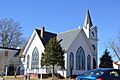
- St. John's Church, Chuckatuck
- Suffolk Center for Cultural Arts
- Suffolk Historic District
- The Seaboard Station Railroad Museum at 326 North Main Street. It's in an old train station and has model trains and railroad items. Admission is free, but donations are welcome.
Climate in Suffolk
Suffolk has a humid subtropical climate. This means it has hot, humid summers and generally mild to cool winters.
| Climate data for Suffolk, Virginia (1991–2020 normals, extremes 1945–present) | |||||||||||||
|---|---|---|---|---|---|---|---|---|---|---|---|---|---|
| Month | Jan | Feb | Mar | Apr | May | Jun | Jul | Aug | Sep | Oct | Nov | Dec | Year |
| Record high °F (°C) | 79 (26) |
81 (27) |
88 (31) |
94 (34) |
98 (37) |
105 (41) |
103 (39) |
103 (39) |
101 (38) |
98 (37) |
85 (29) |
80 (27) |
105 (41) |
| Mean daily maximum °F (°C) | 49.3 (9.6) |
52.4 (11.3) |
59.4 (15.2) |
69.2 (20.7) |
76.1 (24.5) |
83.4 (28.6) |
86.8 (30.4) |
85.1 (29.5) |
79.6 (26.4) |
70.5 (21.4) |
60.5 (15.8) |
52.7 (11.5) |
68.8 (20.4) |
| Daily mean °F (°C) | 40.2 (4.6) |
42.7 (5.9) |
49.1 (9.5) |
58.6 (14.8) |
66.4 (19.1) |
74.2 (23.4) |
78.3 (25.7) |
76.8 (24.9) |
71.3 (21.8) |
61.0 (16.1) |
50.6 (10.3) |
43.7 (6.5) |
59.4 (15.2) |
| Mean daily minimum °F (°C) | 31.1 (−0.5) |
32.9 (0.5) |
38.9 (3.8) |
48.0 (8.9) |
56.7 (13.7) |
65.1 (18.4) |
69.7 (20.9) |
68.6 (20.3) |
63.0 (17.2) |
51.5 (10.8) |
40.8 (4.9) |
34.8 (1.6) |
50.1 (10.1) |
| Record low °F (°C) | −5 (−21) |
4 (−16) |
14 (−10) |
24 (−4) |
30 (−1) |
40 (4) |
49 (9) |
46 (8) |
39 (4) |
23 (−5) |
18 (−8) |
4 (−16) |
−5 (−21) |
| Average precipitation inches (mm) | 3.66 (93) |
2.96 (75) |
4.07 (103) |
3.62 (92) |
3.95 (100) |
4.70 (119) |
5.69 (145) |
5.77 (147) |
5.80 (147) |
4.26 (108) |
3.65 (93) |
3.69 (94) |
51.82 (1,316) |
| Average snowfall inches (cm) | 3.1 (7.9) |
1.5 (3.8) |
0.3 (0.76) |
0.0 (0.0) |
0.0 (0.0) |
0.0 (0.0) |
0.0 (0.0) |
0.0 (0.0) |
0.0 (0.0) |
0.0 (0.0) |
0.0 (0.0) |
0.9 (2.3) |
5.8 (15) |
| Average precipitation days (≥ 0.01 in) | 10.7 | 9.5 | 11.2 | 10.3 | 11.1 | 11.2 | 11.6 | 10.9 | 9.5 | 8.2 | 9.1 | 10.4 | 123.7 |
| Average snowy days (≥ 0.1 in) | 1.2 | 0.7 | 0.3 | 0.0 | 0.0 | 0.0 | 0.0 | 0.0 | 0.0 | 0.0 | 0.0 | 0.4 | 2.6 |
| Source: NOAA | |||||||||||||
Images for kids
-
Driver Historic District
-

Great Dismal Swamp
-
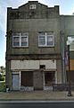
Phoenix Bank of Nansemond
-
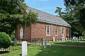
St. John's Chuckatuck

_(4578425529).jpg)


See also
 In Spanish: Suffolk (Virginia) para niños
