Fort Magruder facts for kids

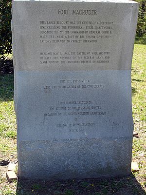
Fort Magruder Monument
|
|
| Coordinates | 37°15′50.29″N 76°39′58.68″W / 37.2639694°N 76.6663000°W |
|---|---|
| Location | Williamsburg, Virginia |
Fort Magruder was a large dirt fort, about 30-foot (9.1 m) high. It was built across the main road between Yorktown and Williamsburg, Virginia. Williamsburg was once the capital of Virginia. This fort was a key part of a long line of defenses called the Williamsburg Line. It was also known as Redoubt Number 6.
Fort Magruder was super important for defending Williamsburg during the Peninsula Campaign in 1862. It was located right where two main roads from Yorktown and Lee's Mill met. This made it a vital spot. It played a major role in the Battle of Williamsburg on May 5, 1862.
Contents
The Peninsula Campaign and General Magruder
During the American Civil War, the Peninsula Campaign was a huge military plan. The Union army launched it in southeastern Virginia from March to July 1862. It was the first big attack in the eastern part of the war.
The Union plan was to capture the Confederate capital, Richmond. Union Maj. Gen. George B. McClellan led the operation. His army traveled by boat and then marched up the Virginia Peninsula. They started from Fort Monroe and aimed for Richmond, about 75 miles (121 km) away.
The main Confederate defense force was the Army of the Peninsula. It was led by Brig. Gen. John B. "Prince John" Magruder. He was a popular leader who had been holding back Union forces since 1861. When McClellan's large army arrived in early 1862, Magruder only had about 13,000 men.
The Confederates' early strategy was to delay the Union army. This gave them time to build strong defenses outside Richmond. General Magruder was an amateur actor. He used clever tricks to make his small army seem much larger. He would march his troops back and forth with lots of noise. This made it look like he had a huge force. Historian Stephen Sears called these actions "performances of the Prince John Players."
Magruder's tricks worked. The very cautious McClellan moved slowly with his much larger army. This gave the Confederates valuable time to build a long defensive line near Richmond.
Fort Magruder was a large dirt fort named after General Magruder. It was the most important part of the Williamsburg Line. This was a third set of defenses across the peninsula. It was located west of the Warwick Line, which was anchored by Mulberry Island, the Warwick River, and Yorktown.
Building the Williamsburg Line Defenses
The Williamsburg Line was a series of forts built across the Virginia Peninsula. It was east of Williamsburg. This defensive line stretched from College Creek in the south to Queen's Creek in the north. College Creek flows into the James River. Queen's Creek flows into the York River.
Fourteen redoubts, or small forts, were built along this line. Fort Magruder (Redoubt Number 6) was right in the middle. It was in a very important spot. This idea of a defensive line was not new. In 1632, the Virginia Colony built a fence of wooden stakes across the same six miles (10 km) of land. This was to defend against attacks from Native Americans. That old fence was gone by 1862. The earlier fence had a small fortified settlement called Middle Plantation. In 1699, this settlement was renamed Williamsburg.
Colonel Benjamin S. Ewell was a leader of the 32nd Virginia Infantry. He had studied to be a civil engineer at the United States Military Academy (West Point). Before the war, he was the President of the College of William and Mary in Williamsburg. He lived nearby on a farm in James City County.
In 1861, Colonel Ewell formed the 32nd Virginia from local militia groups. These groups came from several counties. In May 1861, General Robert E. Lee put Colonel Ewell in charge of building the Williamsburg Line.
Ewell did not make much progress by late June 1861. So, General Magruder replaced him with Lt. Col. Lafayette McLaws. Soldiers and enslaved people built the line east of Williamsburg. This was suggested by Captain Alfred L. Rives. He was a civil engineer from Virginia Military Institute.
The 14 redoubts stretched about 4 miles (6.4 km) across. They were located 600 yards (550 m) to 800 yards (730 m) apart. Redoubt #1 was behind Quarterpath Road. Redoubts 11 and 14 were at the northern end of the line, near the York River. The site of Redoubt 12 is now in New Quarter Park.
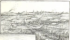
Redoubt #6 became known as Fort Magruder. It was shaped like a long pentagon. Its walls were 15 feet (4.6 m) high and nine feet thick. A dry moat, nine feet deep, protected the dirt walls. The fort had eight guns. The Williamsburg Line was not finished when the Union army started marching from Fort Monroe on April 4, 1862.
Standoff at the Warwick Line
As the Peninsula Campaign continued, Confederate General Joseph E. Johnston moved his army east. He wanted to help Magruder and face McClellan's forces. This led to the Battle of Yorktown, which lasted from April 5 to May 4, 1862. During this time, the Union forces were stopped at the Warwick Line. This line stretched across the peninsula from the James River to the York River.
In the early morning of May 4, the Confederates quietly left the Warwick Line. They decided not to defend the Williamsburg Line. Instead, they moved further west toward Richmond. The Williamsburg Line became very important for a short time. It helped delay the Union army's chase. This gave the Confederates time to move west on the poor roads of the sandy Tidewater area.
About 24 hours later, McClellan found out the Confederates had moved. Union troops soon marched toward Williamsburg. They used the only two main roads west. These were the Lee's Mill and Yorktown-Williamsburg Roads. They met about 600 feet (180 m) southeast of Fort Magruder.
The Battle of Williamsburg
On May 5, 1862, Fort Magruder was a major site of the first big fight of the Peninsula Campaign. Nearly 32,000 Confederate soldiers and 41,000 Union soldiers fought during the Battle of Williamsburg. Military historians say the battle ended with no clear winner.
The fort was built on a very narrow piece of land. To the west was Tutters Neck Pond. To the east was Cubb's Creek. This made it hard to get to the town of Williamsburg beyond the fort. There were 3,800 Union and Confederate soldiers who were killed or wounded in the battle.
Fort Magruder Today
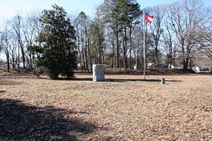
The original site of Fort Magruder is about 1-mile (1.6 km) east of Colonial Williamsburg. It is off Penniman Road. This road is the border between James City County and York County. A monument stands on the southeast side of Penniman Road. It was put there by the United Daughters of the Confederacy.
About one-third of the original dirt walls of the fort still remain. The site is fenced off and not open to the public right now.
In early 2006, Riverside Health System gave 22 acres (89,000 m2) of land to create a public park. This land was part of a larger 350 acres (1.4 km2) area they bought from Colonial Williamsburg in 2004. The land is about 1.5 miles (2.4 km) south of Fort Magruder. It includes two redoubts that were part of the Williamsburg Line. This new park is called Redoubt Park.
At the site of Redoubt 9, archaeologists found something interesting in 2016. This site is in the middle of Interstate 64 in York County. They unearthed a jade blue bottle less than six inches long. It was filled with nails. It was next to what they thought was a fireplace. Researchers from William and Mary think it might be a witch bottle. People used these objects in England to trap witches or evil spirits. Only a few such bottles have been found in the United States. This bottle likely came with Union troops who occupied the redoubt after the Battle of Williamsburg.
 | Misty Copeland |
 | Raven Wilkinson |
 | Debra Austin |
 | Aesha Ash |


