Rushmore Cave facts for kids
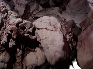
Rushmore Cave is a cool cave you can visit! It's super close to the famous Mount Rushmore National Memorial in the United States. Inside, you'll find all sorts of amazing natural rock shapes. It's also the ninth longest cave in South Dakota, stretching out for about 3,652.6 feet (1,113.3 m)!
How Rushmore Cave Was Found
The cave was discovered way back in 1876. Back then, there was a special wooden channel called a log flume. It carried water to help with mining in a town called Hayward. One day, this flume broke, and water spilled onto the side of a hill.
As the water flowed down, it started disappearing into a small hole. Miners who were fixing the flume noticed this. They wondered where the water was going! After fixing the flume, they decided to explore the hole.
They went about 30 feet (9.1 m) inside, then came to a big drop, about 15 feet (4.6 m) down. They left the cave, found a tree, and used it as a ladder to get further in. The miners soon saw that most of the cave was made of a rock called limestone. They knew limestone doesn't have gold, so they stopped looking for treasure and left the cave alone. But some people in town heard about the discovery and became very curious!
How the Cave Formed Over Time
Rushmore Cave was created over a very, very long time – about 360 million years! It all started during a period called the Mississippian Period. Back then, the whole Black Hills area was covered by a huge ocean.
Many kinds of sea creatures, like crabs and other shelled animals, lived in this ocean. When these creatures died, their bodies sank to the bottom of the sea. Over time, their soft parts rotted away, leaving behind their hard bones and shells. These pieces got squished together and slowly hardened into the rock we call limestone. This limestone is what makes up most of the cave today.
What You Can See Inside
Rushmore Cave has many different rooms, each with its own special look! Some of the cool rooms include:
- The Entrance Room
- The Post Office
- The Image Room
- The Big Room
- Fairyland
- The Rope Room
- The Geode Room
- The Rouge Room (also called the Party Room)
- The Arrowhead Room
- The Floral Room
The cave also has unique rock formations. You'll see things like boxwork, which looks like a honeycomb pattern on the walls. There are also many "dripstone" formations, which are created by water dripping over thousands of years. These include:
- Stalactites: These hang down from the cave ceiling, like icicles.
- Stalagmites: These grow up from the cave floor.
- Columns: These form when a stalactite and a stalagmite meet in the middle.
- Helictites: These are twisted, worm-like formations that seem to defy gravity.
- Flowstone: This looks like frozen waterfalls on the cave walls.
43°52′28.10″N 103°19′54.72″W / 43.8744722°N 103.3318667°W
 | John T. Biggers |
 | Thomas Blackshear |
 | Mark Bradford |
 | Beverly Buchanan |


