Russells Point, Ohio facts for kids
Quick facts for kids
Russells Point, Ohio
|
|
|---|---|
|
Village
|
|
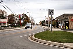
Downtown Russells Point
|
|
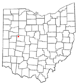
Location of Russells Point, Ohio
|
|
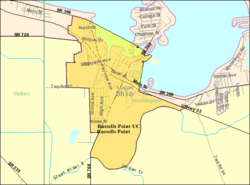
Detailed map of Russells Point
|
|
| Country | United States |
| State | Ohio |
| County | Logan |
| Townships | Washington, Stokes |
| Area | |
| • Total | 1.01 sq mi (2.63 km2) |
| • Land | 0.93 sq mi (2.41 km2) |
| • Water | 0.08 sq mi (0.22 km2) |
| Elevation | 1,001 ft (305 m) |
| Population
(2020)
|
|
| • Total | 1,320 |
| • Density | 1,419.35/sq mi (548.25/km2) |
| Time zone | UTC-5 (Eastern (EST)) |
| • Summer (DST) | UTC-4 (EDT) |
| ZIP code |
43348
|
| Area code(s) | 937, 326 |
| FIPS code | 39-69302 |
| GNIS feature ID | 2399146 |
Russells Point is a small village in northwest Logan County, Ohio, United States. It is located right on the edge of Indian Lake. This lake has been a popular spot for summer vacations for a long time. In 2020, about 1,320 people lived in Russells Point.
Contents
History of Russells Point
A post office opened in Russells Point in 1913. A post office is where you send and receive mail. The village was named after James Russell. He was the person who owned the land where the town was built.
2024 Tornado Impact
On March 14, 2024, a very strong tornado hit Russells Point. It also affected other towns near Indian Lake. The tornado struck around 7:51 PM. It caused a lot of damage to homes and businesses. Some buildings were completely destroyed. Sadly, some people lost their lives, and many others were injured. Weather experts later said it was an EF-3 tornado. This means it was a powerful tornado with strong winds.
Geography and Location
Russells Point is located in Ohio. It has a total area of about 1.01 square miles (2.63 square kilometers). Most of this area is land, about 0.93 square miles (2.41 square kilometers). The rest, about 0.08 square miles (0.22 square kilometers), is water. This water is part of Indian Lake.
Population and People
| Historical population | |||
|---|---|---|---|
| Census | Pop. | %± | |
| 1930 | 344 | — | |
| 1940 | 554 | 61.0% | |
| 1950 | 909 | 64.1% | |
| 1960 | 1,111 | 22.2% | |
| 1970 | 1,104 | −0.6% | |
| 1980 | 1,156 | 4.7% | |
| 1990 | 1,504 | 30.1% | |
| 2000 | 1,619 | 7.6% | |
| 2010 | 1,391 | −14.1% | |
| 2020 | 1,320 | −5.1% | |
| U.S. Decennial Census | |||
What the 2010 Census Showed
In 2010, a count of the population was done. This is called a census. It showed that 1,391 people lived in Russells Point. There were 618 households, which are groups of people living together. About 342 of these were families.
Most people in the village were White (97.3%). A small number of people were from other racial backgrounds. About 1.1% of the population was Hispanic or Latino.
About 31.9% of households had children under 18. Many households (44.7%) were not families. This means they were individuals or unrelated people living together. About 38.7% of all households had just one person living there. Also, 17.3% of households had someone aged 65 or older living alone.
The average age in the village was 38 years old. About 25.7% of residents were under 18. About 16.9% were 65 or older. The population was almost evenly split between males (48.6%) and females (51.4%).
Getting Around Russells Point
Russells Point is located on the south side of Indian Lake. Because of this, several important roads pass through it.
Main Roads
U.S. Route 33 is the main road that goes through Russells Point. Other important state roads include State Route 366 and State Route 708. State Route 720 also starts on the northwest side of the village.
Boating Access
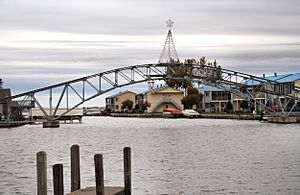
Since it's on a lake, Russells Point has places where boats can stop. Many restaurants and other businesses have docks. This makes it easy for people to arrive by boat.
See also
 In Spanish: Russells Point (Ohio) para niños
 | William Lucy |
 | Charles Hayes |
 | Cleveland Robinson |


