Logan County, Ohio facts for kids
Quick facts for kids
Logan County
|
|||
|---|---|---|---|
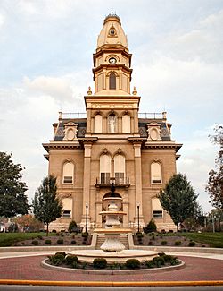
Logan County Courthouse
|
|||
|
|||
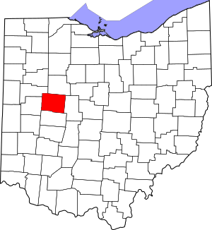
Location within the U.S. state of Ohio
|
|||
 Ohio's location within the U.S. |
|||
| Country | |||
| State | |||
| Founded | March 1, 1818 | ||
| Named for | Benjamin Logan | ||
| Seat | Bellefontaine | ||
| Largest city | Bellefontaine | ||
| Area | |||
| • Total | 467 sq mi (1,210 km2) | ||
| • Land | 458 sq mi (1,190 km2) | ||
| • Water | 8.3 sq mi (21 km2) 1.8%% | ||
| Population
(2020)
|
|||
| • Total | 46,150 | ||
| • Density | 98.82/sq mi (38.16/km2) | ||
| Time zone | UTC−5 (Eastern) | ||
| • Summer (DST) | UTC−4 (EDT) | ||
| Congressional district | 4th | ||
Logan County is a place in the western part of Ohio, a state in the United States. In 2020, about 46,150 people lived here. The main town, or county seat, is Bellefontaine.
The county got its name from Benjamin Logan. He was a person who had conflicts with Native American groups in this area long ago. Logan County is part of a larger area around Bellefontaine. This area is also connected to the bigger Columbus region.
Contents
Exploring Logan County's Geography
Logan County covers about 467 square miles (1,210 square kilometers). Most of this area is land, with a small part being water.
Ohio's Highest Point
Did you know that the highest natural point in Ohio is in Logan County? It's called Campbell Hill. It stands at 1,549 feet (472 meters) tall. You can find it northeast of Bellefontaine.
Neighboring Counties
Logan County shares its borders with several other counties:
- Hardin County to the north
- Union County to the east
- Champaign County to the south
- Shelby County to the west
- Auglaize County to the northwest
Main Roads and Highways
Many important roads help people travel through Logan County. These include:
 U.S. Route 33
 U.S. Route 68
 State Route 47
 State Route 117
 State Route 235
 State Route 245
 State Route 273
 State Route 274
 State Route 287
 State Route 292
 State Route 347
 State Route 365
 State Route 366
 State Route 368
 State Route 508
 State Route 533
 State Route 540
 State Route 559
 State Route 706
 State Route 708
 State Route 720
People of Logan County
| Historical population | |||
|---|---|---|---|
| Census | Pop. | %± | |
| 1820 | 3,159 | — | |
| 1830 | 6,440 | 103.9% | |
| 1840 | 14,015 | 117.6% | |
| 1850 | 19,162 | 36.7% | |
| 1860 | 20,996 | 9.6% | |
| 1870 | 23,028 | 9.7% | |
| 1880 | 26,267 | 14.1% | |
| 1890 | 27,386 | 4.3% | |
| 1900 | 30,420 | 11.1% | |
| 1910 | 30,084 | −1.1% | |
| 1920 | 30,104 | 0.1% | |
| 1930 | 28,981 | −3.7% | |
| 1940 | 29,624 | 2.2% | |
| 1950 | 31,329 | 5.8% | |
| 1960 | 34,803 | 11.1% | |
| 1970 | 35,072 | 0.8% | |
| 1980 | 39,155 | 11.6% | |
| 1990 | 42,310 | 8.1% | |
| 2000 | 46,005 | 8.7% | |
| 2010 | 45,858 | −0.3% | |
| 2020 | 46,150 | 0.6% | |
| U.S. Decennial Census 1790-1960 1900-1990 1990-2000 2020 |
|||
Population in 2010
In 2010, there were 45,858 people living in Logan County. They lived in 18,111 households. About 12,569 of these were families. The county had about 100 people per square mile.
Most people in the county were white (95.3%). Other groups included Black or African American (1.6%), Asian (0.5%), and American Indian (0.3%). About 1.2% of the people were of Hispanic or Latino background.
Many people had German (30.9%), Irish (13.5%), or English (9.1%) family roots. The average age in the county was about 39.9 years old.
Towns and Villages in Logan County
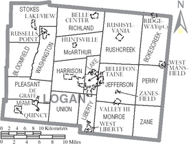
Logan County has one main city and many smaller villages and communities.
City
- Bellefontaine (This is the county seat, where the main government offices are.)
Villages
Townships
Townships are smaller areas within a county, often with their own local government.
- Bloomfield
- Bokes Creek
- Harrison
- Jefferson
- Lake
- Liberty
- McArthur
- Miami
- Monroe
- Perry
- Pleasant
- Richland
- Rushcreek
- Stokes
- Union
- Washington
- Zane
Other Communities
Logan County also has smaller communities that are not officially cities or villages. These include:
- Chippewa Park
- East Liberty
- Lewistown
- Big Springs
- Bloom Center
- Cherokee
- Flatwoods
- Gretna
- Harper
- Horton
- Logansville
- McKees Town
- Middleburg
- New Jerusalem
- New Richland
- North Greenfield
- Northwood
- Orchard Island
- Pickrelltown
- Santa Fe
- Walnut Grove
- White Town
Famous People from Logan County
Many interesting people have come from Logan County:
- George Bartholomew - He invented concrete pavement, which is used for roads and sidewalks.
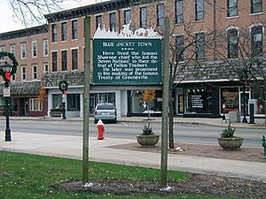
- Blue Jacket (Weyapiersenwah) - A famous Shawnee chief.
- Bethany Dillon - A singer who was nominated for a music award in 2004.
- Allan W. Eckert - A well-known author.
- Jim Flora - A talented artist.
- Melville J. Herskovits - An anthropologist, someone who studies human societies and cultures.
- Kin Hubbard - A cartoonist and journalist.
- Samuel Johnston - A professional wrestler.
- Edward D. Jones - An investment banker, who helps businesses with money matters.
- Austin Eldon Knowlton - An architect, who designs buildings.
- William Lawrence - A Republican politician. He was involved in important events like trying to remove President Andrew Johnson from office. He also helped create the United States Department of Justice and the American Red Cross.
- The Mills Brothers - A famous group of entertainers.
- Raymond Stanton Patton (1882–1937) - A rear admiral and director of the United States Coast and Geodetic Survey.
- Norman Vincent Peale - A minister and author.
See also
 In Spanish: Condado de Logan (Ohio) para niños
 | Janet Taylor Pickett |
 | Synthia Saint James |
 | Howardena Pindell |
 | Faith Ringgold |


