Saint-Célerin facts for kids
Quick facts for kids
Saint-Célerin
|
|
|---|---|
 |
|
| Country | France |
| Region | Pays de la Loire |
| Department | Sarthe |
| Arrondissement | Mamers |
| Canton | Savigné-l'Évêque |
| Intercommunality | Pays des Brières et du Gesnois |
| Area
1
|
13.47 km2 (5.20 sq mi) |
| Population
(Jan. 2021)
|
Lua error in Module:Wd at line 1,575: attempt to index field 'wikibase' (a nil value). |
| Demonym(s) | Gérois, Géroise |
| Time zone | UTC+01:00 (CET) |
| • Summer (DST) | UTC+02:00 (CEST) |
| INSEE/Postal code |
72271 /72110
|
| Elevation | 79–151 m (259–495 ft) |
| 1 French Land Register data, which excludes lakes, ponds, glaciers > 1 km2 (0.386 sq mi or 247 acres) and river estuaries. | |
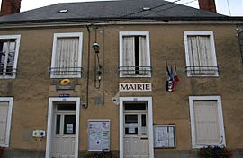
Saint-Célerin is a small town, also called a commune, located in the western part of France. It is found in the region called Pays de la Loire. This commune is part of the Sarthe department.
Contents
About Saint-Célerin
Saint-Célerin is a charming commune in the French countryside. It is a place where people live and work together. Communes are the smallest areas of local government in France. They are like small towns or villages.
Where is Saint-Célerin?
Saint-Célerin is in the Sarthe department. This department is known for its green landscapes. It is part of the larger Pays de la Loire region. This region is in western France.
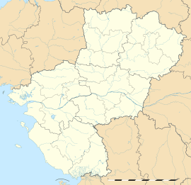
The commune's exact location can be described using coordinates. It is at about 48.1236 degrees north and 0.4317 degrees east. This helps people find it on a map.
What is a Commune?
A commune is a basic local government area in France. It is like a city or town. Each commune has its own mayor and local council. They manage things like schools, roads, and local services.
Saint-Célerin is one of many communes in France. There are thousands of them across the country. They help organize daily life for people.
Geography and Nature
Saint-Célerin covers an area of about 13.47 square kilometers. This is roughly 5.2 square miles. The land in the commune is not flat. Its elevation changes quite a bit.
The lowest point in Saint-Célerin is 79 meters (about 259 feet) above sea level. The highest point reaches 151 meters (about 495 feet). This varied landscape can include hills and valleys.
Who Leads Saint-Célerin?
Like all communes, Saint-Célerin has a mayor. The mayor is the head of the local government. They are chosen by the people who live in the commune.
The mayor helps make decisions for the community. They work with a local council. Together, they manage the commune's budget and services. They also represent the commune to the wider region.
People of Saint-Célerin
The people who live in Saint-Célerin are called Gérois (for men) or Géroise (for women). The number of people living in the commune changes over time. This is called the population.
The population figures are updated regularly. They help local leaders plan for the future. They ensure there are enough services for everyone.
See also
 In Spanish: Saint-Célerin para niños
 | Kyle Baker |
 | Joseph Yoakum |
 | Laura Wheeler Waring |
 | Henry Ossawa Tanner |


