Saint-Denis-Maisoncelles facts for kids
Quick facts for kids
Saint-Denis-Maisoncelles
|
|
|---|---|

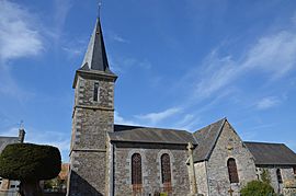
The church in Saint-Denis-Maisoncelles
|
|
| Country | France |
| Region | Normandy |
| Department | Calvados |
| Arrondissement | Vire |
| Canton | Bény-Bocage |
| Intercommunality | Bény-Bocage |
| Area
1
|
2.36 km2 (0.91 sq mi) |
| Population
(1999)
|
74 |
| • Density | 31.36/km2 (81.2/sq mi) |
| Time zone | UTC+01:00 (CET) |
| • Summer (DST) | UTC+02:00 (CEST) |
| INSEE/Postal code |
14573 /14350
|
| Elevation | 104–194 m (341–636 ft) (avg. 194 m or 636 ft) |
| 1 French Land Register data, which excludes lakes, ponds, glaciers > 1 km2 (0.386 sq mi or 247 acres) and river estuaries. | |
Saint-Denis-Maisoncelles was a small French village. It was located in the Calvados department, which is in the northwest part of France. This area used to be called the Basse-Normandie region.
On January 1, 2016, Saint-Denis-Maisoncelles joined with other nearby villages. They all became part of a new, larger village called Souleuvre-en-Bocage. This means Saint-Denis-Maisoncelles is no longer a separate "commune" (which is like a small town or village area in France).
Contents
What is a Commune?
In France, a "commune" is the smallest area of local government. Think of it like a small town or village. Each commune has its own mayor and local council. They manage things like local roads and schools.
Why Do Communes Merge?
Sometimes, small communes like Saint-Denis-Maisoncelles merge together. This often happens to help them work better. By joining, they can share resources and services. This can make it easier to manage things for everyone.
Where Was Saint-Denis-Maisoncelles Located?
Saint-Denis-Maisoncelles was in the Calvados department. This department is known for its beautiful countryside. It is also famous for its history, especially from World War II. The area is in the northwest of France.
Geography and Landscape
The village was in a hilly area. Its highest point was 194 meters (about 636 feet) above sea level. The lowest point was 104 meters (about 341 feet). The total area of the commune was 2.36 square kilometers. That's about 0.91 square miles.
Who Was the Mayor?
Before it merged, the mayor of Saint-Denis-Maisoncelles was Claude Eudeline. He served as mayor from 2008 to 2014. A mayor is the leader of a commune. They help make decisions for the local community.
See also
 In Spanish: Saint-Denis-Maisoncelles para niños
 | Dorothy Vaughan |
 | Charles Henry Turner |
 | Hildrus Poindexter |
 | Henry Cecil McBay |


