Saint-Pierre-des-Ormes facts for kids
Quick facts for kids
Saint-Pierre-des-Ormes
|
|
|---|---|
| Country | France |
| Region | Pays de la Loire |
| Department | Sarthe |
| Arrondissement | Mamers |
| Canton | Mamers |
| Intercommunality | Communauté de communes du Saosnois |
| Area
1
|
10.12 km2 (3.91 sq mi) |
| Population
(2006)
|
225 |
| • Density | 22.23/km2 (57.58/sq mi) |
| Demonym(s) | Pétriormois, Pétriormoise |
| Time zone | UTC+01:00 (CET) |
| • Summer (DST) | UTC+02:00 (CEST) |
| INSEE/Postal code |
72313 /72600
|
| Elevation | 68–104 m (223–341 ft) |
| 1 French Land Register data, which excludes lakes, ponds, glaciers > 1 km2 (0.386 sq mi or 247 acres) and river estuaries. | |
Saint-Pierre-des-Ormes is a small and charming commune located in the western part of France. A commune is like a small town or village with its own local government.
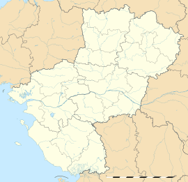
This commune is found in the region called Pays de la Loire. It's also part of the Sarthe department. Think of a department as a smaller area within a region, similar to a county in some other countries.
Contents
About Saint-Pierre-des-Ormes
Where is Saint-Pierre-des-Ormes?
Saint-Pierre-des-Ormes is located in the northwest of the Sarthe department. It's part of the Mamers area and the Mamers canton. These are ways France divides its land for administrative purposes.
How Many People Live There?
As of 2006, about 225 people lived in Saint-Pierre-des-Ormes. People who live there are called Pétriormois (for males) or Pétriormoise (for females). It's a quiet place, perfect for those who enjoy peaceful village life.
What is the Size of the Commune?
The total area of Saint-Pierre-des-Ormes is about 10.12 square kilometers. That's roughly 3.9 square miles. The land here ranges in height from 68 meters (223 feet) to 104 meters (341 feet) above sea level.
Who is in Charge?
The local leader of Saint-Pierre-des-Ormes is called the mayor. From 2008 to 2014, the mayor was Michel Ched'Homme. The mayor helps manage the commune and makes decisions for its residents.
See also
 In Spanish: Saint-Pierre-des-Ormes para niños


