Sainte-Marguerite River (Saguenay) facts for kids
Quick facts for kids Sainte-Marguerite River |
|
|---|---|

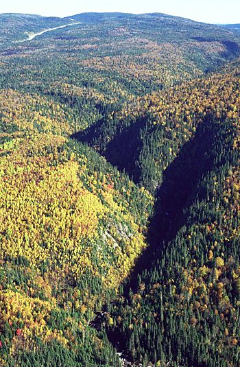
Valley of Sainte-Marguerite River
|
|
|
Location of the mouth in province of Quebec
|
|
| Country | Canada |
| Province | Quebec |
| Region | Mont-Valin, unorganized territory |
| Physical characteristics | |
| Main source | Sainte-Marguerite Lake 678 m (2,224 ft) |
| River mouth | Saguenay River 48°15′47″N 69°56′44″W / 48.2631°N 69.9456°W |
| Length | 100 km (62 mi) |
| Basin features | |
| Tributaries |
|
The Sainte-Marguerite River is a river in Quebec, Canada. It flows through the wild, unorganized area of Mont-Valin. This river is like a smaller stream that flows into the bigger Saguenay River.
What's in a Name?
The name 'Sainte-Marguerite River' first showed up on a map in 1731. This map was made for the king's father, Laure. The name also refers to a bay and a cape (a piece of land sticking out into the water) near where the river meets the Saguenay River.
River's Journey
The Sainte-Marguerite River starts its 100-kilometer (about 62 miles) journey at Sainte-Marguerite Lake. This lake is very high up, at 678 meters (about 2,224 feet) above sea level. The lake collects water from many smaller bodies of water. These are located west of Mont-Valin, a mountain 785 meters (about 2,575 feet) tall. This area is part of the zec Martin-Valin, a protected zone.
River's Path
First, the river flows northwest for a few kilometers. Then, it turns southwest for about 15 kilometers (9 miles). After that, it makes a sharp turn to the southeast. It then flows alongside the Saguenay River for about 60 kilometers (37 miles). For its final stretch, the river turns southwest again for 2.4 kilometers (1.5 miles). Finally, it flows into Sainte-Marguerite Bay at sea level. This bay is 2.7 kilometers (1.7 miles) long and 1.3 kilometers (0.8 miles) wide. The bay's entrance is about 25 kilometers (15.5 miles) upstream from the Tadoussac ferry.
Smaller Streams and Creeks
The main rivers that flow into the Sainte-Marguerite River are:
- "la Petite rivière Sainte-Marguerite nord-est"
- "la rivière Valin"
- "le Bras des Murailles" (which also has its own tributary, "le ruisseau Couture")
Some of the smaller creeks that join the Sainte-Marguerite River are:
- Barre Creek
- Épiphanie Creek
- Épinette Creek
- "de la Cage" Creek
Exciting Rapids
The Sainte-Marguerite River has many exciting rapids along its path. Here are some of them, starting from the upper part of the river:
- Le Rapide Vert: This rapid is located 2.7 kilometers (1.7 miles) northwest of "Montagne Brulée," a mountain 404 meters (1,325 feet) high.
- Le Grand rapide: You'll find this big rapid northwest of "Montagne de Bardsville," a mountain 337 meters (1,106 feet) high. Across the river, to the north, is "Mont Arthur-Leblanc," which is 465 meters (1,526 feet) tall.
- Rapide de la Montagne: This rapid is about 4 kilometers (2.5 miles) northeast of "Montagne du Bras Morin," a mountain 493 meters (1,617 feet) high.
 | Mary Eliza Mahoney |
 | Susie King Taylor |
 | Ida Gray |
 | Eliza Ann Grier |


