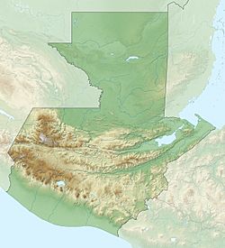
San Antonio Sacatepéquez facts for kids
Quick facts for kids
San Antonio Sacatepéquez
|
|
|---|---|
| Country | |
| Department | |
| Time zone | GMT -6 |
| Climate | Cwb |
San Antonio Sacatepéquez is a municipality in the San Marcos department of Guatemala. A municipality is like a local government area, similar to a town or county. It is known for its beautiful natural surroundings and unique climate.
Contents
Exploring San Antonio Sacatepéquez: Its Communities
San Antonio Sacatepéquez is made up of several smaller areas, including villages and settlements. These communities are where people live and work, forming the different parts of the municipality. Here's a list of some of them:
| Location | # | Name |
|---|---|---|
| Villages | 1 | Las Barrancas |
| 2 | San Isidro Ixcolochi | |
| 3 | Candelaria Siquival | |
| 4 | Santa Rita | |
| 5 | Santa Irene | |
| 6 | San Miguel de Los Altos | |
| 7 | Santa Rosa de Lima | |
| 8 | San José Granados | |
| 9 | San Rafael Sacatepéquez | |
| 10 | Santo Domingo | |
| Settlements | 1 | La Felicidad |
| 2 | Vista Hermosa | |
| 3 | San Francisco | |
| 4 | Siete Tambores | |
| 5 | Nueva Jerusalén | |
| 6 | Potrerillos | |
| 7 | Canchegua | |
| 8 | El Mirador | |
| 9 | San Ramón | |
| 10 | Tojchiná | |
| 11 | Las Escobas |
What's the Weather Like?
San Antonio Sacatepéquez has a mild or temperate climate. This type of weather is classified as Cwb according to the Köppen climate classification system. This means it has warm, rainy summers and dry, mild winters.
| Climate data for San Antonio Sacatepéquez | |||||||||||||
|---|---|---|---|---|---|---|---|---|---|---|---|---|---|
| Month | Jan | Feb | Mar | Apr | May | Jun | Jul | Aug | Sep | Oct | Nov | Dec | Year |
| Mean daily maximum °C (°F) | 17.3 (63.1) |
17.8 (64.0) |
19.4 (66.9) |
20.4 (68.7) |
20.3 (68.5) |
19.5 (67.1) |
19.4 (66.9) |
19.9 (67.8) |
19.4 (66.9) |
18.6 (65.5) |
18.2 (64.8) |
17.6 (63.7) |
19.0 (66.2) |
| Daily mean °C (°F) | 9.8 (49.6) |
10.2 (50.4) |
11.8 (53.2) |
13.4 (56.1) |
14.5 (58.1) |
14.5 (58.1) |
14.4 (57.9) |
14.2 (57.6) |
14.4 (57.9) |
13.5 (56.3) |
11.8 (53.2) |
10.8 (51.4) |
12.8 (55.0) |
| Mean daily minimum °C (°F) | 2.4 (36.3) |
2.7 (36.9) |
4.2 (39.6) |
6.4 (43.5) |
8.8 (47.8) |
9.6 (49.3) |
9.4 (48.9) |
8.5 (47.3) |
9.4 (48.9) |
8.4 (47.1) |
5.5 (41.9) |
4.1 (39.4) |
6.6 (43.9) |
| Average precipitation mm (inches) | 5 (0.2) |
5 (0.2) |
23 (0.9) |
61 (2.4) |
210 (8.3) |
305 (12.0) |
230 (9.1) |
252 (9.9) |
290 (11.4) |
201 (7.9) |
21 (0.8) |
12 (0.5) |
1,615 (63.6) |
| Source: Climate-Data.org | |||||||||||||
Where is San Antonio Sacatepéquez Located?
San Antonio Sacatepéquez is located about 9 kilometers (about 5.6 miles) southeast of San Marcos. It shares its borders with several other municipalities and departments.
 |
Río Blanco, San Marcos Department municipality Sibilia Quetzaltenango Department municipality |
 |
||
| San Pedro Sacatepéquez, San Marcos Department municipality | Sibilia and Palestina de Los Altos, Quetzaltenango municipalities | |||
| San Pedro Sacatepéquez, municipio del departamento de San Marcos | San Pedro Sacatepéquez, San Marcos Department municipality |
See also
 In Spanish: San Antonio Sacatepéquez para niños
 | John T. Biggers |
 | Thomas Blackshear |
 | Mark Bradford |
 | Beverly Buchanan |


