
San Bautista facts for kids
Quick facts for kids
San Bautista
|
|
|---|---|
|
City & Municipality
|
|

San Bautista
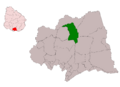
Location in Uruguay
|
|
| Country | |
| Department | |
| Population
(2011 Census)
|
|
| • Total | 1,973 |
| Time zone | UTC -3 |
| Postal code |
90604
|
| Dial plan | +598 4313 (+4 digits) |
San Bautista is a small city located in the Canelones Department in southern Uruguay. It is also the name of the larger area, called a municipality, that the city belongs to. A municipality is like a local government area.
Contents
Where is San Bautista Located?
Finding San Bautista on the Map
San Bautista is about 60 kilometers (around 37 miles) north of Montevideo, which is the capital city of Uruguay. You can find it where two important roads, Route 6 and Route 81, meet.
The History of San Bautista
How San Bautista Became a City
San Bautista has grown a lot over the years. On June 28, 1854, it was officially recognized as a "Villa," which means a town. Later, on June 20, 1901, its status changed to "Pueblo," meaning a village. Finally, on June 8, 1993, San Bautista was officially made a "Ciudad," which means a city. This shows how it grew from a small settlement to the city it is today.
How Many People Live in San Bautista?
Population Numbers for San Bautista
In 2011, about 1,973 people lived in the city of San Bautista. The local government of Canelones, called the Intendencia, estimated that the larger municipality area has about 4,045 residents.
| Year | Population |
|---|---|
| 1908 | 4,051 |
| 1963 | 1,750 |
| 1975 | 1,454 |
| 1985 | 1,555 |
| 1996 | 1,685 |
| 2004 | 1,880 |
| 2011 | 1,973 |
Source: Instituto Nacional de Estadística de Uruguay
Places to Visit in San Bautista
Local Churches and Landmarks
One important building in San Bautista is the St. John the Baptist Parish Church. This is a Roman Catholic church where people go to worship.
Images for kids
-
Location map of the Municipality of San Bautista

See also
 In Spanish: San Bautista para niños
