San José La Máquina facts for kids
Quick facts for kids
San José La Máquina
|
|
|---|---|
|
Municipality
|
|
| Country | |
| Department | |
| Gazetted | 3 March 2014 |
| Seat | San José La Máquina |
| Government | |
| • Type | Mayor–council |
| Area | |
| • Total | 147 km2 (57 sq mi) |
| Population
(2018 Census)
|
|
| • Total | 23,062 |
| • Estimate
(2018)
|
24,969 |
| • Density | 156.9/km2 (406.3/sq mi) |
| • Seat | 2,646 (2015 projection) |
| Time zone | UTC-6 (Central) |
| Website | Official website: http://municipalidadsanjoselamaquina.gob.gt/ |
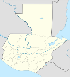
San José La Máquina is a town in Guatemala. It is a municipality located in the Suchitepéquez area. This town is about 26 kilometers (16 miles) south of Mazatenango, which is the capital city of the department.
Contents
Geography of San José La Máquina
San José La Máquina is found on the flat coastal area of southern Guatemala, near the Pacific Ocean. It shares borders with other towns in Suchitepéquez. These include Cuyotenango to the north, San Lorenzo to the northeast, and Mazatenango to the southeast. To the west, it borders San Andrés Villa Seca in the Retalhuleu Department. The total area of the municipality is 147 square kilometers (57 square miles).
Land and Rivers
The land in San José La Máquina is mostly flat. Its height above sea level ranges from 51 to 95 meters (167 to 312 feet). Most of the forests here have been cleared to make space for farms.
Two rivers, the Icán and the Sís, flow through San José La Máquina. They form the eastern and western edges of the municipality. Both rivers start near the Santo Tomás volcano. Unfortunately, these rivers face pollution challenges from waste.
Climate
San José La Máquina has a tropical savanna climate. This means it has a wet season and a dry season.
- The wet season is from May to October. Temperatures during this time are usually between 21 and 24 degrees Celsius (70–75 degrees Fahrenheit).
- The dry season is from November to April. Temperatures can get hotter, ranging from 31 to 38 degrees Celsius (88–100 degrees Fahrenheit).
The area gets about 2400 millimeters (94 inches) of rain each year.
History of San José La Máquina
The land where San José La Máquina now stands was once part of a large farm called "Trapiche Grande." This farm grew guayacán trees, which are known for their wood. Queen Wilhelmina of the Netherlands used to own this farm.
Land Changes and a New Name
Between 1950 and 1955, the land from "Trapiche Grande" was taken by the government as part of new land laws called Decree 900. The land was then divided between the Suchitepéquez and Retalhuleu departments. The part in Suchitepéquez was named La Máquina. This name, which means "the machine," came from an old belt conveyor found abandoned on a road nearby. Local people fixed the machine and used it to build roads in the area.
Becoming a Municipality
Starting in 1980, the people living in San José La Máquina worked hard to make their town a separate municipality. This goal was finally achieved on February 12, 2014. The Congress of the Republic of Guatemala officially announced that San José La Máquina would separate from the municipality of Cuyotenango. This decision was then published in the official newspaper, Diario de Centro América, on March 3, 2014.
People of San José La Máquina
In the 2018 census, San José La Máquina had a total population of 23,062 people. The National Institute of Statistics later estimated the population to be 24,969 in 2018.
The largest town within the municipality is also called San José La Máquina. In 2015, it was estimated to have 4396 residents. Most people in San José La Máquina, over 95%, speak Spanish.
Culture
The most important celebration in San José La Máquina is the feast day of Saint Joseph. This festival has been celebrated in the town since 1951.
Economy and Infrastructure
The economy of San José La Máquina mainly depends on farming. The most important crop grown for sale is corn. Other important crops include sesame and tobacco. Farmers also grow watermelons, bananas, and peanuts. Raising cattle is another big part of the town's economy.
The roads in San José La Máquina need improvement. Departmental road SCH-7 is the main road in the area, but only parts of it are paved. This road connects Cuyotenango with the beach town of Tulate.
See also
 In Spanish: San José La Máquina para niños
 | Misty Copeland |
 | Raven Wilkinson |
 | Debra Austin |
 | Aesha Ash |


