San Juan Cacahuatepec facts for kids
Quick facts for kids
San Juan Cacahuatepec
|
|
|---|---|
|
Municipality and town
|
|
 |
|

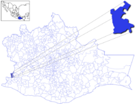
Location of the municipality in Oaxaca
|
|
| Country | |
| State | Oaxaca |
| Area | |
| • Total | 153.1 km2 (59.1 sq mi) |
| Population
(2005)
|
|
| • Total | 8,134 |
| Time zone | UTC-6 (Central Standard Time) |
| • Summer (DST) | UTC-5 (Central Daylight Time) |
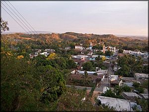
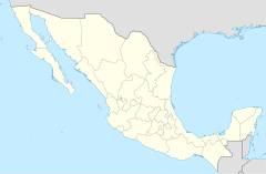
San Juan Cacahuatepec is a town and municipality in the Mexican state of Oaxaca. It is located close to the border with the state of Guerrero. This area is in the western part of the Costa Region.
In 2005, about 8,134 people lived in San Juan Cacahuatepec. It is an important place for the Amuzgo, who are an indigenous group of Mexico. The name "Cacahuatepec" comes from the Nahuatl language. It means "Place of Cacao-bean mountain."
Farmers in the area grow many crops. These include corn, beans, sugarcane, rice, and different kinds of tropical fruits. The town closest to San Juan Cacahuatepec is Pie de la Cuesta.
Contents
History of San Juan Cacahuatepec
Early History and Spanish Rule
Long ago, the area where San Juan Cacahuatepec is now was home to a group of people called the Yopes. In 1523, the region became part of Spain's control. This was during the time when Spain was taking over many lands in the Americas.
Times of Conflict and Change
San Juan Cacahuatepec has seen several periods of unrest and fighting.
- In the early 1800s, it was a meeting place for rebel forces. These forces were led by a general named Hermenegildo Galeana. They were fighting for Mexico's independence.
- Later, in 1854, the town faced a difficult time. It was damaged by the forces of Antonio López de Santa Anna, a famous Mexican general and president.
See also
 In Spanish: San Juan Cacahuatepec para niños


