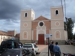
San Lorenzo, Tarija facts for kids
San Lorenzo (also called Villa San Lorenzo) is a small town in Bolivia. It is located in the Tarija Department.
Where is San Lorenzo?
San Lorenzo is the main town of the Eustaquio Méndez Province. It sits high up, about 2,001 meters (6,565 feet) above sea level. The town is on the left side of the Río Calama river. It is about 15 kilometers (9 miles) north of Tarija, which is the capital city of the department.
21°25′00″S 64°44′58″W / 21.41667°S 64.74944°W
People in San Lorenzo
In 1992, a count of the people (called a census) showed that San Lorenzo had 2,340 residents. By the 2001 census, the population grew to 2,754 people. Experts thought that by 2007, more than 3,000 people would be living there.
San Lorenzo is famous for being the home of Eustaquio Méndez. He was an important leader in the fights for Argentina's independence. You can visit the local museum, called Casa del Moto Méndez. It shows some of his personal items and old weapons.
Weather in San Lorenzo
The weather in San Lorenzo changes throughout the year. Here are some details about the temperatures and rainfall in the area:
| Climate data for Coimata, elevation 2,027 m (6,650 ft), (1980–2015) | |||||||||||||
|---|---|---|---|---|---|---|---|---|---|---|---|---|---|
| Month | Jan | Feb | Mar | Apr | May | Jun | Jul | Aug | Sep | Oct | Nov | Dec | Year |
| Record high °C (°F) | 34.8 (94.6) |
35.2 (95.4) |
34.0 (93.2) |
35.0 (95.0) |
36.4 (97.5) |
35.0 (95.0) |
35.8 (96.4) |
35.8 (96.4) |
36.6 (97.9) |
37.0 (98.6) |
38.8 (101.8) |
36.8 (98.2) |
38.8 (101.8) |
| Mean daily maximum °C (°F) | 25.5 (77.9) |
25.2 (77.4) |
24.8 (76.6) |
24.2 (75.6) |
23.8 (74.8) |
24.0 (75.2) |
23.8 (74.8) |
25.0 (77.0) |
25.4 (77.7) |
26.6 (79.9) |
26.2 (79.2) |
25.9 (78.6) |
25.0 (77.1) |
| Daily mean °C (°F) | 19.8 (67.6) |
19.4 (66.9) |
18.9 (66.0) |
17.5 (63.5) |
14.9 (58.8) |
13.6 (56.5) |
13.3 (55.9) |
15.0 (59.0) |
16.6 (61.9) |
18.9 (66.0) |
19.3 (66.7) |
19.8 (67.6) |
17.3 (63.0) |
| Mean daily minimum °C (°F) | 14.0 (57.2) |
13.5 (56.3) |
13.0 (55.4) |
10.7 (51.3) |
6.1 (43.0) |
3.1 (37.6) |
2.9 (37.2) |
4.9 (40.8) |
7.7 (45.9) |
11.2 (52.2) |
12.4 (54.3) |
13.6 (56.5) |
9.4 (49.0) |
| Record low °C (°F) | 7.3 (45.1) |
2.2 (36.0) |
2.3 (36.1) |
−2.6 (27.3) |
−6.4 (20.5) |
−9.8 (14.4) |
−10.5 (13.1) |
−8.7 (16.3) |
−6.2 (20.8) |
0.9 (33.6) |
1.0 (33.8) |
4.8 (40.6) |
−10.5 (13.1) |
| Average precipitation mm (inches) | 158.0 (6.22) |
139.0 (5.47) |
109.6 (4.31) |
30.4 (1.20) |
3.1 (0.12) |
0.6 (0.02) |
0.7 (0.03) |
2.8 (0.11) |
11.1 (0.44) |
41.0 (1.61) |
70.4 (2.77) |
153.2 (6.03) |
719.9 (28.33) |
| Average precipitation days | 14.1 | 12.8 | 11.1 | 4.7 | 1.3 | 0.3 | 0.5 | 0.9 | 2.4 | 6.1 | 8.9 | 12.8 | 75.9 |
| Average relative humidity (%) | 72.5 | 74.9 | 76.0 | 72.1 | 65.3 | 57.2 | 54.0 | 53.5 | 55.1 | 60.3 | 61.3 | 69.5 | 64.3 |
| Source: Servicio Nacional de Meteorología e Hidrología de Bolivia | |||||||||||||
| Climate data for Tucumillas, elevation 2,560 m (8,400 ft) (1977–2015) | |||||||||||||
|---|---|---|---|---|---|---|---|---|---|---|---|---|---|
| Month | Jan | Feb | Mar | Apr | May | Jun | Jul | Aug | Sep | Oct | Nov | Dec | Year |
| Mean daily maximum °C (°F) | 20.8 (69.4) |
20.4 (68.7) |
20.2 (68.4) |
19.8 (67.6) |
19.7 (67.5) |
20.9 (69.6) |
20.3 (68.5) |
21.2 (70.2) |
21.4 (70.5) |
22.2 (72.0) |
21.8 (71.2) |
21.6 (70.9) |
20.9 (69.5) |
| Daily mean °C (°F) | 15.8 (60.4) |
15.5 (59.9) |
15.3 (59.5) |
14.2 (57.6) |
12.5 (54.5) |
12.6 (54.7) |
11.8 (53.2) |
12.7 (54.9) |
13.4 (56.1) |
15.4 (59.7) |
15.6 (60.1) |
16.1 (61.0) |
14.2 (57.6) |
| Mean daily minimum °C (°F) | 10.7 (51.3) |
10.6 (51.1) |
10.4 (50.7) |
8.6 (47.5) |
5.4 (41.7) |
4.3 (39.7) |
3.3 (37.9) |
4.2 (39.6) |
5.4 (41.7) |
8.7 (47.7) |
9.4 (48.9) |
10.6 (51.1) |
7.6 (45.7) |
| Average precipitation mm (inches) | 186.8 (7.35) |
172.2 (6.78) |
136.0 (5.35) |
29.2 (1.15) |
4.7 (0.19) |
0.9 (0.04) |
2.3 (0.09) |
4.0 (0.16) |
8.9 (0.35) |
40.8 (1.61) |
76.3 (3.00) |
146.3 (5.76) |
808.4 (31.83) |
| Average precipitation days | 13.6 | 12.5 | 11.4 | 4.7 | 1.4 | 0.6 | 0.5 | 0.7 | 1.8 | 5.5 | 8.0 | 11.2 | 71.9 |
| Source: Servicio Nacional de Meteorología e Hidrología de Bolivia | |||||||||||||
See also
 In Spanish: San Lorenzo (Tarija) para niños
 | John T. Biggers |
 | Thomas Blackshear |
 | Mark Bradford |
 | Beverly Buchanan |


