San Luis Pass facts for kids
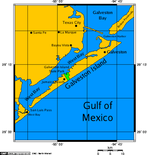
San Luis Pass is a narrow waterway located at the southwest tip of Galveston Island in Texas. It connects a calm area called West Bay to the big, open Gulf of Mexico. The waters here can be very dangerous. Strong currents, hidden deep spots, and cloudy water make it unsafe for swimming. A bridge called the San Luis Pass-Vacek Toll Bridge crosses over the pass, connecting Galveston Island to Brazoria County.
Contents
Understanding San Luis Pass Waters
The water levels in San Luis Pass can change a lot each day. This is due to the tides, which can make the water nearly 2 feet higher or lower. These changes are very noticeable in narrow waterways like this one.
Why the Water Can Be Dangerous
The currents in San Luis Pass are very strong. These dangerous currents can reach up to a mile away from the pass along both islands. Because of these strong currents and hidden deep areas, it is not safe to swim in the pass.
The water in the pass can be as deep as 40 feet in some places. The shape of the seafloor also changes often. Daily tides shift the sand, and big storms like hurricanes can change the area even more. For safety, entering the water from the Galveston Island side is not allowed.
Fun Activities at San Luis Pass
Even though swimming is not safe, San Luis Pass offers other activities. Many people enjoy fishing from the banks here. It is a popular spot for catching redfish, especially from June through October.
Camping and Bird Watching
Camping used to be allowed on the Galveston side of the pass. However, it is now only permitted at the San Luis Pass Camp Ground. This county park is located on the Brazoria County side of the pass.
The Galveston side of San Luis Pass is also a great place for bird watching. Many different types of birds can be seen here.
Changes After Hurricane Ike
In September 2008, a big storm called Hurricane Ike hit the area. This hurricane changed the land around San Luis Pass forever. What was once a public beach and a driveway is now part of the Gulf of Mexico. The land where a fishing pier's bait shop once stood is now always underwater. The pier itself was destroyed and was not rebuilt.
San Luis Pass-Vacek Toll Bridge
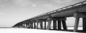
The San Luis Pass-Vacek Toll Bridge is also known as the San Luis Pass Bridge. It was built just before the year 1970. Galveston County operates this bridge.
Bridge Details
The bridge has two lanes for traffic. It is about 1.3 miles long. There is a small fee of $2 to cross the bridge. On the other side of the pass, in Brazoria County, the closest town is Surfside Beach.
History of San Luis Island
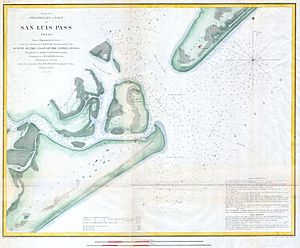
Across the pass from Galveston, there was once an island named San Luis. This island became connected to a larger piece of land called Follet's Island in 1885. This happened when a smaller waterway, called Little Pass, closed up. Follet's Island was once known as the Velasco Peninsula.
San Luis was once a small town that had about 2,000 people after 1836. By 1989, only about 20 people lived in this area. Today, the San Luis Pass County Park is located in this historic spot.
 | Georgia Louise Harris Brown |
 | Julian Abele |
 | Norma Merrick Sklarek |
 | William Sidney Pittman |


