San Marcos, Ocotepeque facts for kids
Quick facts for kids
San Marcos
|
|
|---|---|
|
Municipality
|
|
| Country | |
| Department | Ocotepeque |
| Villages | 14 |
| Area | |
| • Municipality | 169 km2 (65 sq mi) |
| Population
(2020 projection)
|
|
| • Municipality | 22,598 |
| • Density | 133.7/km2 (346.3/sq mi) |
| • Urban | 7,754 |
| Postal code |
43201
|
San Marcos is a town and a municipality in the country of Honduras. It is part of the Ocotepeque area. In 2013, the town itself had about 6,836 people.
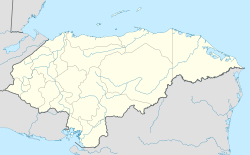
This municipality is home to around 22,598 people, based on a 2020 estimate. It is located in the western part of Honduras. San Marcos shares borders with the countries of Guatemala and El Salvador.
The area is found between Mount Meredon, which is the highest point in Honduras, and two rivers: the Rio Grande and the Suntulin River. San Marcos was first started by gold miners from Spain and Belgium. Today, San Marcos de Ocotepeque is known for its many cultural events, like plays and literary gatherings.
Who Lives in San Marcos?
This section talks about the people who live in San Marcos. It looks at the different groups of people that make up the community.
Population Makeup
According to a count done in 2013, the San Marcos municipality had 19,978 residents. Most of the people living there, about 98.27%, were Mestizo. This means they have mixed European and Indigenous backgrounds.
A smaller number of people were identified as White (0.89%). About 0.50% were Indigenous, meaning they are descendants of the original inhabitants. Around 0.30% of the population was Black or Afro-Honduran. A very small group, 0.05%, belonged to other backgrounds.
See also
 In Spanish: San Marcos (Ocotepeque) para niños
 | Bayard Rustin |
 | Jeannette Carter |
 | Jeremiah A. Brown |


