San Mateo, Florida facts for kids
Quick facts for kids
San Mateo, Florida
|
|
|---|---|

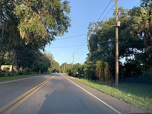
San Mateo as seen from Highway 100.
|
|
| County | Putnam County |
| Time zone | UTC-5 (EST) |
| • Summer (DST) | UTC-4 (EDT) |
| ZIP code |
32187
|
| Area code(s) | 386 |
San Mateo is a small place in Putnam County, Florida, United States. It is called an "unincorporated community." This means it's a group of homes and businesses that isn't officially a city or town with its own local government. Instead, the county government helps manage things like roads and services.
San Mateo is found just southeast of the city of Palatka. It sits right on the eastern side of the St. Johns River. This river is a very important waterway in Florida. The main road that goes through San Mateo is US Route 17. Other roads like Florida State Road 20 and Florida State Road 100 also pass nearby.
Location and Landscape
San Mateo is located at coordinates 29.607 degrees north and 81.585 degrees west. It is about 72 feet (or 22 meters) above sea level. Being right on the St. Johns River means the area has beautiful views of the water. The community stretches from a place called Buzzard Island to the entrance of Dunn's Creek. This makes it a great spot for enjoying nature and river activities.
 | DeHart Hubbard |
 | Wilma Rudolph |
 | Jesse Owens |
 | Jackie Joyner-Kersee |
 | Major Taylor |

