San Patricio, New Mexico facts for kids
Quick facts for kids
San Patricio, New Mexico
|
|
|---|---|
| Country | United States |
| State | New Mexico |
| County | Lincoln |
| Time zone | UTC-7 (Mountain (MST)) |
| • Summer (DST) | UTC-6 (MDT) |
| ZIP codes |
88348
|
| Area code(s) | 575 |
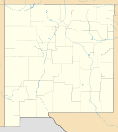
San Patricio is a tiny community in Lincoln County, New Mexico. It sits along the Rio Ruidoso and U.S. Highway 70. You can find it between the towns of Hondo and Glencoe. It's also just east of the beautiful Lincoln National Forest.
This small community is home to the San Patricio Retreat Center. This is a quiet place for reflection, recently bought by a local church group. You can also visit the Hurd-LaRinconada Gallery here. This gallery shows amazing original artworks by the famous Wyeth and Hurd families. There are even guest houses on the ranch for visitors.
Contents
What is the History of San Patricio?
How Did San Patricio Begin?
In the 1850s, Hispanic families settled in this area. They built special homes called placitas. These were adobe family compounds built with strong walls for protection. Some of these old homes are still standing today!
Later, more settlers from Europe and America moved to the area. By 1867, about 40 families lived in San Patricio. That same year, the first acequia (an irrigation ditch) was dug in the Hondo Valley right here. This helped farmers water their crops.
How Did San Patricio Get Its Name?
Around 1870, the town was first named Ruidoso, after the nearby river. A few years later, it got its current name from a Catholic church built there. This church was called La Iglesia de San Patricio, or San Patricio Catholic Church.
This church was the very first one in the area. It became a super important place for everyone in the community. Many similar churches can be found throughout the Hondo Valley.
What Happened During the Lincoln County War?
San Patricio was involved in the Lincoln County War, a famous conflict in New Mexico history. Even Billy the Kid was known to attend dances in town during the 1870s. In 1878, some people connected to James Dolan caused trouble in the town.
How Did San Patricio Change Over Time?
By the 1920s, the town's population grew to 822 people. In the 1930s, famous artists Peter Hurd and his wife Henriette Wyeth moved to San Patricio. They started a farm and eventually owned a large ranch. Many other artists followed them to live in the area.
During World War II, fewer people lived in San Patricio. After the war, new highways were built. This caused businesses to move to follow the new path of U.S. Route 70. In 1967, St. Jude's Church was built. This church brought together people from all the nearby Catholic churches in the Hondo Valley.
Where is San Patricio Located?
What are the Coordinates and Elevation of San Patricio?
San Patricio is located at coordinates 33.408976 degrees North and -105.326928 degrees West. The town sits at an elevation of 5,436 feet (1,657 meters) above sea level.
What Rivers and Roads are Near San Patricio?
San Patricio is close to where the Rio Ruidoso and Rio Bonito rivers meet. Glencoe is to the west, and Hondo is to the east. After these rivers join, they become the Rio Hondo.
U.S. Route 70 runs through the town. The Sierra Blanca Regional Airport is about a 16.5-mile drive away.
What is the Economy of San Patricio?
What Fruits Grow in San Patricio?
The San Patricio area is well-known for its delicious apples. Apple orchards were a very important part of the local economy until the mid-1900s. Farmers also grew other fruits like peaches, pears, and cherries. They sold these fruits and other farm products to truckers.
However, floods in 1941 and 1965, along with cold weather, have been big challenges for these orchards.
What Businesses Were in San Patricio?
In the past, San Patricio had many businesses. These included a general store, a grocery shop, a bar, a pool hall, a post office, and a gas station. By the early 2000s, only the post office was still open.
What About Education in San Patricio?
San Patricio built its first school before 1880. In 1880, about 70 students attended the school. By 1920, that number grew to 153 students. The four-room elementary school closed in 1960. This happened when smaller school districts in the area joined together with Hondo's elementary school.
 | Valerie Thomas |
 | Frederick McKinley Jones |
 | George Edward Alcorn Jr. |
 | Thomas Mensah |


