Lincoln National Forest facts for kids
Quick facts for kids Lincoln National Forest |
|
|---|---|
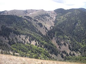
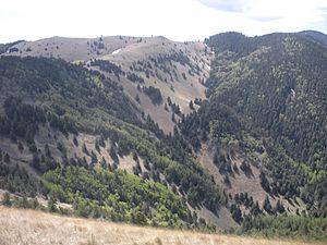
Lincoln National Forest - view from Crest Trail
|
|
| Location | New Mexico, United States |
| Nearest city | Alamogordo, NM |
| Area | 1,103,897 acres (4,467.31 km2) |
| Established | July 26, 1902 |
| Governing body | U.S. Forest Service |
| Website | Lincoln National Forest |
The Lincoln National Forest is a huge natural area in southern New Mexico. It's managed by the U.S. Forest Service. This forest was first created in 1902. It covers over 1.1 million acres (about 4,467 square kilometers).
The forest stretches from near the Texas border into parts of Chaves, Eddy, Lincoln, and Otero counties. It includes four mountain ranges and many different environments. You can find everything from desert areas to thick forests and grassy mountain tops. The Lincoln National Forest helps protect nature, manage resources, and offers fun places for people to visit. It has important timber (wood) resources, special wilderness areas, and popular spots for outdoor activities and winter sports. The main office is in Alamogordo, with smaller offices in Carlsbad, Cloudcroft, and Ruidoso.
Contents
How the Forest Began
Long ago, before Europeans arrived, the Niit'a-héõde band of the Mescalero Apache people lived on this land. The Lincoln National Forest we know today started from several smaller forest areas. These were set up between 1902 and 1908.
One of the first was the Lincoln Forest Reserve, created in 1902. Other areas like the Gallinas Forest Reserve, Guadalupe National Forest, and Sacramento National Forest were added later. These areas covered mountains like the Guadalupe, Sacramento, Sierra Blanca, Capitan, and Gallinas ranges. They had many different types of land, from desert plants to tall pine trees and high grasslands.
In 1908, President Theodore Roosevelt decided to combine some of these forests into bigger units. This included adding the Gallinas National Forest to the Lincoln National Forest. He also combined the Guadalupe and Sacramento National Forests to create the Alamo National Forest. This new forest was based in Alamogordo.
Later, in 1917, President Woodrow Wilson made another change. He moved the lands of the Alamo National Forest to the Lincoln National Forest. This made the Lincoln National Forest much larger! The last big change happened in 1945. The Gallinas area was moved from the Lincoln Forest to the Cibola National Forest.
Exploring the Forest Today
Today, the Lincoln National Forest is divided into three main parts, called Ranger Districts:
- The Smokey Bear Ranger District, with its office in Ruidoso.
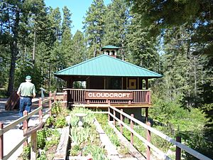
- The Sacramento Ranger District, with its office in Cloudcroft.
- The Guadalupe Ranger District, with its office in Carlsbad.
Sacramento Ranger District
This district was first created in 1907 as the Sacramento National Forest. It covers the southern part of the Sacramento Mountains, east of Alamogordo. This area is full of trees like Douglas Fir, Ponderosa pine, aspen, and oak. It also has many creeks and waterfalls.
The Sacramento district is just south of the Mescalero Apache Reservation. You can drive through this district on U.S. 82, which passes through the villages of Cloudcroft and Mayhill. Another scenic road, New Mexico State Road 6563, leads to the village of Sunspot.
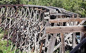
Old Railroad Trestle
The Sacramento Mountains have always been important for timber (wood). In 1898, a special railroad was built to carry timber. It was called the Alamogordo and Sacramento Mountain Railway. This railway was an amazing engineering feat! It climbed over 4,700 feet in just 32 miles. It had many sharp turns and tall bridges called trestles.
Even though the tracks were removed in 1948, you can still see parts of the old railroad. The most famous part is the 320-foot-long trestle over Mexican Canyon, near Cloudcroft. It stands 52 feet above the canyon floor! You can see it from viewpoints on U.S. 82 or by walking short trails from the Trestle Recreation Area.
Sunspot Observatory
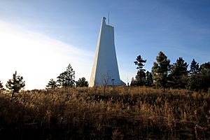
The high mountains of the Sacramentos are also home to a special place: the National Solar Observatory. Here, you'll find the Richard B. Dunn Solar Telescope. When it opened in 1969, it was the best telescope in the world for looking at the sun up close!
The observatory is in the southern part of the district. You can visit it during certain times of the year. To get there, you drive on the beautiful New Mexico State Road 6563, also known as the Sunspot Scenic Byway. It's a 15.5-mile drive from Cloudcroft to the village of Sunspot.
Smokey Bear District
This district was part of the very first forest reserve created in 1902. Today, the Smokey Bear Ranger District manages lands around the Capitan Mountains and near Ruidoso. It's also close to the Sierra Blanca (White Mountains).
This district is huge, covering over 423,000 acres. Its elevation ranges from about 5,400 feet to 11,580 feet in the Capitan Mountains. Because of this, it has many different environments. You'll find desert shrubs, forests of pinyon pine, juniper, and spruce, and high grasslands above the treeline.
This area also has two special "Wilderness Areas" and one of the forest's two ski resorts, Ski Apache, near Ruidoso. You can reach the district using U.S. 70, which goes through Ruidoso. U.S. 380 also crosses parts of the forest near Capitan and Lincoln.
Smokey Bear's Story
One of the most famous stories from the forest is about the real-life Smokey Bear! In 1950, a big fire called the Capitan Gap fire swept through the forest. A tiny bear cub was rescued from a burnt tree. He was found by either a New Mexico Game and Fish ranger or soldiers helping to fight the fire. The cub had burns and other injuries.
The cub was named Smokey Bear, after the U.S. Forest Service's symbol for fire safety. This symbol was created in 1944. The little bear became a living symbol of fire awareness and prevention. He was flown to the National Zoo in Washington D.C. Many people visited him and sent him letters. Smokey Bear lived at the zoo until he passed away in 1976. He was brought back to New Mexico and buried near Capitan in November 1976.
Lincoln County War
Much of this district is in Lincoln County. This area was the site of the Lincoln County War in 1878-1879. This was a complicated and violent fight between ranchers, bankers, and politicians. They were all trying to control the county.
One major event happened in the village of Lincoln itself. Supporters of Sheriff George W. Peppin surrounded the house of a merchant named Alexander McSween. Soldiers from a nearby fort watched. McSween was killed, but some of his supporters, called "regulators," escaped. They were led by a young man named William Bonney, who later became famous as the gunfighter Billy the Kid. The fighting continued until early 1879, when federal troops arrived to bring peace back to the area.
Guadalupe Ranger District
This district is a wild and rugged area of mountains and ridges. It covers about 288,540 acres. It starts at the Texas and New Mexico border and follows the Guadalupe Mountains for almost 50 miles. It was first set up in 1907 as the Guadalupe National Forest. Later, it became part of the Alamo National Forest. When the Alamo Forest was closed in 1917, the Guadalupe area became part of the Lincoln National Forest.
The Guadalupe Mountains are part of an ancient reef system. This reef formed millions of years ago when a large sea covered the area. The district's elevation changes a lot, from about 7,500 feet in the south to 3,500 feet in the north. In the south, you'll find steep canyons. As you go north, it changes to rolling hills and smaller canyons that lead to the Pecos River valley.
Fire Lookout Towers
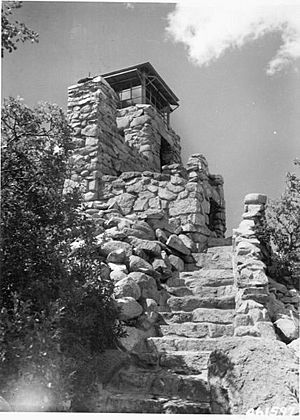
Preventing and fighting fires is very important in the Lincoln National Forest. That's why many fire lookout towers were built here. There used to be sixteen lookout structures, and nine of them are still standing today. Six of these are even listed on the National Register of Historic Places!
These towers are all different. The Monjeau Lookout in the Smokey Bear Ranger District is a unique stone building from the 1930s. The Sacramento Lookout is a 62-foot-tall steel tower with a small cabin on top. The Dark Canyon Lookout is 48 feet tall and stands over deep canyons in the southern Guadalupe District. Most of these lookouts can be visited by the public. Some are even being considered for rental cabins!
Weather in the Forest
The weather in the Lincoln National Forest changes a lot depending on how high up you are.
- High Elevations (7,000 feet and up): In summer, it's cool at night (around 40°F/4°C) and warm during the day (up to 78°F/26°C). In winter, nights can be very cold (-15°F/-26°C), but days can warm up to 50°F/10°C.
- Middle Elevations (6,000 to 7,000 feet): Summer temperatures are usually 50°F/10°C to 85°F/29°C. In winter, it rarely drops below 0°F/-18°C, usually staying between 10°F/-10°C and 50°F/10°C.
- Lower Elevations (below 6,000 feet): Temperatures are generally about 10°F/5°C warmer all year round.
Spring is often windy, which makes the forest very dry. This means there's a high risk of fires. Fire season usually starts in March or April and lasts until mid-July. If the fire danger gets too high, open fires might be banned, and some forest areas or roads might even close.
The rainy season begins in July and lasts through September. This helps to reduce the fire threat. The first snow usually falls in late October or early November and can continue for several months. Towns at middle elevations, like Ruidoso and Capitan, get about 30-40 inches of snow each year. Higher places, like Cloudcroft, often get 70 inches of snow!
Forest Resources and Economy
The National Forest system has three main goals: protecting nature, managing resources, and providing recreation.
One of the oldest uses of the forest has been for grazing livestock. For over a hundred years, allowing animals to graze on public lands has helped the local economy. For example, between 1970 and 2003, about 6,233 calves grazed in the forest each year. This added millions of dollars to the local economy.
Another important resource is timber, which means wood from trees like oak, Ponderosa pine, and fir. People have used this wood for generations. Logging (cutting down trees for wood) is one of the oldest economic activities in the forest. From 1970 to 1990, logging brought in about $11 million each year to the local counties. However, since 1990, less logging has happened, which has reduced income for the region.
The third main use of the forest is tourism, or "dispersed recreation." People have been visiting the Lincoln National Forest for fun since railroads and highways made it easier to get there. In 2004, over 735,000 visitors came to the forest. This brought in millions of dollars to the local economy. However, tourism can be less stable than grazing or logging. It can be affected by things like fires, droughts, or even high gas prices.
Studies have shown that no single activity—grazing, logging, or tourism—can bring enough money to the region by itself. All three are important for the local economy.
Collecting Firewood
Even though large-scale logging has decreased, people can still collect firewood from the forest. Visitors can buy permits to collect up to four cords of wood. This includes both fallen wood and standing green trees from special collection areas. You can get these permits at the Forest Headquarters or any of the three Ranger District offices.
Christmas Trees
Another fun tradition in the Lincoln National Forest is cutting down Christmas trees during the holiday season. You can buy permits to harvest your own Christmas tree at the Forest Headquarters or any of the three District Ranger Offices.
Fun Things to Do
The Lincoln National Forest is a popular place for year-round fun! It offers many activities, from camping and picnicking to hiking, horseback riding, and winter sports. You can also explore special wilderness areas.
Smokey Bear Ranger District Activities
This district has 6 developed family campgrounds and 2 group-camping areas. Some are free, while others charge a fee. Two campgrounds, Three Rivers and Baca, are open all year. The others, which are higher up, are usually open from May to September, depending on the weather.
Picnic areas include Schoolhouse Canyon and Cedar Creek. Cedar Creek has picnic tables, grills, water, and restrooms. It also has a covered pavilion you can reserve for groups.
The district has over 50 hiking trails! Most are less than three miles long and are in the two wilderness areas. If you like longer hikes, try the 20-mile-long Crest Trail in the White Mountain Wilderness or the 11.1-mile South Base Trail in the Capitan Wilderness.
Sacramento Ranger District Activities
This is the most developed of the three districts. It has 10 developed campgrounds and 5 group-camping sites. Some are free, like James Canyon and Upper Karr Canyon. Upper Karr is open all year, while others are usually open from May to September. Popular picnic spots include the Trestle Recreation Area near Cloudcroft and Bluff Springs, which is near a beautiful waterfall.
There are more than 50 trails here for all skill levels. Many trails explore small canyons, lead to waterfalls, or follow old railroad beds. While most trails are short, the Sacramento district also has long backpacking trails. One is the 29-mile-long Rim Trail. Another is the 5-mile Dog Canyon National Recreation Trail. It starts outside the forest and climbs over 2,000 feet into the mountains!
Guadalupe Ranger District Activities
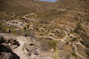
This is the most remote district. It has only one developed area: Sitting Bull Falls Picnic Area. This is like an oasis in the desert, about 20 miles west of Carlsbad. It has picnic tables, grills, water, and restrooms. You can also walk a short trail (0.5 miles) to the 150-foot Sitting Bull Falls. This area is only for day use; no camping is allowed.
The district has 23 developed trails, most of which are three miles or less. They range from easy to difficult and can be found throughout the district. Most of these trails allow pack animals like horses. However, motorized vehicles are not allowed on trails in the Guadalupe district, though they are allowed on most forest roads. A scenic drive is the 50-mile trip west from Carlsbad on N.M. 137 to 5 Points Vista. This overlook offers amazing views of the Guadalupe Mountains.
Wilderness Areas
The Lincoln National Forest has two special wilderness areas: the Capitan Mountains Wilderness and the White Mountain Wilderness. Both are in the Smokey Bear Ranger District. In wilderness areas, no cars or machines are allowed. You can only explore them on foot or by horse. These areas are completely natural, with no amenities, so visitors must practice "Leave No Trace" camping.
Capitan Mountains Wilderness
This wilderness area was created in 1980. It protects 34,000 acres of rugged mountains north of Lincoln and northeast of Capitan. It's special because it's one of the few east-west mountain ranges in New Mexico.
The Capitan Mountains Wilderness is 12 miles long and 2 to 6 miles wide. Elevations range from about 5,500 feet to 10,083 feet at the top of Capitan Peak. Because the area is so rugged, there are only a few trailheads, and you might need a 4-wheel drive vehicle to reach them.
White Mountain Wilderness
The White Mountain Wilderness was created in 1964. It first protected 28,118 acres northwest of Ruidoso. In 1980, it was made even larger, adding another 16,860 acres.
This wilderness starts at the northern border of the Mescalero Apache Reservation. It follows the main ridge of the White Mountains (Sierra Blanca in Spanish) for 12.5 miles north. It's 4 to 12 miles wide and includes many side canyons and a few year-round streams. You can reach the over 50 trails in this wilderness from several trailheads, like Three Rivers and Nogal Canyon.
Dispersed Camping
Many parts of the Lincoln National Forest allow "dispersed camping." This means you can drive up to 300 feet from public roads and set up camp for free! You don't need a permit. However, these are undeveloped areas, so there's no water, restrooms, or other facilities. Not all forest lands allow dispersed camping, so check a map for the specific Ranger District to find the right spots. Popular areas include Upper Bonito and Lower Karr Canyon.
Horseback Riding and Mountain Biking
Horses and other pack animals are allowed on most trails in the forest. Mountain bikes are also allowed on most trails in the Sacramento district and over 10 trails in the Smokey Bear district. However, no mechanized vehicles (like bikes) are allowed on any trails in the Guadalupe district.
Off-Highway Vehicles (OHVs)
The roads and some trails in the Lincoln National Forest are popular for Off-Highway Vehicles (OHVs), like motorcycles and ATVs. All three districts allow OHVs less than 50 inches wide on special forest service roads. Always check the current Motor Vehicle User Map to see which roads are open. Many trails in the Sacramento and Smokey Bear Ranger Districts are also open to OHVs, including the last 28 miles of the Rim Trail. Remember, all trails in the Guadalupe Ranger District are closed to motorized vehicles.
Winter Fun
Winter in southern New Mexico brings new ways to have fun in the Lincoln National Forest!
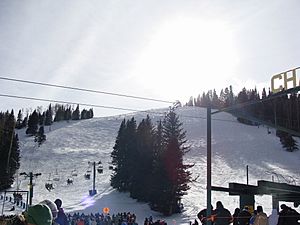
- Skiing and Snowboarding: You can ski and snowboard at Ski Apache. This resort is owned by the Mescalero Apache tribe and is on Sierra Blanca, about 15 miles west of Ruidoso.
- Sledding and Tubing: The Upper Karr Canyon Area near Cloudcroft is a great spot for sledding and tubing.
- Cross-Country Skiing: Two trails, the Fir Trail (1.9 miles) and the Little Apache Trail (2.8 miles), are kept open in winter for cross-country skiing. You can get to these trails from the Silver Overflow Campground near Cloudcroft.
- Winter Camping: For campers, the Three Rivers and Baca campgrounds in the Smokey Bear district, and the Upper Karr Canyon site in the Sacramento district, are open all year.
Where to Find the Forest
Towns and Villages Inside the Forest
Many small towns and villages are located within the Lincoln National Forest:
- Cloudcroft, New Mexico
- High Rolls, New Mexico
- Mayhill, New Mexico
- Ruidoso, New Mexico
- Ruidoso Downs, New Mexico
- Sacramento, New Mexico
- Sunspot, New Mexico
- Timberon, New Mexico
- Queen, New Mexico
- Capitan, New Mexico
- Lincoln, New Mexico
Nearby Cities
Larger cities close to the Forest include:
Getting There
Airports
- Sierra Blanca Regional Airport: This airport is about 15 miles (24 km) northwest of Ruidoso.
Major Highways
These main highways go through the Lincoln National Forest:
- U.S. Route 70
- U.S. Route 82
- U.S. Route 380
- NM 37
- NM 48
Other Cool Places Nearby
The Lincoln National Forest is just one of many amazing public lands in south-central New Mexico.
- White Sands National Park: Just west of the Sacramento Ranger District, you'll find White Sands National Park. It's famous for its huge, shifting dunes of white gypsum sand. You can explore the dunes, have a picnic, or even do primitive camping here.
- Oliver Lee Memorial State Park: South of Alamogordo, this New Mexico state park is at the bottom of a canyon. It offers tent and RV camping, and group picnic areas. It's also the start of the Dog Canyon Trail, which climbs 2,000 feet into the Sacramento Mountains.
- Organ Mountains–Desert Peaks National Monument: About 70 miles west of Alamogordo, this newer park protects the jagged Organ Mountains near Las Cruces. It has a campground and trails for day hikes.
South of the Guadalupe District, near Carlsbad, are two famous national parks:
- Carlsbad Caverns: About 30 miles west of Carlsbad, this park is world-famous for its amazing caves. You can explore developed parts of the caverns or even go backpacking on the ridges above.
- Guadalupe Mountains National Park: Just west of Carlsbad Caverns, in Texas, is Guadalupe Mountains National Park. It protects Guadalupe Peak and El Capitan, the two tallest mountains in Texas. It also has beautiful McKittrick Canyon, known for its fall colors. It's a favorite place for hikers and backpackers, with many trails for day trips or longer adventures. You can even hike 4.5 miles to the top of Guadalupe Peak! The park has two campgrounds for visitors.
See also
 In Spanish: Bosque nacional Lincoln para niños
 | Kyle Baker |
 | Joseph Yoakum |
 | Laura Wheeler Waring |
 | Henry Ossawa Tanner |


