Queen, New Mexico facts for kids
Quick facts for kids
Queen, New Mexico
|
|
|---|---|
| Country | United States |
| State | New Mexico |
| County | Eddy |
| Elevation | 5,843 ft (1,781 m) |
| Time zone | UTC-7 (Mountain (MST)) |
| • Summer (DST) | UTC-6 (MDT) |
| ZIP codes |
88220
|
| Area code(s) | 575 |
| GNIS feature ID | 909922 |
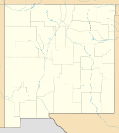
Queen is a small, unincorporated community in Eddy County, located in southeastern New Mexico. It sits in the foothills on the east side of the Guadalupe Mountains, within the southern Lincoln National Forest. While it now has about 50 residents, it was once considered a ghost town. In the early 1900s, it was a busy center for ranching. Queen is found along NM Route 137, about 27 miles (50 miles by road) southwest of Carlsbad.
History of Queen
The area around Queen was first settled by the Jornada Mogollon people. They were farmers and hunters who lived here around 200 CE. Their time in the area ended around 1450 when Apache and other groups from the plains arrived. Two important archaeological sites from the Mogollon people are located in Queen.
The modern community of Queen was started in 1905 by a businessman named J. W. Tulk. He made a deal with the local Queen Ranch (which is now called Womack Ranch) to get land and water. Tulk then built a store and worked to get a post office for the new settlement. As part of their agreement, the town was named Queen. The post office operated from 1905 until 1920. At that time, ranching in the area had slowed down, and the community became very small. For a while, the only thing left was a single chimney. However, people began to move back to Queen in the late 1900s.
Places to Visit
Near the center of Queen, you'll find a ten-foot stone memorial. This memorial honors Frank A. Kindel, who was known as "The Flying Paper Boy Of The Guadalupes." He was a pilot who sadly crashed here in 1964.
Close by is the Last Chance Canyon Apache/Cavalry Battle Site. This is a historic spot that is recognized as a New Mexico Registered Cultural Property. It marks a place where a battle between Apache and cavalry soldiers once happened.
Sitting Bull Falls is another popular place to visit. It's a great spot for a day hike and a nice picnic area.
About 20 miles southwest, at the end of NM Highway 137, is Dog Canyon Campground. This campground is part of the Guadalupe Mountains National Park.
Local Economy
As of 2008, there is no gas station available in Queen.
 | Claudette Colvin |
 | Myrlie Evers-Williams |
 | Alberta Odell Jones |


