Guadalupe Mountains National Park facts for kids
Quick facts for kids Guadalupe Mountains National Park |
|
|---|---|
|
IUCN Category II (National Park)
|
|
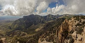
Guadalupe Peak, the highest point in Texas, as seen from Hunter Peak
|
|
| Location | Culberson County and Hudspeth County, Texas, US |
| Nearest city | Dell City, Texas |
| Area | 86,367 acres (349.51 km2) |
| Established | September 30, 1972 |
| Visitors | 172,347 (in 2018) |
| Governing body | National Park Service |
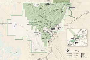
Guadalupe Mountains National Park is a special place in the United States. It is located in the Guadalupe Mountains in West Texas. This park is home to Guadalupe Peak, which is the highest point in Texas. It stands tall at about 8,751 feet (2,667 meters). Another famous peak is El Capitan. This mountain was a helpful landmark for early travelers. The park covers a large area of about 86,367 acres (349.5 square kilometers). It shares the same mountain range with Carlsbad Caverns National Park in New Mexico. Visitors can explore beautiful forests and enjoy amazing views of the Chihuahuan Desert.
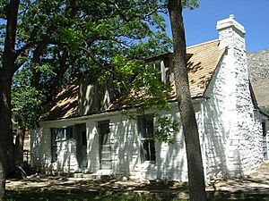
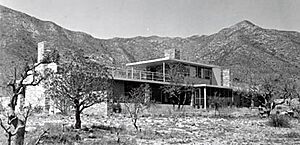
The McKittrick Canyon trail leads to a stone cabin. This cabin was built in the early 1930s. It was a vacation home for Wallace Pratt, a petroleum geologist. He later donated the land to the park. Dog Canyon is on the northern edge of the park. You can reach it from Carlsbad, New Mexico or Dell City, Texas. You can go camping at Pine Springs campground and Dog Canyon. There is also a public corral for horses and other livestock. The park uses Mountain Time.
Contents
Exploring Guadalupe Mountains National Park
Why This Park is Special
Guadalupe Mountains National Park is a place of amazing natural beauty. It protects unique geological features and stunning scenery. The park also preserves a wilderness area. It is an important part of the northern Chihuahuan Desert in West Texas.
A Journey Through Time: Park History
The Guadalupe Mountains are very old. Scientists believe they formed about 272 to 260 million years ago. This was during a time called the Permian period. The mountains have a long and interesting history.
Ancient Inhabitants and Early Explorers
People have lived in these mountains for over 10,000 years. They used the many caves and rock shelters. These early people were hunter-gatherers. They hunted large animals and collected plants for food. We know this from tools, baskets, pottery, and rock art found in the park.
The first Europeans arrived in the 1500s. They were Spanish explorers. They did not settle the area much. The Spanish brought horses to the region. Soon, local tribes like the Apaches learned to use horses. This helped them hunt and travel. The Mescalero Apaches gathered agave plants for food and fiber. You can still find their agave roasting pits in the park.
Ranching and Mail Routes
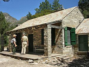
The Mescalero Apaches lived in the mountains until the mid-1800s. After the American Civil War, more people traveled west. This led to conflicts over land and resources. In 1858, Pinery Station was built near Pine Springs. This was a stop for the Butterfield Overland Mail stagecoach. The stagecoach route crossed Guadalupe Pass. Eventually, the Mescalero Apaches moved to designated reservations.
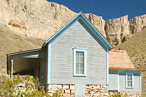
Felix McKittrick was one of the first European settlers. He raised cattle in the 1870s. McKittrick Canyon might be named after him. The Frijole Ranch was the first permanent ranch house. It was built in 1876. It became a community center and post office. Today, it is a museum. The Williams Ranch House was built in 1908.
How the Park Was Created
In 1921, Wallace Pratt visited McKittrick Canyon. He was a geologist and loved its beauty. He bought land there and built two homes. These homes were the Wallace Pratt Lodge and the Wallace E. Pratt House (also called Ship on the Desert).
Pratt and his family used these homes until 1960. He later donated about 6,000 acres (24 square kilometers) of McKittrick Canyon. This land became part of Guadalupe Mountains National Park. The park officially opened to the public in September 1972. In 1978, a large part of the park became a wilderness area. This means it is kept as natural as possible.
The Lay of the Land: Geography
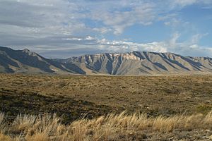
The Guadalupe Mountains are home to Guadalupe Peak. This is the highest point in Texas, reaching about 8,751 feet (2,667 meters). The mountain range stretches from Texas into New Mexico. It rises more than 3,000 feet (914 meters) above the dry Chihuahuan Desert floor. The mountains are surrounded by plains to the east and north.
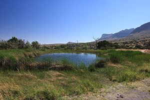
The mountains are mostly made of limestone. This rock formed from an ancient sea reef. Because of this, many high areas have little surface water. McKittrick Canyon has the only important surface water. This is McKittrick Creek, which flows from the eastern side of the mountains.
Weather Wonders: Park Climate
Guadalupe Mountains National Park has a cold semi-arid climate. This means it is generally dry. Summers are relatively hot. Autumns are usually calm and mild. Winters and early springs can be cool to cold. Sometimes, there are snowstorms, sleet, freezing rain, or fog. Strong winds are common from winter through spring. Late summer brings thunderstorms. Even in summer, nights are cool.
Nature's Classroom: Ecology
The park has three main types of natural areas, called ecosystems.
- The Chihuahuan Desert covers the western side. Here you will find salt flats, creosote bushes, and honey mesquite.
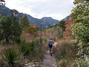
- The canyons, like McKittrick, Bear, and Pine Springs Canyon, have different trees. These include bigtooth maple and chinkapin oak. These trees get water from springs fed by mountain streams.
- High up in the mountains, above 7,000 feet (2,134 meters), are forests. These forests have ponderosa pine, Rocky Mountain Douglas-fir, and small groups of quaking aspen.
The area also has many large cave systems. These include parts of Carlsbad Caverns and Lechuguilla Cave.
Plants of the Guadalupe Mountains
The park is home to over 1,000 kinds of plants. These include many types of cacti, succulents, wildflowers, grasses, and shrubs. The Viola guadalupensis, or Guadalupe Mountains violet, is a very rare plant. It grows only in this park.
Animals of the Guadalupe Mountains
Many mammals live in the park. You might see elk, javelina, gray fox, and American black bear. Other animals include coyotes, bobcats, striped and hog-nosed skunks, and badgers. There are also sixteen types of bat, mule deer, and mountain lions.
The park is also a great place for birdwatching. Common birds include great horned owls, chickadees, sparrows, and woodpeckers. You might also spot turkey vultures, greater roadrunners, hummingbirds, peregrine falcons, wrens, grosbeaks and golden eagles.
See also
 In Spanish: Parque nacional de las Montañas de Guadalupe para niños
 | Leon Lynch |
 | Milton P. Webster |
 | Ferdinand Smith |


