
Culberson County, Texas facts for kids
Quick facts for kids
Culberson County
|
|
|---|---|

Culberson County Courthouse in Van Horn
|
|

Location within the U.S. state of Texas
|
|
 Texas's location within the U.S. |
|
| Country | |
| State | |
| Founded | 1912 |
| Named for | David B. Culberson |
| Seat | Van Horn |
| Largest town | Van Horn |
| Area | |
| • Total | 3,813 sq mi (9,880 km2) |
| • Land | 3,813 sq mi (9,880 km2) |
| • Water | 0.2 sq mi (0.5 km2) 0.01%% |
| Population
(2020)
|
|
| • Total | 2,188 |
| • Estimate
(2022)
|
2,155 |
| • Density | 0.6/sq mi (0.2/km2) |
| Time zones | |
| most of county | UTC−6 (Central) |
| • Summer (DST) | UTC−5 (CDT) |
| northwestern | UTC−7 (Mountain) |
| • Summer (DST) | UTC−6 (MDT) |
| Congressional district | 23rd |
Culberson County is a county located in the U.S. state of Texas. In 2020, about 2,188 people lived there. The main town and county seat is Van Horn. Culberson County was created in 1911 and officially started working as a county in 1912. It is named after David B. Culberson, who was a soldier and a U.S. representative.
Most of Culberson County is in the Central Time Zone. However, the northwestern part, which includes Guadalupe Mountains National Park, is in the Mountain Time Zone. This makes it one of the few U.S. counties that are split between two time zones. It is also one of the nine counties in the Trans-Pecos region of West Texas.
Contents
History of Culberson County
Early People and Native Americans
Long ago, prehistoric people from the Clovis culture lived in rock shelters and caves in Culberson County. They stayed near water sources and left behind tools and rock paintings. Because the land was very rugged, not many explorers came to this area for a long time.
The Jumano Indians helped the Antonio de Espejo expedition in 1582-1583. They showed them a better path near Toyah Lake. Espejo's notes show that the Jumano lived along the Pecos River.
Antonio de Espejo was also the first European to see the Mescalero Apache people. They lived just east of the Guadalupe Mountains. The Mescalero Apache often visited this area to grow their crops. In 1849, John Salmon "Rip" Ford explored the land between San Antonio and El Paso. He wrote in his report that the Mescalero Indians farmed on good land. By the mid-1600s, the Mescaleros had spread their territory from the Guadalupes to other areas. Their presence made it difficult for new settlers to move in.
Explorations and Trails
As people wanted new ways to travel from Texas to California, more explorations happened. A path from San Antonio to El Paso was mapped in 1848.
In 1850, Texas Commissioner Robert Simpson Neighbors was sent to help organize the town of El Paso.
Lt. Francis Theodore Bryan explored a route from San Antonio to El Paso. He camped at Guadalupe Pass in 1849. He suggested digging wells along the route for water. In 1848, the Secretary of War wanted a military base built near the Rio Grande. Major Jefferson Van Horne was sent in 1849 to set up this base.
John Russell Bartlett was asked in 1850 to help with the Treaty of Guadalupe Hidalgo. He described the Guadalupe Mountains as dark and gloomy. He thought a railroad should be built south of these mountains. Later, Captain John Pope looked for a railroad route and also searched for underground water.
Mail services like the San Antonio-San Diego Mail Line and the Butterfield Overland Mail operated in the area from 1857 to 1861. These mail coaches helped people travel to California. It took about 27 days and cost $200 for a one-way ticket. Travelers also had to be brave enough to face the weather and dangers along the way.
Later, different railway companies competed to build tracks. The Texas and Pacific Railway and the Galveston, Harrisburg and San Antonio Railway eventually agreed to share the same tracks.
County Established and Growth

Culberson County was officially created in 1911. It was formed from parts of El Paso County. The county was named after David B. Culberson. In 1912, the county was fully organized, and Van Horn became its main town.
With the new railways, ranchers started to settle in the county. The town of Lobo was settled partly because of false promises from promoters. The people who lived there sued the promoters, forcing them to build the Lobo Hotel. Sadly, two strong earthquakes hit the area. One was in 1929, and another was a 6.0 earthquake near Valentine. This larger quake was felt as far away as Dallas and destroyed the hotel.
Guadalupe Mountains National Park was created in 1972. President Lyndon B. Johnson signed the law to create the park in 1966. A rule was made that all rights to minerals, oil, and gas had to be given to the government.
Space Exploration
Blue Origin, a company that builds space vehicles, has a launch site about 25 miles north of Van Horn, Texas. This company was started by Jeff Bezos.
Geography of Culberson County

According to the United States Census Bureau, Culberson County covers about 3,813 square miles (9,876 km²). Almost all of this is land, with only a tiny bit of water. It is the fifth-largest county in Texas by area. A large part of Guadalupe Mountains National Park is in the northwestern corner of the county. This includes McKittrick Canyon and Guadalupe Peak, which is the highest natural point in Texas at 8,751 feet (2,667 meters).
Main Roads

 Interstate 10
 U.S. Highway 62/U.S. Highway 180
 U.S. Highway 90
 State Highway 54
Neighboring Counties
- Eddy County, New Mexico (north)
- Reeves County (east)
- Jeff Davis County (south)
- Hudspeth County (west)
- Otero County, New Mexico (northwest)
Protected Natural Areas
Population of Culberson County
| Historical population | |||
|---|---|---|---|
| Census | Pop. | %± | |
| 1920 | 912 | — | |
| 1930 | 1,228 | 34.6% | |
| 1940 | 1,653 | 34.6% | |
| 1950 | 1,825 | 10.4% | |
| 1960 | 2,794 | 53.1% | |
| 1970 | 3,429 | 22.7% | |
| 1980 | 3,315 | −3.3% | |
| 1990 | 3,407 | 2.8% | |
| 2000 | 2,975 | −12.7% | |
| 2010 | 2,398 | −19.4% | |
| 2020 | 2,188 | −8.8% | |
| 2022 (est.) | 2,155 | −10.1% | |
| U.S. Decennial Census 1850–2010 2010–2020 |
|||
2020 Census Information
| Race / Ethnicity (NH = Non-Hispanic) | Pop 2000 | Pop 2010 | Pop 2020 | % 2000 | % 2010 | % 2020 |
|---|---|---|---|---|---|---|
| White alone (NH) | 733 | 504 | 445 | 24.64% | 21.02% | 20.34% |
| Black or African American alone (NH) | 19 | 8 | 20 | 0.64% | 0.33% | 0.91% |
| Native American or Alaska Native alone (NH) | 11 | 13 | 11 | 0.37% | 0.54% | 0.50% |
| Asian alone (NH) | 17 | 22 | 28 | 0.57% | 0.92% | 1.28% |
| Pacific Islander alone (NH) | 0 | 0 | 0 | 0.00% | 0.00% | 0.00% |
| Other Race alone (NH) | 0 | 0 | 3 | 0.00% | 0.00% | 0.14% |
| Mixed race or Multiracial (NH) | 46 | 24 | 36 | 1.55% | 1.00% | 1.65% |
| Hispanic or Latino (any race) | 2,149 | 1,827 | 1,645 | 72.24% | 76.19% | 75.18% |
| Total | 2,975 | 2,398 | 2,188 | 100.00% | 100.00% | 100.00% |
As of the 2020 United States census, there were 2,188 people living in the county. There were 668 households and 400 families.
In the year 2000, there were 2,975 people, 1,052 households, and 797 families. The population was spread out, with about 32.20% under 18 years old, and 11.20% who were 65 or older. The average age was 33 years.
Communities in Culberson County
Town
- Van Horn (This is the county seat, meaning it's the main town where the county government is located.)
Unincorporated Communities
These are smaller places that are not officially towns or cities.
- Kent
- Nickel Creek
- Pine Springs
- Plateau
- State Line
- Wild Horse
Ghost Towns
These are places where people used to live, but now they are mostly empty.
Education in Culberson County
All of Culberson County is part of the Culberson County-Allamoore Independent School District.
The entire county is also served by Odessa College, which offers higher education.
Images for kids
-
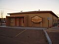
Culberson County Sheriff's Office

See also
 In Spanish: Condado de Culberson para niños
