San Perlita, Texas facts for kids
Quick facts for kids
San Perlita, Texas
|
|
|---|---|

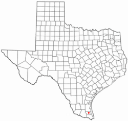
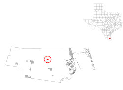
Location of San Perlita, Texas
|
|
 |
|
| Country | United States |
| State | Texas |
| County | Willacy |
| Area | |
| • Total | 0.52 sq mi (1.35 km2) |
| • Land | 0.52 sq mi (1.35 km2) |
| • Water | 0.00 sq mi (0.00 km2) |
| Elevation | 20 ft (6 m) |
| Population
(2020)
|
|
| • Total | 538 |
| • Density | 1,035/sq mi (398.5/km2) |
| Time zone | UTC-6 (Central (CST)) |
| • Summer (DST) | UTC-5 (CDT) |
| ZIP code |
78590
|
| Area code(s) | 956 |
| FIPS code | 48-65636 |
| GNIS feature ID | 1346465 |
San Perlita (also known as Santa Perlita) is a small city in Willacy County, Texas, United States. In 2020, about 538 people lived there. It is part of the larger Brownsville–Harlingen–Raymondville and Matamoros–Brownsville areas.
Contents
Geography of San Perlita
San Perlita is located at coordinates 26.500515 degrees North and -97.643223 degrees West. This means it is in the southern part of Texas.
The United States Census Bureau says the city covers a total area of 0.5 square miles (1.3 square kilometers). All of this area is land, with no water.
People Living in San Perlita
This section shows how the number of people living in San Perlita has changed over the years.
| Historical population | |||
|---|---|---|---|
| Census | Pop. | %± | |
| 1960 | 348 | — | |
| 1970 | 352 | 1.1% | |
| 1980 | 475 | 34.9% | |
| 1990 | 512 | 7.8% | |
| 2000 | 680 | 32.8% | |
| 2010 | 573 | −15.7% | |
| 2020 | 538 | −6.1% | |
| U.S. Decennial Census 1850–1900 1910 1920 1930 1940 1950 1960 1970 1980 1990 2000 2010 |
|||
San Perlita's Population in 2020
The table below shows the different groups of people living in San Perlita in 2020. "NH" means "Non-Hispanic."
| Race | Number | Percentage |
|---|---|---|
| White (NH) | 21 | 3.9% |
| Mixed/Multi-Racial (NH) | 3 | 0.56% |
| Hispanic or Latino | 514 | 95.54% |
| Total | 538 |
As of the 2020 United States census, there were 538 people living in San Perlita. These people lived in 161 households, and 126 of these were families.
Education in San Perlita
Students in San Perlita attend schools that are part of the San Perlita Independent School District.
There are also special schools called magnet schools. These are run by the South Texas Independent School District and serve the community.
See also
 In Spanish: San Perlita (Texas) para niños

