
San Rafael District, San Rafael facts for kids
Quick facts for kids
San Rafael
|
|
|---|---|
|
District
|
|

San Rafael
Location in Costa Rica
|
|
| Country | |
| Province | Heredia |
| Canton | San Rafael |
| Area | |
| • Total | 1.3 km2 (0.5 sq mi) |
| Elevation | 1,264 m (4,147 ft) |
| Population
(2011)
|
|
| • Total | 9,668 |
| • Density | 7,440/km2 (19,300/sq mi) |
| Time zone | UTC−06:00 |
| Postal code |
40501
|
San Rafael is a cool district located in the Heredia province of Costa Rica. It's part of the San Rafael canton.
Contents
Geography
San Rafael covers a small area of about 1.3 square kilometers (that's 0.5 square miles). It sits high up, about 1,264 meters (or 4,147 feet) above sea level. Imagine living in the clouds!
Who Lives in San Rafael?
| Historical population | |||
|---|---|---|---|
| Census | Pop. | %± | |
| 1864 | 2,743 | — | |
| 1883 | 3,818 | 39.2% | |
| 1892 | 1,612 | −57.8% | |
| 1927 | 1,542 | −4.3% | |
| 1950 | 1,556 | 0.9% | |
| 1963 | 2,835 | 82.2% | |
| 1973 | 4,720 | 66.5% | |
| 1984 | 7,141 | 51.3% | |
| 2000 | 8,651 | 21.1% | |
| 2011 | 9,668 | 11.8% | |
|
Instituto Nacional de Estadística y Censos |
|||
Every few years, countries count how many people live there. This is called a census. For the 2011 census, San Rafael had a population of about 9,668 people. The number of people living here has grown a lot over the years!
Getting Around San Rafael
San Rafael has several important roads that help people travel in and out of the district. These are like main highways that connect San Rafael to other places.
Road Routes
The district is connected by these main roads:
 National Route 113
 National Route 116
 National Route 503
Images for kids
-
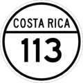
National Route 113 sign
-
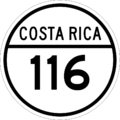
National Route 116 sign
-
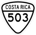
National Route 503 sign


See also
 In Spanish: San Rafael (Heredia) para niños
