Sandy Bay, Saskatchewan facts for kids
Quick facts for kids
Sandy Bay
|
|
|---|---|
|
Northern village
|
|

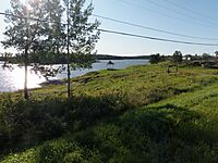
Main Beach on the Churchill River
|
|
| Country | Canada |
| Province | Saskatchewan |
| District | Northern Saskatchewan Administration District |
| Census division | 18 |
| Time zone | CST |
| Area code(s) | 306 |
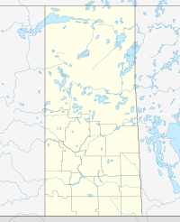
Sandy Bay is a northern village in Saskatchewan, Canada. It is located in the boreal forest of northern Saskatchewan. The village sits on the Churchill River. It is about 70 kilometers north of Pelican Narrows. It is also 190 kilometers northwest of Creighton and Flin Flon. You can reach it by Highway 135 and the Hanson Lake Road.
The community of Sandy Bay has two parts. One is the Northern Village of Sandy Bay. The other is the Wapaskokimaw 202 reserve of the Peter Ballantyne Cree Nation.
Sandy Bay has important services for its residents. These include a health clinic and a community resource center. There is also a pre-school, a K-12 school, and a day-care. About 1,200 people live in Sandy Bay. Around one-quarter of them are members of the Peter Ballantyne Cree Nation.
Contents
History of Sandy Bay
Sandy Bay started because of a power station. This hydroelectric power station was built in the late 1920s. It provided electricity for mines and smelters in Flin Flon, Manitoba.
The community was first located further down the Churchill River. But people were asked to move closer to where the Island Falls Generating Station would be built. This was so they could help build it. The community grew as the power station changed traditional ways of life.
In 1965, Sandy Bay became a Local Community Authority. This meant it could manage some of its own affairs. In 1966, the Island Falls Generating Station became automatic. This caused many jobs to be lost. An all-weather road was built to the community in 1967. Other services followed after the road was built. In the 1980s, Sandy Bay was officially named a northern village.
Today, SaskPower runs the dam, and it is fully automated. Tourism is now the main industry in the area. There is a local store in Sandy Bay. However, most other supplies and groceries are bought in Flin Flon, Manitoba. Flin Flon is about two hours away by gravel and paved roads.
Population Information
In the 2021 Census, Sandy Bay had a population of 671 people. These people lived in 161 homes. This was a growth of 17.3% from its 2016 population of 572 people.
The village covers a land area of 11.42 square kilometers. In 2021, this meant there were about 58.8 people living per square kilometer.
Climate and Weather
| Weather chart for Sandy Bay (Island Falls Station) | |||||||||||||||||||||||||||||||||||||||||||||||
|---|---|---|---|---|---|---|---|---|---|---|---|---|---|---|---|---|---|---|---|---|---|---|---|---|---|---|---|---|---|---|---|---|---|---|---|---|---|---|---|---|---|---|---|---|---|---|---|
| J | F | M | A | M | J | J | A | S | O | N | D | ||||||||||||||||||||||||||||||||||||
|
17
-16
-25
|
15
-11
-20
|
18
-3
-14
|
23
7
-4
|
44
16
4
|
72
21
10
|
75
24
13
|
62
22
12
|
57
14
6
|
35
6
-0
|
21
-5
-11
|
24
-14
-21
|
||||||||||||||||||||||||||||||||||||
| temperatures in °C precipitation totals in mm source: The Weather Network |
|||||||||||||||||||||||||||||||||||||||||||||||
|
Imperial conversion
|
|||||||||||||||||||||||||||||||||||||||||||||||
Sandy Bay has warm summers and cold winters. In summer, the average daytime high is usually below 25°C. However, sometimes it can get very hot, reaching 30°C to 35°C. In winter, the average daytime low is usually above -25°C. But cold weather can bring temperatures down to -40°C.
Most of the rain falls during the summer months, especially in June and July. The area gets about 460mm of rain each year. In summer, rain often falls heavily for short periods. Lightning and thunderstorms happen almost every summer evening. Heavy rain can make lakes, rivers, and streams fill up quickly. This can sometimes cause problems.
In the summer of 2011, Sandy Bay and Pelican Narrows had a lot of rain. It rained heavily for three days. The rivers overflowed, and the main road was washed out in several places. This made the roads impossible to use. The communities were cut off from normal services. No one could leave or enter. The Hanson Lake Road, Highway 106, was also washed out. The provincial Ministry of Transportation worked quickly to fix the roads. They were open again within a few days.
Weather Records
The hottest day ever recorded was on July 21, 1929. The temperature reached 40°C that day. The coldest day ever was on January 15, 1930. The temperature dropped to -46.1°C. The most rain in one day was 77mm. This happened on August 22, 1936. The most snow in one day was 28cm. This fell on November 28, 1973.
Hector Thiboutot School
The Hector Thiboutot Community School teaches students from Kindergarten to Grade 12. The school has more than 500 students. It has a large gymnasium, a science lab, and a home economics room. There is also an industrial arts shop, a community library, and a computer room. The school also has many large classrooms. Teachers can live in furnished rental housing provided by the school. The school offers exciting and challenging programs for its students.
Sandy Bay Memorial Beach
The Sandy Bay Memorial Beach is a special project. It was built to remember children who have drowned in the Churchill River. In the summer of 2011, the community decided to create a safe swimming area.
The beach offers a controlled place for children to swim. It has safety features like floating docks and buoys. There is also an emergency access ramp. These features are not common in many northern Indigenous communities. The community plans to have lifeguards working during the summer. This will make it a perfect place for families to swim. This project has also created new jobs for people in the community. It gives young people work experience. The Hector Thiboutot School joined the project. They teach students about water safety. They also teach about playing near frozen rivers and lakes in winter.
 | Valerie Thomas |
 | Frederick McKinley Jones |
 | George Edward Alcorn Jr. |
 | Thomas Mensah |


