Santa Ana del Táchira facts for kids
Quick facts for kids
San Ana del Táchira
|
|||
|---|---|---|---|
 |
|||
|
|||
| Country | |||
| State | Táchira | ||
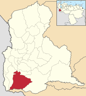
| Municipality | Córdoba Municipality | ||
| Area | |||
| • Total | 619 km2 (239 sq mi) | ||
| Elevation | 807 m (2,648 ft) | ||
| Population
(2013)
|
|||
| • Total | 36,925 | ||
| • Density | 59.65/km2 (154.50/sq mi) | ||
| Time zone | UTC−4 (VET) | ||
| Postal code |
5051
|
||
| Area code(s) | 0276 | ||
| Climate | Aw | ||
| Website | cordoba-tachira.gob.ve | ||
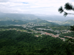
Santa Ana del Táchira is a town in Venezuela. It is the main town of Córdoba Municipality in Táchira state. This town sits high up, about 810 meters (2,657 feet) above sea level. It is located by the Quinimarí River, right in the Andes mountains. Timoteo Chacón founded Santa Ana in 1860. You can find it south of San Cristóbal, nestled among mountains and valleys. The town still shows its history with old streets, traditional houses, and colorful tile roofs.
Contents
Where is Santa Ana del Táchira?
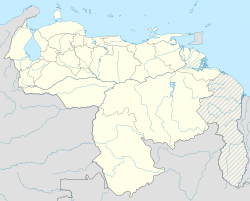
Santa Ana del Táchira is in the southwest of Táchira state. Its exact spot is 07º 38′ 43″ north latitude and 72° 16′ 33″ west longitude.
Connecting Roads and Local Economy
Roads connect the city to other parts of Venezuela. You can travel to cities like Barinas and San Cristóbal from here.
Santa Ana is an important farming area. Farmers mainly grow coffee and vegetables. In the higher areas, they grow special garden plants. In the lower areas, they grow corn and sugar. There are also small factories that clean, dry, store, and sell coffee. The town helps support the farms around it with administrative and other services. People expect that Santa Ana will one day connect with the larger cities of San Cristóbal, Táriba, and Palmira.
The History of Santa Ana
Timoteo Chacón founded the town of Santa Ana. He named it after his oldest daughter, Ana. In 1869, Timoteo Chacón bought the land that would become Córdoba Municipality. General Leopoldo Eugenio Machado sold him the land. The original document did not clearly describe the land's borders. This caused big problems later on. These problems even led to the murder of José Gregorio Villafane Q. in 1889.
How the Land Was Described
According to Don Martín León in 1955, the land was sold for 1,750 pesos. The official borders were:
"from the mouth of the creek Wren in the river Quinimarí, upstream of the creek until an equidistance line could be traced to the sources of the creek Uzateca, Uzateca downstream to its mouth in the river Quinimarí. Quinimarí downstream to find the mouth of the creek La Ratona, starting point ".
This information was written down in a document from 1878. It is kept in the Principal Register of San Cristóbal.
Local Historians
The official historian of Santa Ana is José Joaquín Villamizar Molina. He was born in 1930. His important books include Santa Ana del Táchira and Santa Ana Ciudad de mis Amores.
What Santa Ana Offers
Santa Ana has two branches of Banco Bicentenario, which is a bank.
Schools and Sports
The town has one main high school called Bernabe Vivas. More than 2,000 students attend this school during the day. At night, there is another high school called CCB high school Santa Ana. It has 147 students. The director of this school is Lic. Ramon Roa E.
For sports, Santa Ana has a football (soccer) field with artificial grass. Biking is also very popular here. The Club Lottery Tachira is located in Santa Ana. There are also several Mountain Biking clubs. On Maundy Thursday, bikers often ride to San Vicente of Revenge. This ride is about 40 kilometers (25 miles) long. It includes a tough climb from 800 meters (2,625 feet) to 2,900 meters (9,514 feet).
Local Products and Travel
The main product grown in Santa Ana is coffee. The town is about 20 kilometers (12 miles) from San Cristóbal. The road between them is in good condition.
See also
 In Spanish: Santa Ana del Táchira para niños
 | Georgia Louise Harris Brown |
 | Julian Abele |
 | Norma Merrick Sklarek |
 | William Sidney Pittman |


