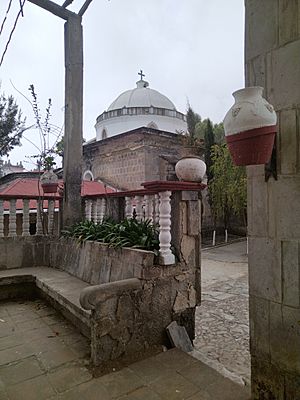
Santa Catarina Ixtahuacan facts for kids
Santa Catarina Ixtahuacan is a town and a special area called a municipality in Guatemala. It is found in the Sololá region of the country. This town sits high up in the mountains, about 2,300 meters (7,500 feet) above sea level. It's part of the Sierra Madre mountain range, which has very steep slopes.
The people who live here mostly speak Kʼicheʼ, which is an ancient language of the Maya people.
A New Home After the Storm
In 1998, a very strong storm called Hurricane Mitch hit the area. It caused big landslides in Santa Catarina Ixtahuacan. Landslides are when a lot of earth and rocks slide down a mountain. Because of this danger, many people moved to a safer, higher place.
About a year after the hurricane, they started a new village called Nueva Santa Catarina Ixtahuacan. This new village was built on land that was part of another town called Nahualá. The new area was known as Chwi Pataan, which means "above the responsibility/duty." Most of the land there was owned by people from Nahualá before 2005.
Old Land, New Claims
Since the year 2000, the people of Ixtahuacan have said that the land where Nueva Santa Catarina Ixtahuacan was built actually belonged to them for a very long time. They believe their ancestors lived there even before the Spanish arrived in Guatemala.
However, there is an old land document from the 1500s called the Título Cristobal Ramirez. This document says that the mountain area, including Chwi Pataan, belonged to the "navalak tak vinak" or "spirited people" of Nahualá. These people were part of a group called the Kaqoj Tamub', who were a part of the larger Kʼicheʼ nation.
Another old book, the Annals of the Kaqchikeks, also talks about different groups of people. It suggests that the people living near a mountain called Kaqix Kan, which is above the old Ixtahuacan, were called "Iqomaq'i'". This name likely refers to the Ekomaq' Tamub' group, who lived in a valley south of Nahualá. This shows that different groups of people lived in these areas long ago, and there have been disagreements about land ownership for a very long time.
See also
 In Spanish: Santa Catarina Ixtahuacán para niños
 | DeHart Hubbard |
 | Wilma Rudolph |
 | Jesse Owens |
 | Jackie Joyner-Kersee |
 | Major Taylor |


