Sierra Madre de Chiapas facts for kids
Quick facts for kids Sierra Madre |
|
|---|---|

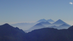
Volcanoes of the Sierra Madre in Guatemala
|
|
| Highest point | |
| Peak | Volcán Tajumulco (Guatemala) |
| Elevation | 4,220 m (13,850 ft) |
| Geography | |
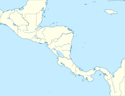
| Countries | Mexico, Guatemala, El Salvador and Honduras |
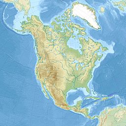
| Range coordinates | 15°30′N 92°36′W / 15.5°N 92.6°W |
| Geology | |
| Orogeny | Central America Volcanic Arc |
The Sierra Madre is a very important mountain range in Central America. It is also known as the Sierra Madre de Chiapas in Mexico. This mountain range stretches across several countries. You can find parts of it in El Salvador, Guatemala, Mexico, and Honduras. The Sierra Madre is part of a much larger chain of mountains. This chain is called the American Cordillera. It forms a long, almost unbroken line of mountains. This "backbone" runs along the western side of North America, Central America, and South America.
Contents
Exploring the Geography of the Sierra Madre
This mountain range runs from the northwest to the southeast. It starts in the state of Chiapas in Mexico. Then it goes across western Guatemala. Finally, it reaches into El Salvador and Honduras. Many of Guatemala's volcanoes are found here. These volcanoes are part of the Central America Volcanic Arc.
South of the Sierra Madre, there is a narrow flat area. This flat land is between the mountains and the Pacific Ocean. To the north of the range, you'll find different kinds of land. There are high areas and low areas. For example, the Chiapas Depression separates the Sierra Madre from the Chiapas Plateau. You'll also find the Guatemalan Highlands and the highlands of Honduras here.
The Sierra Madre acts like a giant wall. It separates the rivers that flow to the Pacific Ocean from those that flow to the Atlantic Ocean. This is called a drainage divide. On the Pacific side, the ocean is very close. So, the rivers are short and flow very fast. Some rivers on the Pacific side start in the Guatemalan Highlands. They cut deep paths through the Sierra Madre. On the eastern side, many rivers flow towards the Atlantic. These rivers are much bigger and wider.
The southern slopes of these mountains are covered by special forests. These are called the Sierra Madre moist forests. The mountains catch the winds coming from the Pacific Ocean. This creates fog, clouds, and rain. This rain helps these cloud forests grow. The high peaks and northern slopes of the Sierra Madre have different forests. These are called the Central American pine–oak forests.
Local Names for the Sierra Madre
Near Guatemala City, this mountain range is known by another name. It is called the Sierra de las Nubes, which means "Mountains of the Clouds." When it enters Mexico, it is called the Sierra de Istatan. The very top of the range is not a sharp ridge. Instead, it is often rounded or flat like a table. The large volcanoes that rise above the range do not always follow the main line of the Sierra. They tend to lean more towards the south, especially near El Salvador.
Amazing Volcanoes of the Sierra Madre
Many of the volcanoes in this range have their bases in the southern foothills. It's hard to divide the Sierra Madre into a northern part and a volcanic part. This is because the volcanoes are often far apart. At least thirteen large streams flow between them. These streams go from the main watershed all the way to the sea. From the coast, the volcanoes look like they rise directly from the main Sierra Madre mountains. But actually, their bases are usually further south.
East of Volcán Tacana, which is 4,092 meters tall, you'll find the Mexican border. The main volcanoes in this area include:
- Volcán Tajumulco: This is the tallest at 4,220 meters.
- Volcán Santa Maria: It is 3,777 meters tall. It erupted in 1902 after being quiet for hundreds of years. Before that, its slopes were covered in thick forests.
- Volcán Atitlán: This volcano is 3,557 meters tall. It overlooks the beautiful Lake Atitlan.
- Acatenango: This one stands at 3,976 meters.
- Volcan de Fuego: Its name means "fire" (3,763 meters). It got this name because it was very active when the Spanish arrived.
- Volcán de Agua: Its name means "water" (3,765 meters). It was named in 1541. This is because it destroyed the old capital of Guatemala. A flood of water from its crater caused the destruction.
- Pacaya: This is a group of volcanic peaks, 2,550 meters tall. They erupted in 1870.
East of the Guatemalan border, the range forms the boundary between El Salvador and Honduras. In El Salvador, the volcanoes are located south of the main range. Here, more than twenty volcanoes form five groups. Between the Sierra Madre and the line of volcanoes, there is a central flat area.
See also
 In Spanish: Sierra Madre de Chiapas para niños
- Geography of Mesoamerica
- Sierra Madre de Chiapas topics
 | Stephanie Wilson |
 | Charles Bolden |
 | Ronald McNair |
 | Frederick D. Gregory |


