Volcán Tacaná facts for kids
Quick facts for kids Volcán Tacaná |
|
|---|---|
 |
|
| Highest point | |
| Elevation | 4,060 m (13,320 ft) |
| Prominence | 1,030 m (3,380 ft) |
| Listing |
|
| Geography | |
| Parent range | Sierra Madre de Chiapas |
| Geology | |
| Mountain type | Stratovolcano |
| Volcanic arc | Central America Volcanic Arc |
| Last eruption | May 1986 |
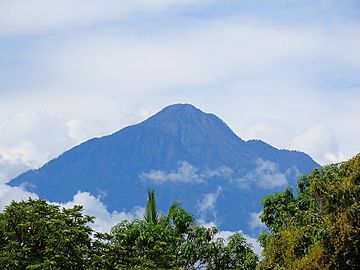
Volcán Tacaná is a huge volcano located on the border between Guatemala and Mexico. It is the second highest peak in Central America, standing tall at about 4,060 meters (13,320 feet). You can find it in the Sierra Madre de Chiapas mountain range. In Mexico, some people call it Volcán Tacina.
Contents
Where is Volcán Tacaná Located?
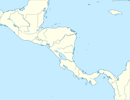
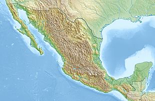
This impressive volcano sits right on the border. On the Guatemalan side, it's in the Tacaná area of the San Marcos Department. On the Mexican side, it's part of the Cacahoatán and Unión Juárez areas in the state of Chiapas.
When Did Tacaná Last Erupt?
The last time Tacaná erupted was in May 1986. It was a small eruption where steam and ash came out, but not lava. Even though it was a small event, the volcano is still watched closely. More than 250,000 people live near it, so scientists keep an eye on its activity to keep everyone safe.
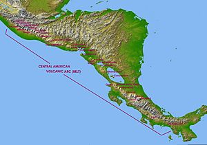
Tacaná is the very first volcano in a long chain of hundreds of volcanoes. This chain stretches for about 1,500 kilometers (930 miles) along the Pacific Ocean coast of Central America. It's called the Central America Volcanic Arc. This arc formed because of a special area deep underground where one of Earth's large plates (the Caribbean Plate) is slowly sliding under another.
The land at the base of the volcano, especially to the northeast, is covered with thick layers of old mudflows. These mudflows, called lahars, are made of volcanic ash and water. If Tacaná erupts again, new mudflows could flow down the valleys into both Guatemala and Mexico, which could be dangerous for people living there.
What Type of Volcano is Tacaná?
Tacaná is a stratovolcano, also known as a composite volcano. This means it's built up over time by many layers of hardened lava, ash, and rocks from past eruptions. It has a large, bowl-shaped area at its top called a caldera, which is about 9 kilometers (5.6 miles) wide. The top of the volcano also has several lava domes, which are like big mounds of thick, slow-moving lava.
Past Eruptions and Their Power
In the past, Tacaná has had mild steam eruptions. Its most powerful known eruption happened around 70 AD. That eruption was very strong and included fast-moving currents of hot gas and volcanic debris called pyroclastic flows. Scientists measure the power of eruptions using something called the Volcanic Explosivity Index (VEI). Tacaná's big eruption in 70 AD was rated a VEI 4, which is a powerful explosion.
Why is Tacaná a Biosphere Reserve?
Volcán Tacaná is part of a special group of volcanoes in Central America. These areas have unique and delicate natural environments with many different kinds of plants and animals. They are important for science, culture, and the economy. The volcano's amazing landscapes and features also have great scientific and natural beauty.
Because of its importance, Tacaná has been named a UNESCO World Network of Biosphere Reserves. This means it's a protected area where people try to balance nature conservation with human activities.
How Can You Visit Tacaná?
Reaching the top of Tacaná can take about 10 hours of hiking. There are two main ways to get there:
- One way is from Finca Navidad, a farm south of the volcano in Guatemala. This path goes through a place called Tojquián Grande and follows the border with Mexico.
- The second way starts on the Mexican side. You can drive from places like El Carmen, Talismán bridge, Cacahoatán, and Unión Juárez. From Unión Juárez, you start hiking.
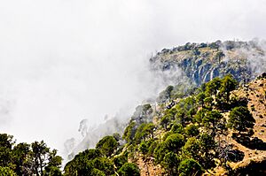
This Mexican route is considered one of the most exciting hikes in Central America. It takes you through winding paths, lush rainforests, small farming villages, and over old lava flows. As you climb higher, you pass through forests and then reach the lowest part of the caldera. From there, the final climb to the summit offers amazing views high above the clouds. You can even see other big volcanoes in the Central American Volcanic Arc, like Tajumulco, from the top!
See also
 In Spanish: Volcán Tacaná para niños
- List of mountain peaks of North America
- List of mountain peaks of Mexico
- List of volcanoes in Mexico
- List of mountain peaks of Central America
- List of volcanoes in Guatemala
- List of mountain peaks of Mexico
 | Jackie Robinson |
 | Jack Johnson |
 | Althea Gibson |
 | Arthur Ashe |
 | Muhammad Ali |


