Tacaná facts for kids
Quick facts for kids
Tacaná
|
|
|---|---|
|
Municipality
|
|
| Country | |
| Department | |
| Area | |
| • Municipality | 377 km2 (146 sq mi) |
| Population
(2018 census)
|
|
| • Municipality | 75,788 |
| • Density | 201.03/km2 (520.7/sq mi) |
| • Urban | 8,725 |
| Climate | Cwb |
Tacaná is a town and a municipality in Guatemala. It is located in the San Marcos area. Tacaná is an important place with a rich past.
Contents
History of Tacaná

Long ago, around 1690, the area of Tejutla was very large. It included many towns that are separate municipalities today. These towns were Comitancillo, Ixchiguán, Concepción Tutuapa, Sipacapa, Sibinal, Tajumulco, and Tacaná.
A writer named Francisco Antonio de Fuentes y Guzmán described Tejutla. He said it was a "prosperous land" with good weather and plenty of water.
Tejutla: A Center of Trade and Religion
Tejutla was a busy place for trade and religious activities. In 1767, Joseph Domingo Hidalgo called Tejutla "El Curato." This meant it was the main trading center for all the towns nearby.
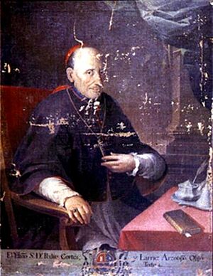
Later, in 1770, a bishop named Dr. Pedro Cortés y Larraz visited Tejutla. He called it "Santiago at the top of the hill." He reported that many families lived well in the area.
Tacaná's Place in Guatemala
In 1821, a new constitution for Central America was created. For the first time, Tejutla was officially part of the San Marcos region. This was an important step for the area.
By 1870, Tejutla had grown a lot. Its leaders asked the government to make it a department capital. This new department would include Tacaná and other towns.
Changes in Power and Land
Later, there was a big change in government. New leaders, called liberals, took power. They were led by generals Miguel Garcia Granados and Justo Rufino Barrios.
These new leaders made many changes. They took land from religious groups and gave it to their friends. This changed who owned the land in the area. Many people became large landowners.
Climate in Tacaná
Tacaná has a mild climate. It is known as a temperate climate. This means it has moderate temperatures throughout the year.
| Climate data for Tacaná | |||||||||||||
|---|---|---|---|---|---|---|---|---|---|---|---|---|---|
| Month | Jan | Feb | Mar | Apr | May | Jun | Jul | Aug | Sep | Oct | Nov | Dec | Year |
| Mean daily maximum °C (°F) | 19.0 (66.2) |
19.4 (66.9) |
20.9 (69.6) |
21.3 (70.3) |
20.7 (69.3) |
19.9 (67.8) |
19.8 (67.6) |
20.2 (68.4) |
19.7 (67.5) |
19.2 (66.6) |
19.3 (66.7) |
19.3 (66.7) |
19.9 (67.8) |
| Daily mean °C (°F) | 11.5 (52.7) |
11.8 (53.2) |
13.2 (55.8) |
14.1 (57.4) |
14.7 (58.5) |
14.7 (58.5) |
14.6 (58.3) |
14.4 (57.9) |
14.5 (58.1) |
13.9 (57.0) |
12.9 (55.2) |
12.4 (54.3) |
13.6 (56.4) |
| Mean daily minimum °C (°F) | 4.1 (39.4) |
4.2 (39.6) |
5.6 (42.1) |
7.0 (44.6) |
8.8 (47.8) |
9.6 (49.3) |
9.4 (48.9) |
8.7 (47.7) |
9.3 (48.7) |
8.6 (47.5) |
6.5 (43.7) |
5.5 (41.9) |
7.3 (45.1) |
| Average precipitation mm (inches) | 6 (0.2) |
6 (0.2) |
24 (0.9) |
66 (2.6) |
171 (6.7) |
268 (10.6) |
194 (7.6) |
219 (8.6) |
255 (10.0) |
173 (6.8) |
26 (1.0) |
12 (0.5) |
1,420 (55.7) |
| Source: Climate-Data.org | |||||||||||||
See also
 In Spanish: Tacaná (San Marcos) para niños
 | Charles R. Drew |
 | Benjamin Banneker |
 | Jane C. Wright |
 | Roger Arliner Young |


