Santa Maria Mountains facts for kids
Quick facts for kids Santa Maria Mountains |
|
|---|---|
| Highest point | |
| Peak | Hyde Creek Mountain (Santa Maria Mountains-(center-SW)) |
| Elevation | 7,272 ft (2,217 m) |
| Dimensions | |
| Length | 16 mi (26 km) NW-SE |
| Geography | |
| Country | United States |
| Communities | Tucker, Chino Valley, Bagdad and Seligman |
| Range coordinates | 34°51′24″N 112°54′34″W / 34.8567°N 112.9094°W |
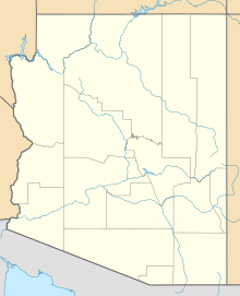
The Santa Maria Mountains are a mountain range in central-northwest Arizona. They stretch for about 16 miles (26 km) in Yavapai County. This area is known for its flat-topped hills called mesas and other mountain ranges. It's part of Arizona's special transition zone. This zone is where the desert lowlands meet the higher, cooler plateaus.
To the west, you'll find the Aquarius and Mohon Mountains, which run alongside the Santa Maria Mountains. Small towns like Tucker and Chino Valley are located to the east of the mountains.
About the Santa Maria Mountains
The Santa Maria Mountains run from the northwest to the southeast. They are connected to a smaller mountain range called the Cornell Mountains to their south. To the east, you'll find the Williamson Valley, which is a small valley with a wash (a dry streambed).
The area around the mountains has many different landforms. You can see hills, peaks, mesas (flat-topped mountains), and flat areas. To the north, there's North Fork Creek and part of the Juniper Mountains, known as Juniper Mesa. To the southeast, you'll find Tailholt Mesa, which is east of the Cornell Mountains.
On the northwest side of the range, there are flat areas called Sawmill and Johnson Flats. These flats connect to the Mohon Mountains to the west. To the southwest, there are other ridges and mesas. These are all part of smaller mountain areas near the mining town of Bagdad.
Mountain Peaks to Explore
The Santa Maria Mountains have several interesting peaks. In the northwest part of the range, you can find:
- Bear Mountain
- Janes Butte
- Dairy Mountain, which is about 7,165 feet (2,184 meters) tall.
In the center-south of the range, there's Granite Knob, standing at about 6,625 feet (2,019 meters). Bald Mountain is to the northeast, reaching about 5,900 feet (1,798 meters).
The highest point in the range is Hyde Creek Mountain. It's located southwest of Bald Mountain, closer to the Cornell Mountains. Hyde Creek Mountain is about 7,272 feet (2,217 meters) tall. The Apache Creek Wilderness area is right next to Hyde Creek Mountain to the north.
See also
 In Spanish: Sierra de Santa María para niños
 | Victor J. Glover |
 | Yvonne Cagle |
 | Jeanette Epps |
 | Bernard A. Harris Jr. |


