Aquarius Mountains facts for kids
Quick facts for kids Aquarius Mountains |
|
|---|---|
| Highest point | |
| Peak | Snow Mountain (Arizona) |
| Elevation | 5,879 ft (1,792 m) |
| Dimensions | |
| Length | 45 mi (72 km) N-S |
| Width | 15 mi (24 km) |
| Geography | |
| Country | United States |
| Settlements | Wikieup, Cane Springs and Kingman |
| Range coordinates | 34°55′05″N 113°26′29″W / 34.9181°N 113.4413°W |
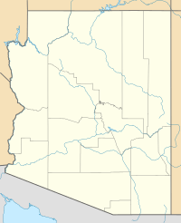
The Aquarius Mountains are a mountain range in Mohave County, Arizona. They stretch for about 45 miles (72 km) from north to south. These mountains are part of a special area called the Arizona transition zone. This zone is where the lower deserts meet the higher plateaus of Arizona.
To the west of the Aquarius Mountains, you'll find the Big Sandy River. Further west are the Hualapai Mountains. These mountains are a type of landform created by large blocks of the Earth's crust moving up and down.
The area around the Aquarius Mountains is also part of the Mojave Desert. This desert stretches all the way down to Wickenburg, Arizona. You can even see cool Joshua trees here! In fact, a highway nearby, U.S. Route 93 in Arizona, is known as the Joshua Tree Highway.
About the Aquarius Mountains
The Aquarius Mountains mostly run from north to south. In the southern part, they curve a bit towards the southeast. The northern part of these mountains connects with another range called the Mohon Mountains.
In this northern area, where the two ranges meet, you'll find two creeks: Trout Creek and Knight Creek. Both of these creeks flow west towards the Big Sandy River. There are also seven named peaks and a place called Cedar Basin in this area.
Highest Points
The very highest point in the Aquarius Mountains is a peak called Snow Mountain (Arizona). It stands tall at 5,879 feet (1,792 meters) high.
Another high point in the range is Grey Mountain. It's located in the far southwest part of the mountains, reaching 5,261 feet (1,604 meters). Grey Mountain is part of the Aquarius Cliffs.
Getting There
You can reach the Aquarius Mountains by using U.S. Route 93 in Arizona. This highway runs north and south through the Big Sandy River Valley, which is on the western side of the mountains.
If you're near Wikieup, Arizona, which is in the southwest part of the range, Route 93 turns southeast towards Wickenburg. Wickenburg is about 65 miles (105 km) away. You can also get to the northern parts of the mountains from south of Interstate 40.
 | Selma Burke |
 | Pauline Powell Burns |
 | Frederick J. Brown |
 | Robert Blackburn |


