Big Sandy River (Arizona) facts for kids
Quick facts for kids Big Sandy River |
|
|---|---|

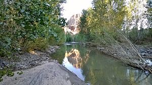
Big Sandy River in the Arrastra Mountain Wilderness
|
|
|
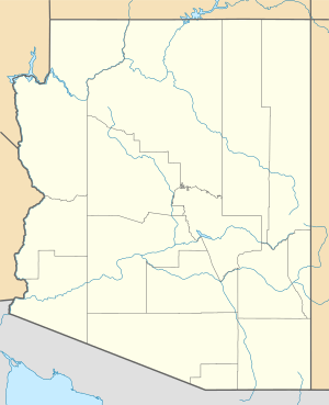
Location of the mouth of the Big Sandy River
|
|
| Country | United States |
| State | Arizona |
| County | Mohave, La Paz |
| Physical characteristics | |
| Main source | Between Hualapai and Aquarius ranges East of U.S. Route 93 near Hualapai Indian Reservation, Mohave County 2,435 ft (742 m) 34°55′21″N 113°37′37″W / 34.92250°N 113.62694°W |
| River mouth | Bill Williams River Alamo Lake State Park, La Paz County 1,237 ft (377 m) 34°18′38″N 113°31′36″W / 34.31056°N 113.52667°W |
| Length | 55.7 mi (89.6 km) |
| Basin features | |
| Basin size | 1,988 sq mi (5,150 km2) |
The Big Sandy River is a river in northwestern Arizona, in the United States. It flows through Mohave and La Paz counties. This river is special because it flows all year in some parts and only sometimes in others.
The river starts where two smaller streams, Cottonwood Wash and Trout Creek, meet. This spot is inside the Hualapai Indian Reservation. The Big Sandy River then flows south past towns like Wikieup. It also goes through the Arrastra Mountain Wilderness, a protected natural area.
Eventually, the Big Sandy River joins the Santa Maria River. Together, they form the Bill Williams River. The Bill Williams River then flows into Alamo Lake State Park. The Big Sandy River is about 55.7 miles (89.6 km) (89.6 km) long.
The area of land that drains water into the Big Sandy River is called its drainage basin. This basin covers about 2,000 square miles (5,200 km2) (5,180 km²) across Mohave, La Paz, and Yavapai counties. The Hualapai Mountains are to the west of the river. The Aquarius and Mohon Mountains are to the east. The highest point in this whole area is Hualapai Peak, which is 8,417 feet (2,566 m) (2,566 m) tall.
Water Flow in the Big Sandy River
The Big Sandy River has water flowing in it all year long in some sections. This is called perennial flow. This happens mainly south of the Signal Ghost Town site. In other parts of the river, especially further north, the water only flows at certain times, like after heavy rains. This is called intermittent flow.
Scientists measure how much water flows in the river. From 2007 to 2016, the amount of water flowing at the Signal Ghost Town site changed a lot. It could be as low as 22 US gallons (83 L) (83 liters) per second. But during big floods, like in early 2010, it could reach nearly 524,000 US gallons (1,980,000 L) (1,983,500 liters) per second! That's a huge difference.
Most of the water in the Big Sandy River basin comes from underground water sources called aquifers. These are like huge sponges of rock and soil that hold water underground. Wells in the area can pump out an average of 300 US gallons (1,100 L) (1,136 liters) of water per minute. Some wells, like at Cane Springs, can pump out even more, up to 2,000 US gallons (7,600 L) (7,571 liters) per minute.
A lot of the water pumped from this area is used for mining operations. Mining uses a lot of water to process minerals. In the year 2000, about 1,142 people lived in the Big Sandy River basin.
Wildlife in the River Basin
The Big Sandy River basin is home to many amazing animals and plants. Some of these species are endemic, meaning they are found only in this specific region.
One important resident is the southwestern willow flycatcher. This is an endangered bird, which means there are very few left. The river basin has one of the few remaining riparian areas in Arizona. Riparian areas are special places along rivers with lots of trees and plants that need water. These areas are very important for wildlife.
Besides the flycatcher, you might also find wild burros living in the river valley. These burros are a protected species. Other animals include ring-tailed cats, mountain lions, and coyotes.
The plant life is also rich. You can see tall sycamore trees, willows, and cottonwood trees growing along the riverbanks.
Water Use Discussions
Water is a very important resource in Arizona, especially in dry areas. Because of this, there have been discussions about how the water from the Big Sandy River basin should be used.
In 2001, a group that decides where big projects can be built said no to a plan for a new power plant. This plant would have used natural gas and needed a lot of water – about 2,400 to 2,500 US gallons (9,100 to 9,500 L) (9,085 to 9,464 liters) of water per minute to cool its machines. The group decided it wasn't a good idea because of the environmental impact and how much water it would use.
Later, in 2015, the U.S. Department of the Interior and a mining company wanted to make an agreement. This agreement would allow the mining company to move the right to use water from one of their properties to wells in the Big Sandy Basin. This water would then be pumped to a mining town called Bagdad, Arizona.
Mohave County was concerned about this plan. They worried about losing water rights and tax money. So, they officially objected to the agreement. The state water department has not yet made a final decision on this matter.
The proposed agreement would let the mining company pump an extra 10,055 acre-feet (about 343 million gallons) of water each year from the Big Sandy Basin. An acre-foot is the amount of water needed to cover one acre of land one foot deep. Most of the water pumped from the Big Sandy Basin, about 96%, is used for mining. The basin naturally gets about 22,000 acre-feet of water each year from rain and other sources.
The Hualapai Tribe also had a part in these discussions. They agreed to the water deal.
 | Janet Taylor Pickett |
 | Synthia Saint James |
 | Howardena Pindell |
 | Faith Ringgold |


