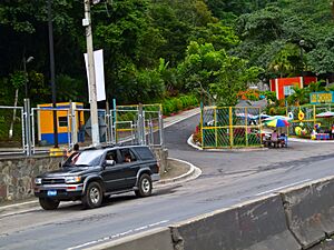
Santa Tecla, El Salvador facts for kids
Quick facts for kids
Santa Tecla
|
||
|---|---|---|
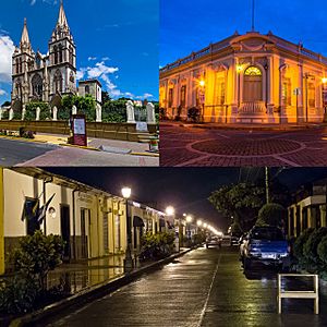
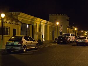
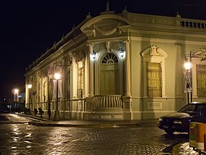
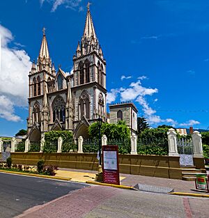
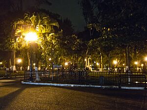
From top, left to right: Iglesia El Carmen, Palacio Municipal de Santa Tecla, Paseo El Carmen.
|
||
|
||
| Nickname(s):
Tecla, Nueva San Salvador
|
||
| Motto(s):
¡Inseparable de Ti!
|
||
| Country | ||
| Department | La Libertad Department | |
| Metro | San Salvador Metropolitan Area | |
| Town | 8 August 1854 as Nueva San Salvador | |
| City | 1 January 1856 | |
| Department Capital | 21 January 1865 | |
| Renamed as Santa Tecla | 1 January 2004 | |
| Government | ||
| • Type | Democratic, Mayor-Council Municipality | |
| Area | ||
| • Municipality | 112.2 km2 (43.32 sq mi) | |
| • Urban | 9.0 km2 (5.5 sq mi) | |
| Elevation | 931 m (3,053.6 ft) | |
| Population
(2020)
|
||
| • Municipality | 139,908 | |
| • Density | 1,902/km2 (36,200/sq mi) | |
| • Urban | 124,938 | |
| Time zone | UTC−6 (Central Standard Time) | |
| SV-LI |
CP 1501
|
|
| Area code(s) | + 503 | |
| HDI (2007) | 0.821 – very high | |
| Website | http://www.santatecladigital.gob.sv// | |
Santa Tecla is a city in El Salvador. It is the main city of the La Libertad department.
The city is named after Saint Thecla, an early Christian saint from the 1st century. She was believed to be a follower of Paul of Tarsus. Santa Tecla is located at the base of the San Salvador Volcano. It is also part of the larger San Salvador metropolitan area. The nearby city of Antiguo Cuscatlán is to its east.
Contents
History of Santa Tecla
Santa Tecla was first created on August 8, 1854. It was called "Nueva San Salvador" then. President José María San Martín founded it after an earthquake destroyed the capital city.
From 1855 to 1859, it was the capital of El Salvador. In 1865, it became the capital of its department. The city grew a lot because of its successful coffee farms. It became an important city for business.
In 2003, the city's name was changed to "Santa Tecla." This was the original name of the area before the city was built. In 2004, for its 150th birthday, two concerts were held. They featured the famous singer Fernando del Valle.
The current mayor of Santa Tecla is Henry Flores.
How Santa Tecla is Divided
City Districts
Santa Tecla is split into 5 main districts. Each district has its own smaller areas like neighborhoods and communities.
District 1:
- Residencial Acovit
- Residencial Girasoles
- Reparto El Quequeisque
- Colonia Quezaltepec
- Residencial Alpes Suizos 1
- Residencial Alpes Suizos 2
- Residencial Europa
- Lotificación Monteverde
- Colonia Nuevo Amanecer
- Colonia Don Bosco
- Colonia Las Delicias
- Residencial Pinares de Suiza
- Comunidad Guadalupe 1 y 2
- Cantón Victoria
District 2:
- Colonia Buena Vista
- Colonia Cumbres de Santa Tecla
- Residencial San Antonio
- Residencial Casa Bella
- Residencial Casa Verde 1
- Urbanización Hacienda San José
- Urbanización Brisas de Santa Tecla
- Parque Residencial Villas de Francia 1
- Residencial Altos de Santa Mónica
- Residencial Montesión
- Residencial Pinares de Santa Mónica
- Parque Residencial Villas de Francia 2
- Colonia Jardines del Rey
- Comunidad Las Margaritas
- Colonia Santa Mónica
- Colonia Santa Teresa
- Comunidad Nueva Esperanza
- Residencial Los Cipreses 1, 2, 3 y La Colina
- Comunidad El Progreso
- Comunidad El Tanque
- Urbanización San Antonio Las Palmeras
- Colonia Las Palmeras
- Residencial San Rafael
- Residencial Peña Blanca
District 3:
- Bosques de Santa Teresa
- Finca de Asturias Norte
- Finca de Asturias Sur
- Joyas de la Montaña
- La Montaña 1
- La Montaña 2
- Paso Fresco
- Jardines de La Sabana 1, 2 y 3
- Jardines de Merliot
- Jardines del Volcán 1, 2, 3 y 4
- Comunidad El Rosal
- Residencial Maya
- Jardines de la Libertad
- Jardines de Merliot
- Comunidad El Trébol
- Residencial Miraflores
- Residencial Británica
- Cantón Álvarez
- Cantón El Progreso
District 4:
- 8° Calle
- 4° Calle
- 3° Calle Entre 16° Y 7° Av.
- 1° Calle Entre 16° Y 7° Av.
- 6° Calle
- Calle Daniel Hernández
- 2° Calle
- Calle José Ciriaco López
- 7° Calle (Entre 2° Y 4° Av.)
- 5° Calle (Entre 2° Y 4° Av.)
- 9° Calle Entre 2° Y 4° Av.)
- 6° Calle
- 10 ° Calle
- 14 ° Calle
- 12 ° Calle
- Comunidad María Victoria
- Residencial El Paraíso
- Residencial Las Colinas 1
- Residencial Cima del Paraíso
- Comunidad El Paraíso
- Comunidad San Martin
- Urbanización Alemania
- Colonia Residencial El Paraíso
- Residencial Las Gardenias
- Comunidad El Carmencito
- Comunidad Nueva Esperanza
- Residencial Altos de Utila 1
- Residencial Altos de Utila 2
- Residencial Altos de Utila 3
- Residencial Bethania
- Residencial Las Piletas
- Residencial Utila Place
- Quinta Residencial Las Piletas
- Urbanización Villa Bosque
- Urbanización Palmira
- Parque Residencial Primavera 1 y 2
- Colonia San José del Pino
- Comunidad San Rafael
- Comunidad Fátima
- Comunidad La Cruz del Refugio
- Residencial Alturas De Tenerife
- Los Arrecifes
District 5:
- Cantón Ayagualo
- Cantón Las Granadillas
- Cantón El Triunfo
- Cantón El Limón
- Cantón El Matazano
- Cantón Sacazil
- Cantón Los Pajales
- Comunidad Santa Marta
- Comunidad Altos del Matazano
Rural Areas
Santa Tecla also has a rural area with 12 cantons:
- Álvarez
- Ayagualo
- El Limón
- El Matazano
- El Progreso
- El Triunfo
- Las Granadillas
- Loma Larga
- Los Pajales
- Sacazil
- Victoria
People of Santa Tecla
Most people in Santa Tecla have a mixed background. Many residents moved here from other parts of El Salvador. They mainly came from the Santa Ana and Chalatenango departments.
About 92% of the people live in the city areas. This makes Santa Tecla one of the most urban cities in the country. A small part of the population (8%) lives in less developed communities. The city has a low unemployment rate of 5.1%. Many homes have basic services like water, sewer, electricity, and trash collection.
| Data | Figures |
| Human Development Index | 0.955 |
| Life Expectancy | 87.0 |
| Literacy Rate, (15 years or older) | 96.4% |
| Rate of School Enrollment | 91
98.4% |
| GDP Per Capita | USD $30,203 |
| Access to Running Water | 89.4% |
| Unemployment Rate | 5.1% (3.7% male, 6.2% female) |
| Population living under poverty (less than $1.25 a day) | 5.2% |
Geography and Landscape
Santa Tecla is a district and municipality in the La Libertad Department. It shares borders with several other towns. These include Colón, San Juan Opico, and San Salvador.
It is located between specific geographic coordinates. The city's land has different types of soil. These include red clay and rocky soils. The area also has volcanic materials like lava and ash.
Mountains and Hills
The most famous natural feature is the San Salvador volcano. It is also called Quezaltepec. This volcano is about 7.1 kilometers north of Santa Tecla. Its highest point is 1,893 meters above sea level.
Other important hills are:
- Amates: 7.5 kilometers west of Santa Tecla, 1,036 meters high.
- Virgin or Elephant: 11.4 kilometers west, 1,011 meters high.
- El Volador: 6.3 kilometers southwest, 790 meters high.
Because of its soil and many natural springs, Santa Tecla can have landslides. This happens especially during earthquakes. For example, in January and February 2001, major earthquakes caused landslides.
Important Buildings and Places
Historic Buildings
Santa Tecla Museum (MUTE)
The Santa Tecla Museum building was built in 1902. It was first designed as a prison by architect José Jeréz. He also designed many other famous buildings in Santa Tecla.
The building has a tall main tower. This tower used to be the mayor's office. The prison had large cells, each meant for 15 people. But sometimes, up to 40 people were kept in one cell. There were also small punishment cells. One was called "the little one" where it was completely dark and silent. Visitors can still feel how cold this room was today.
Santa Tecla Municipal Palace
Santa Tecla has many beautiful old buildings. The Municipal Palace is one of them. It was built around 1911 as a home. Later, it became city offices.
This building is a mix of different styles. It has 17 rooms, large columns, and a central courtyard. It shows styles like neo-gothic and neo-renaissance. José Jeréz, the same architect who designed the museum, likely designed this palace too.
The palace was damaged by an earthquake in 2001. But it was fixed up with help from Spain. In 2008, it became the Municipal Palace of Fine Arts. It is now a place for art classes for kids and adults.
El Carmen Cathedral
The Iglesia El Carmen church is a very old building in Santa Tecla. It was built between 1856 and 1914. It has a special neo-Gothic style. Its walls are made of brick and talpetate, a material from volcanic ash.
The church has three old bells. Each bell has a name: Carmela (from 1908), “La Chaleca” (from 1918), and “Corazón” (from 1923). These bells used to ring throughout Santa Tecla. The earthquakes in 2001 badly damaged the church. Experts said it was unsafe to use.
Parks and Plazas
Daniel Hernandez Town Square
This square is in downtown Santa Tecla, along the Pan-American highway. It's a nice place to relax and learn about the city's past.
In the square, you will find a monument to Daniel Hernandez. He was a teacher who knew a lot about many subjects. At just 15 years old, he was an expert in math, geography, and chemistry. Hernandez helped plan the streets of Santa Tecla. He also helped bring water services and the first lighted plaza to the city. He died in 1896 in the city he helped build.
Jose Maria San Martin Town Square
Santa Tecla, once called “Nueva San Salvador,” was the temporary capital of El Salvador. Because of this, it has many historic places. Two of these are the José María San Martín and Daniel Hernandez town squares.
The José María San Martín square is on Daniel Hernandez street. It has a monument to former president José María San Martín. He ordered the city to be built on August 8, 1854.
In 1854, a big earthquake damaged San Salvador, the capital. So, the government moved to a "new" city. This new city was "Nueva San Salvador," built in a safer valley. José María San Martín was president at that time. He passed away in 1857.
Fun Things to Do
Shopping
Plaza Merliot
Plaza Merliot is a shopping mall built in 1994. It was the first mall in Santa Tecla. It has three levels and a food court. Many people in Santa Tecla still like to shop here.
Nature Tourism
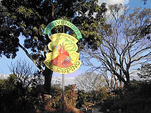
Ecoparque El Espino
Ecoparque El Espino is a nature park located at the base of the San Salvador Volcano. It is about 5.1 kilometers north of downtown Santa Tecla. The park is 35 hectares (about 86 acres) and has many pine and coffee trees.
You can do many activities here, like mountain biking. The park has three hiking trails, each taking about 45 minutes to walk. You'll see large, old trees and a 24-meter-long hanging bridge.
Many local birds like toucans live here. You might also see wild animals like armadillos and rabbits. One special spot is “El Infiernillo” (the little hell). Here, steam comes out from deep underground. The park uses special equipment to watch this volcanic activity. At the end of a walk, you can reach an outlook at 1,233 meters high. From there, you get an amazing view of the city.
Los Chorros
Los Chorros is a natural park about 5.7 kilometers west of Santa Tecla. It is a popular place for both local and international visitors. The park has 12 acres of land, with four acres open to the public.
Many water springs from the San Salvador volcano feed its four pools. One pool is for children, and another has slides. The park opened in 1952. It was created thanks to the idea of a Salvadoran poet, Raul Contreras.
Los Chorros has hosted big events, like Miss Universe in 1975. In 2001, earthquakes damaged the park, but it was rebuilt quickly. Today, you can find playgrounds, picnic areas, and walking trails. There are also ramps for people with disabilities.
Boqueron (San Salvador) Volcano
The Boqueron park is on top of the San Salvador volcano. It is about 13.6 kilometers from downtown Santa Tecla. The main attraction is a huge crater. It is 5 kilometers wide and 558 meters deep.
El Boquerón has cool weather all year. The park has many walking trails through pine trees. You can see beautiful flowers like hydrangeas. Wildlife here includes armadillos, raccoons, and deer.
If you are adventurous, you can hike down to “El Boqueroncito” inside the main crater. From there, you can see the “Picacho,” the highest point of the volcano. The volcano last erupted in 1917. This caused a lot of damage to nearby towns. Recently, the road to the volcano has been improved. New restaurants and coffee shops have opened, making it a great place to visit.
Sports and Recreation
In 2007, the Santa Tecla Fútbol Club was started. The city's mayor at the time, Óscar Ortiz, helped create it. The club moved up to the top football league in 2012.
They won their first championship in 2015. This allowed them to play in an international competition. They won again in 2016 and 2017. A famous player, Sebastián Abreu from Uruguay, helped them win these titles.
In 2015, Mayor Roberto d’Aubuisson Jr. focused on improving sports. He made green areas and parks better. These places became fun spots for families. The El Cafetalón park was improved. New parks like Adela Van Severen were built. These efforts helped promote sports in the city.
Santa Tecla now has several municipal sports schools:
- Football School
- Basketball School
- Indoor Volleyball School
- Beach Volleyball School
- Tae Kwon Do School
- Karate Do School
- Skateboarding Classes
- Aerobics Classes
- Boxing and Judo Classes
- Weightlifting Classes
- Wrestling Classes
- Handball Classes
- Padel Classes
Education in Santa Tecla
Santa Tecla has 104 schools. 34 are public schools, and 70 are private schools. In 2001, about 17,000 students were in public schools. This covered about 46% of all students aged 5 to 19.
Private schools have more buildings but teach fewer students. They cover about 42% of students. Some well-known private schools include:
- Cuscatlán British Academy (ABC): Teaches all classes in English.
- Lycée Français de San Salvador: Teaches all classes in French.
- Lamatepec School: A bilingual Catholic school for boys.
- Floresta: A bilingual Catholic school for girls.
Other important schools are Saint Cecilia Salesian School and St. Agnes School. Santa Tecla is home to the first Salesian institute in Central America, founded in 1899.
The city also has higher education options, like universities. The Higher School of Economy and Business (ESEN) is a well-known university here. Another is the Communications University Monica Herrera. It offers degrees in design, marketing, and communications.
Sister Cities
Santa Tecla has sister city relationships with:
 Gijon, Spain
 Nesodden, Norway
See also
 In Spanish: Santa Tecla (El Salvador) para niños
 | James Van Der Zee |
 | Alma Thomas |
 | Ellis Wilson |
 | Margaret Taylor-Burroughs |


