Sarn Badrig facts for kids

Sarn Badrig, also known as Sarn Padrig, is a long, natural ridge found under the sea in Cardigan Bay, off the west coast of Wales. Its name comes from the Welsh language and means 'St. Patrick's causeway'. It is one of several similar ridges in the area.
These underwater ridges are made of rocks and gravel. They were left behind by huge sheets of ice. This happened when the ice melted at the end of the last ice age.
What is Sarn Badrig?
Sarn Badrig is the longest of these underwater ridges. It stretches for about 20 kilometers (about 12 miles). It starts near Mochras Point, which is close to Harlech. From there, it goes southwest, running alongside the Llŷn Peninsula.
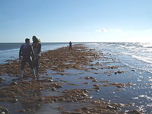
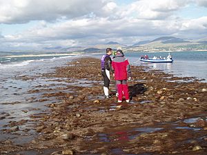
You can sometimes see parts of Sarn Badrig. This happens when the tide is very low. Because it is hidden under the water, it can be dangerous for ships. They need to be careful not to hit it.
Other Nearby Ridges
There are other similar underwater ridges in Cardigan Bay. One of them is called Sarn y Bwch. This ridge is located near the town of Tywyn. Another example is Sarn Gynfelyn. You can find this one north of Aberystwyth.
Legends About Sarn Badrig
In old Welsh stories, Sarn Badrig plays a special role. It is said to be one of the walls or dykes. These walls protected a legendary land called Cantre'r Gwaelod. This land was believed to be a rich and fertile kingdom. However, the stories say it was eventually lost to the sea.


