Mochras facts for kids
Quick facts for kids Mochras |
|
|---|---|
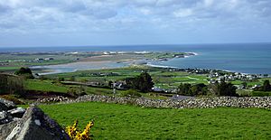
 Mochras above Llandanwg village |
|
| OS grid reference | SH552265 |
| Principal area | |
| Ceremonial county | |
| Country | Wales |
| Sovereign state | United Kingdom |
| Post town | LLANBEDR |
| Postcode district | LL45 |
| Dialling code | 01341 |
| Police | North Wales |
| Fire | North Wales |
| Ambulance | Welsh |
| EU Parliament | Wales |
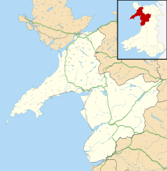
Mochras, often called Shell Island, is a special piece of land in Gwynedd, Wales. It's a peninsula, which means it's almost completely surrounded by water. Long ago, in 1819, a man named the Earl of Winchelsey changed where the River Artro flowed into the sea. This change helped create the peninsula we see today. Before this, people reached the area through the village of Llandanwg, which is now across the water.
Contents
Discover Shell Island
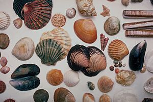
Shell Island is super famous for two main things: the huge variety of seashells that wash up on its beaches and its beautiful wildflowers. Some people even say it's connected to an old Welsh legend about a lost land called Cantre'r Gwaelod.

How to Get There
Getting to Shell Island by car is a bit of an adventure! You can only cross a special road called a causeway when the tide is out. This causeway goes right over the River Artro's estuary. But don't worry, if you're walking, you can always get there from the nearby Morfa Dyffryn beach. This beach stretches for miles south of the island. Emergency vehicles can use a special route through a nearby airfield anytime.
Camping Adventures
Shell Island has a very popular campsite. It's known for offering a unique "wild camping" experience. This means you can pitch your tent far away from other campers, giving you lots of space and privacy. You can even have campfires on the beach, which is a lot of fun! On the campsite itself, you can have raised fires or barbecues, but not open fires on the ground.
Nature and Seasons
Shell Island is part of the amazing Snowdonia National Park. Because of this, the campsite closes from the end of October until March. During these cooler months, local farmers bring their sheep from the lowlands to graze on the island. It's a peaceful time when the sheep get to enjoy the quiet landscape.
Island's Deep Secrets
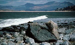
Shell Island is also important for scientists who study the Earth. Underneath the beach, there are very old rocks. In the late 1960s, scientists drilled a super deep hole, almost 2 kilometers down! They found much younger rocks on top of very ancient ones. This showed them that a huge fault, like a giant crack in the Earth's crust, runs through the area. It's a place where old and new parts of the Earth's history meet.
 | Madam C. J. Walker |
 | Janet Emerson Bashen |
 | Annie Turnbo Malone |
 | Maggie L. Walker |


