Saverton, Missouri facts for kids
Quick facts for kids
Saverton, Missouri
|
|
|---|---|

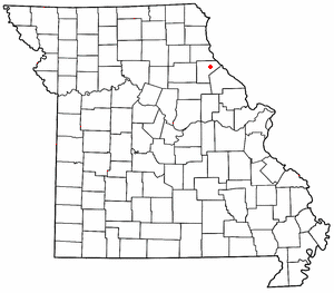
Location of Saverton in Missouri
|
|
| Country | United States |
| State | Missouri |
| County | Ralls |
| Area | |
| • Total | 1.27 sq mi (3.29 km2) |
| • Land | 0.96 sq mi (2.50 km2) |
| • Water | 0.31 sq mi (0.80 km2) |
| Elevation | 492 ft (150 m) |
| Population
(2020)
|
|
| • Total | 213 |
| • Density | 220.73/sq mi (85.23/km2) |
| FIPS code | 29-66062 |
| GNIS feature ID | 2806421 |
Saverton is a small community in eastern Ralls County, Missouri, United States. It's not an official city or town, but rather an unincorporated community. This means it doesn't have its own local government like a city does.
Saverton is located right next to the famous Mississippi River. It's about ten miles (16 km) southeast of the larger city of Hannibal. Saverton is considered part of the Hannibal Micropolitan Statistical Area. This means it's connected to Hannibal for things like jobs and services.
History of Saverton
Saverton was started way back in 1819. It was named after the Saverton family, who were probably important people living in the area at that time. A post office opened in Saverton in 1832. This helped people send and receive mail easily.
Saverton School's Special Status
The old Saverton School building is very important. In 1998, it was added to the National Register of Historic Places. This is a special list of buildings, sites, and objects in the United States that are important to history. Being on this list helps protect the school building for future generations.
People of Saverton
Population Numbers
The word "demographics" means facts about the people who live in a place. This includes how many people there are. According to the 2020 United States Census, 213 people lived in Saverton. This number helps us understand how the community has grown or changed over time.
| Historical population | |||
|---|---|---|---|
| Census | Pop. | %± | |
| 2020 | 213 | — | |
| U.S. Decennial Census | |||
 | Tommie Smith |
 | Simone Manuel |
 | Shani Davis |
 | Simone Biles |
 | Alice Coachman |

