Scale (ratio) facts for kids
The scale of a map or model helps us understand how big or small something is compared to its real size. It's like a special code that tells you the ratio between a distance on the map and the actual distance in the world.
For example, if a map has a scale of 1:50,000, it means that 1 cm on the map is actually 50,000 cm (or 500 m) in real life. So, if you measure 2 cm on that map, it would be 1000 m (1 kilometre) in the real world!
When you see a drawing, a model, or even a photo of something, the scale tells you how much the object has been "shrunk" or "grown" from its original size. A 1:25 scale model of a 30-meter-tall building would be 1.20 meters tall. It's much smaller, but it keeps the same proportions.

Contents
Understanding Scale
Scale is a way to show how big or small something is compared to its actual size. It's used in many different areas, from maps to models and even in science.
Scale in Maps
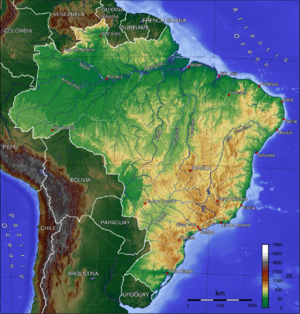
Maps use scale to fit large areas onto a smaller piece of paper or screen. A map's scale helps you figure out real distances. For instance, a map of a city might have a scale of 1:10,000. This means every 1 unit on the map is 10,000 units in the real world.
Scale in Models
Models are smaller versions of real objects. Think about toy cars or model airplanes. They are built to a certain scale. A 1:64 scale model car means the toy car is 64 times smaller than the real car. This helps them look just like the original, but in a size you can hold.
Scale Bars
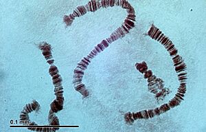
Scale bars are special lines on maps, diagrams, or images. They show you a specific distance, like "100 meters" or "1 micrometer." This is super helpful, especially for very tiny things like cells or very large things like galaxies. Scale bars help you quickly understand the size of what you are looking at without needing to do calculations.
Related Topics
More to Explore
- In Spanish: Escala (relación) para niños
 | William Lucy |
 | Charles Hayes |
 | Cleveland Robinson |


