
Scheduled monuments in Staffordshire facts for kids
Staffordshire, a county in England, is home to many amazing historical places called scheduled monuments. These are special archaeological sites or old buildings that are really important to the country's history. They are protected by law so they can be preserved for everyone to learn from and enjoy.
Contents
Discover Staffordshire's Ancient Wonders
What are Scheduled Monuments?
A scheduled monument is like a super important historical treasure. It could be an old castle, an ancient burial mound, or even the remains of a Roman camp. These sites are so important that the government gives them special protection. This means no one can change them without permission.
English Heritage is the group that helps find and list these special places. They work with the Secretary of State for Culture, Media and Sport to make sure these sites are safe. There are about 20,000 scheduled monuments across the United Kingdom! Sometimes, one entry on the list can even include more than one site.
A scheduled monument can also be a listed building. However, English Heritage often thinks that being a listed building offers even better protection for old buildings. If a monument is no longer considered important enough, it can be removed from the list.
Types of Ancient Sites in Staffordshire
Staffordshire has over 250 scheduled monuments! These include many different kinds of historical sites. You can find ancient burial mounds called barrows, old Roman camps, strong castles, and medieval moated sites (places surrounded by water for defense). Let's explore some cool examples!
Castles and Forts
Staffordshire has some fantastic castles and hillforts that tell stories of knights and ancient battles.
- Alton Castle is a grand castle located in Alton. It has a long history and is a great example of medieval architecture.
- Chartley Castle in Stowe-by-Chartley is another important castle. It also includes old water systems and garden remains.
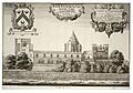
- Eccleshall Castle is found in Eccleshall. It's a historic site that once played a role in local power.
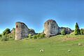
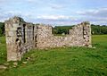
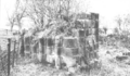
- Heighley Castle in Madeley is a fascinating ruin. It shows us what castles looked like long ago.
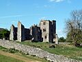
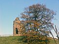
- Stafford Castle is a well-known landmark in Stafford. It's a great place to imagine life in the past.
- Tamworth Castle is in Tamworth. This castle has stood for centuries and seen many historical events.
- Tutbury Castle in Tutbury is another impressive castle. It has a rich history and offers great views.
Besides castles, there are also ancient hillforts. These were large, protected settlements built on hills.
- Berry Ring hillfort in Bradley is an example of an ancient fort.
- Castle Ring in Cannock Chase is a large hillfort. It was also used as a medieval hunting lodge.
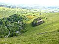
- Kinver Edge Hillfort in Kinver is another important hillfort. It was a strong, single-walled fort.
- There are also multivallate (multi-walled) hillforts like the one at Berth Hill in Maer and Bury Bank in Stone Rural.
Ancient Burial Mounds (Barrows)
Many scheduled monuments in Staffordshire are barrows. These are ancient burial mounds where people were buried long, long ago. They come in different shapes, like bowl barrows (shaped like an upside-down bowl) and long barrows.
- The Auctioneer's Mound in Loggerheads is a bowl barrow.
- There are many bowl barrows found across the Staffordshire Moorlands, like Blake Low bowl barrow and Brund Low bowl barrow.
- Longlow is a famous long barrow in Wetton.
Moated Sites
Moated sites are old homes or settlements that were surrounded by a ditch filled with water. This was a way to protect the people living there.
- Alley's Lane moated site in Church Eaton is an example.
- Bagot's Bromley moated manorial enclosure is another interesting site.
- Norbury Manor in Norbury is a moated site that also has eight fishponds.
- Sandon Old Hall moated site in Sandon is another important example.
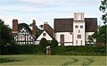
- The site of Old Madeley Manor in Madeley includes a moated site, a 16th-century house, gardens, and a watermill.
Roman and Industrial Sites
Staffordshire also has remains from the Roman period and early industrial times.
- The Roman site of Letocetum in Wall, Lichfield, was an important Roman settlement.
- There are also Roman camps near Swindon iron works and in Kinvaston.
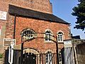
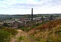
- Chatterley Whitfield Colliery in Stoke-on-Trent is a scheduled monument related to mining. It shows the county's industrial past.
- Consall Lime Kilns and the Copper mines on Ecton Hill are other examples of industrial heritage.
Crosses and Other Structures
Many ancient crosses are also protected. These often mark important places or were used for religious purposes.
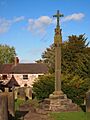
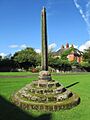
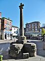
- Abbots Bromley market cross is a historic cross.
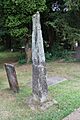
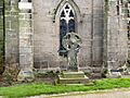
- Anglo-Scandinavian crosses are found in places like Chebsey, Alstonefield, and Ilam.
- The Butter Cross in Bradnop is another example of a historic cross.
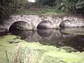
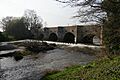
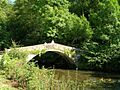
- Essex Bridge in Great Haywood is a beautiful old bridge.
- Brindley's Mill in Leek is a historic mill.
Staffordshire's scheduled monuments offer a fascinating look into the past, from prehistoric times to the medieval period and beyond. They are important reminders of the people and events that shaped the county.
Images for kids
-
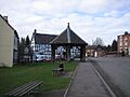
Abbots Bromley market cross
-
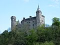
Alton Castle
-
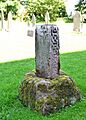
Anglo-Scandinavian cross fragment, St Peter's churchyard
-
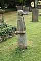
Anglo-Scandinavian cross, Church of the Holy Cross
-
Anglo-Scandinavian cross, Church of the Holy Cross
-
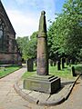
Anglo-Scandinavian cross, St Edward's Church
-
Anglo-Scandinavian cross, St Mary's churchyard
-
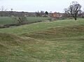
Bagot's Bromley moated manorial enclosure
-
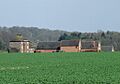
Boscobel House
-
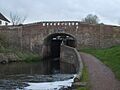
Bridge, towpath and lock on Staffordshire and Worcestershire Canal at Awbridge
-
Brindley's Mill
-
Burton upon Trent Abbey
-
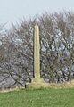
Butter Cross, Bradnop
-
Canal aqueduct
-
Castle Ring
-
Chartley Castle
-
Chatterley Whitfield Colliery
-
Churchyard cross, St Edward's churchyard
-
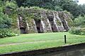
Consall Lime Kilns
-
Copper mines on Ecton Hill
-
Creswell Chapel
-
Cross in Rocester churchyard
-
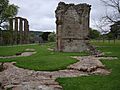
Croxden Abbey
-
Devil's Ring and Finger
-
Dieu-la-Cres Abbey (remains)
-
Dove Bridge
-
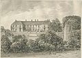
Eccleshall Castle
-
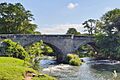
Ellastone Bridge
-
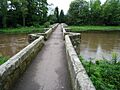
Essex Bridge, Great Haywood
-
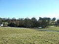
Garshall moated site
-
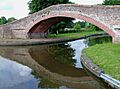
Great Haywood canal bridge No 109
-
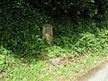
Greatgate Whipping Post
-
Hales Roman Villa
-
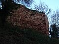
Heighley Castle
-
Kinver Edge Hillfort
-
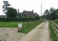
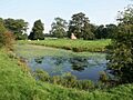
Littywood moated site
-
Market Cross
-
Norbury Manor
-
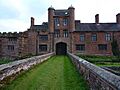
Pillaton Old Hall
-
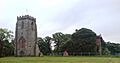
Ranton Priory
-
Sandon Old Hall moated site
-
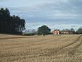
Shenstone Park moated site
-
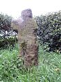
Shepherd's Cross
-
Site of Old Madeley Manor
-
St Bertram's Bridge, Ilam
-
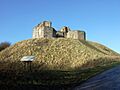
Stafford Castle
-
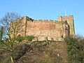
Tamworth Castle
-
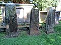
Three Anglo-Scandinavian crosses in St Mary's and All Saints' churchyard
-
Throwley Old Hall
-
Tutbury Castle
-
Roman site of Letocetum
-
Wychnor deserted medieval village

.jpg)

,_Ilam_Churchyard.jpg)


.jpg)


.jpg)


.jpg)


,_Leek.jpg)


.jpg)


