Selawik Lake facts for kids
Quick facts for kids Selawik Lake |
|
|---|---|

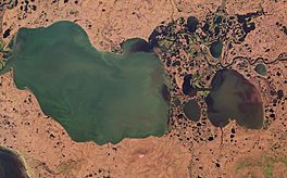
Satellite image of Selawik Lake by Sentinel-2
|
|
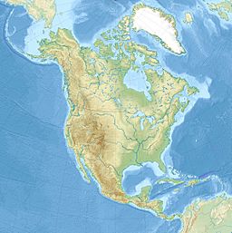
| Location | Northwest Arctic Borough, Alaska |
| Coordinates | 66°29′39″N 160°41′27″W / 66.49417°N 160.69083°W |
| Basin countries | United States |
| Max. length | 31 miles (50 km) |
| Surface area | 404 square miles (1,050 km2) |
| Surface elevation | 0 metres (0 ft) |
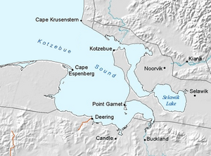
Selawik Lake is a large lake in Alaska, United States. Its name in the Inupiaq is Imaġruk. The lake is located about 7 miles (11 km) southwest of the town of Selawik, Alaska.
Selawik Lake is quite long, stretching about 31 miles (50 km). It covers a huge area of 404 square miles (1,046 square kilometers). The lake is next to the Selawik National Wildlife Refuge and the Baldwin Peninsula. Its waters flow into the Hotham Inlet and then into Kotzebue Sound.
This impressive lake is the third largest lake in Alaska. Only Iliamna Lake and Becharof Lake are bigger. It is also the seventeenth largest lake in the entire United States.
History of Selawik Lake's Name
The name of Selawik Lake has a long history. The first report of its name came between 1842 and 1844. This was from Lieutenant Lavrenty Zagoskin of the Imperial Russian Navy. He wrote the name as Chilivik.
He likely meant this name to refer to a local Eskimo tribe or village. Later, around 1850, the lake's name appeared again. This was during one of the expeditions searching for Sir John Franklin.
See also
 In Spanish: Lago Selawik para niños
 | Emma Amos |
 | Edward Mitchell Bannister |
 | Larry D. Alexander |
 | Ernie Barnes |


