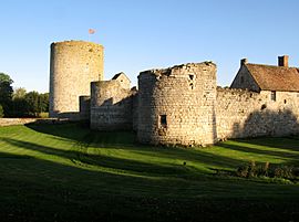
Seringes-et-Nesles facts for kids
Quick facts for kids
Seringes-et-Nesles
|
|
|---|---|
 |
|
| Country | France |
| Region | Hauts-de-France |
| Department | Aisne |
| Arrondissement | Château-Thierry |
| Canton | Fère-en-Tardenois |
| Intercommunality | Tardenois |
| Area
1
|
13.49 km2 (5.21 sq mi) |
| Population
(2008)
|
290 |
| • Density | 21.5/km2 (55.7/sq mi) |
| Time zone | UTC+01:00 (CET) |
| • Summer (DST) | UTC+02:00 (CEST) |
| INSEE/Postal code |
02713 /02130
|
| Elevation | 117–193 m (384–633 ft) (avg. 165 m or 541 ft) |
| 1 French Land Register data, which excludes lakes, ponds, glaciers > 1 km2 (0.386 sq mi or 247 acres) and river estuaries. | |
Seringes-et-Nesles is a small village, also known as a commune, located in the northern part of France. It is found in the Aisne department, which is part of the Picardie region.
About Seringes-et-Nesles
Seringes-et-Nesles is a quiet place with a small population. In 2008, about 290 people lived there. The village covers an area of 13.49 square kilometers.
Where is Seringes-et-Nesles?
This commune is located in the Aisne department. This department is in the Picardie region of France. It is situated in the northern part of the country.
The village is about 165 meters (around 541 feet) above sea level. The lowest point is 117 meters, and the highest point is 193 meters.
Who is the Mayor?
The mayor of Seringes-et-Nesles is Michel Alvoet. A mayor is an elected official. They are in charge of leading the local government of a town or village. Mr. Alvoet served as mayor from 2008 to 2014.
See also
 In Spanish: Seringes-et-Nesles para niños
 | James Van Der Zee |
 | Alma Thomas |
 | Ellis Wilson |
 | Margaret Taylor-Burroughs |


