Serra de Llaberia facts for kids
Quick facts for kids Serra de Llaberia |
|
|---|---|

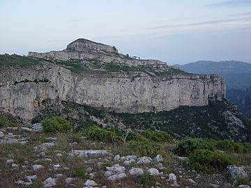
View of Mont-redon's massive karstic cliffs
|
|
| Highest point | |
| Elevation | 918.3 m (3,013 ft) |
| Geography | |
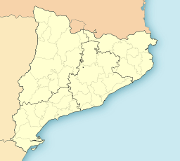
| Location | Baix Camp & Ribera d'Ebre, (Catalonia) |
| Parent range | Catalan Pre-Coastal Range |
| Geology | |
| Mountain type | Karstic |
| Climbing | |
| First ascent | Unknown |
| Easiest route | From Fatges or Tivissa |
The Serra de Llaberia is a mountain range found in Catalonia, Spain. It sits between the Prades Mountains and the Tivissa-Vandellòs Mountains. This area is known for its beautiful natural landscapes.
This mountain range is part of a larger group of mountains called the Catalan Pre-Coastal Range. It's like a smaller piece of a bigger puzzle!
Contents
What are the Main Peaks of Serra de Llaberia?
The highest points in the Serra de Llaberia are:
- Mola de Llaberia, which stands at 918.3 meters (about 3,013 feet) tall.
- La Miranda, almost as tall at 918 meters.
- Mont-redon, reaching 864 meters (about 2,835 feet).
These peaks offer amazing views of the surrounding areas.
How Did Serra de Llaberia Get Its Name?
The mountain range gets its name from a small village called Llaberia. This village is now part of the larger town of Tivissa. It's common for places to be named after nearby towns or features.
Are There Other Mountains Nearby?
Yes, there is a smaller mountain range called the Serra de Montalt. This range is actually a part of the main Serra de Llaberia. Think of it as a branch off the main mountain chain.
See also
 In Spanish: Sierra de Llabería para niños
- Montalt
- Catalan Pre-Coastal Range
- Mountains of Catalonia
 | Aaron Henry |
 | T. R. M. Howard |
 | Jesse Jackson |


