Shenandoah Farms, Virginia facts for kids
Quick facts for kids
Shenandoah Farms, Virginia
|
|
|---|---|
| Country | |
| State | |
| County | |
| Area | |
| • Total | 11.5 sq mi (29.7 km2) |
| • Land | 11.3 sq mi (29.3 km2) |
| • Water | 0.2 sq mi (0.4 km2) |
| Elevation | 800 ft (244 m) |
| Population
(2010)
|
|
| • Total | 3,033 |
| • Density | 268/sq mi (103.4/km2) |
| Time zone | UTC−5 (Eastern (EST)) |
| • Summer (DST) | UTC−4 (EDT) |
| ZIP codes |
22630, 22642
|
| FIPS code | 51-71810 |
| GNIS feature ID | 2629750 |
Shenandoah Farms is a special type of community in Warren County, Virginia, in the United States. A small part of it also reaches into Clarke County. It's called an "unincorporated community" because it doesn't have its own local government like a city or town. It's also a "census-designated place," which means the government counts its population for official records.
In 2010, about 3,033 people lived in Shenandoah Farms. It's a popular spot for fun and relaxation. The community is built on the western side of the Blue Ridge Mountain and right next to the Shenandoah River.
Contents
Where is Shenandoah Farms?
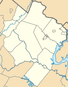
Shenandoah Farms is located in the northeastern part of Warren County. A small section of the community also extends into Clarke County. This area is in the state of Virginia, which is on the east coast of the United States.
Geographic Location
The community is nestled in a beautiful natural setting. It sits on the slopes of the Blue Ridge Mountain. The famous Shenandoah River flows nearby, adding to the scenic views. This location makes it a great place for outdoor activities.
Elevation and Coordinates
Shenandoah Farms is about 800 feet (244 meters) above sea level. You can find it on a map using these coordinates: 38 degrees 58 minutes 51 seconds North, and 78 degrees 2 minutes 47 seconds West. These numbers help pinpoint its exact spot on Earth.
What is a Census-Designated Place?
A census-designated place, or CDP, is an area that the United States Census Bureau identifies for statistical purposes. It's like a town or city, but it doesn't have its own local government. People who live in a CDP are usually part of a larger county government.
Why CDPs are Important
CDPs help the government collect information about where people live. This data is used for planning and understanding population trends. It helps show how many people live in certain areas, even if those areas aren't official cities or towns.
Population and Area
In 2010, the population of Shenandoah Farms was 3,033 people. This number helps us understand how many residents live in the community.
Size of the Community
The total area of Shenandoah Farms is about 29.7 square kilometers (11.5 square miles). Most of this area is land, about 29.3 square kilometers (11.3 square miles). A small part, about 0.4 square kilometers (0.2 square miles), is water.
Time Zone
Shenandoah Farms is in the Eastern Time Zone. This means that during most of the year, it follows Eastern Standard Time (EST). During EST, the time is 5 hours behind UTC (UTC-5).
Daylight Saving Time
In the warmer months, the community switches to Eastern Daylight Time (EDT). During EDT, the clocks are moved forward by one hour. This means the time is 4 hours behind UTC (UTC-4). This change helps make better use of daylight in the evenings.
See also
 In Spanish: Shenandoah Farms (Virginia) para niños
 | Laphonza Butler |
 | Daisy Bates |
 | Elizabeth Piper Ensley |


