
Clarke County, Virginia facts for kids
Quick facts for kids
Clarke County
|
|||
|---|---|---|---|
|
County
|
|||

Old Clarke County Courthouse and Confederate monument
|
|||
|
|||

Location within the U.S. state of Virginia
|
|||
 Virginia's location within the U.S. |
|||
| Country | |||
| State | |||
| Founded | 1836 | ||
| Named for | George Rogers Clark | ||
| Seat | Berryville | ||
| Largest town | Berryville | ||
| Area | |||
| • Total | 178 sq mi (460 km2) | ||
| • Land | 176 sq mi (460 km2) | ||
| • Water | 2.2 sq mi (6 km2) 1.2% | ||
| Population
(2020)
|
|||
| • Total | 14,783 | ||
| • Density | 83.05/sq mi (32.07/km2) | ||
| Time zone | UTC−5 (Eastern) | ||
| • Summer (DST) | UTC−4 (EDT) | ||
| Congressional district | 6th | ||


Clarke County is a county located in the state of Virginia. In 2020, about 14,783 people lived there. Its main town, or county seat, is Berryville. Clarke County is part of the larger Washington, D.C. area.
Contents
History of Clarke County
The first European settlement in what is now Clarke County happened in 1736. Thomas Fairfax, 6th Lord Fairfax of Cameron built a home called Greenway Court. This home was near a place now known as White Post. White Post got its name from a big signpost that showed the way to Lord Fairfax's house.
This area was once claimed by the Six Nations Iroquois people. They had taken control of the land around 1672. In 1744, the land was bought from them by Governor Gooch through the Treaty of Lancaster.
Many early settlers in Clarke County were children of wealthy farmers from eastern Virginia. They received large land grants from Lord Fairfax. About two-thirds of the county was settled by these farming families. This way of life, focused on large farms, continued until the American Civil War. Clarke County officially became a county in 1836. It was separated from Frederick County and was well-known for growing a lot of wheat.
During the American Civil War, a famous Confederate leader named John S. Mosby, also known as "the Gray Ghost," was active here. In the summer of 1864, he raided the supply train of Union General Philip Sheridan in Berryville. Two important battles also took place in Clarke County: the Battle of Cool Spring in July 1864 and the Battle of Berryville in September 1864.
In 1881, the Bank of Clarke County was started. It is still an active local bank today, with its main office in Berryville.
In the early 1900s, a future Virginia politician named Harry F. Byrd Sr. moved near Berryville with his wife. He became a successful farmer, growing peaches and apples. Byrd later became a state senator and then the Governor of Virginia. He also served as a United States senator for over 30 years.
In 1996, Forrest Pritchard helped bring new life to Smithfield Farm. He started raising animals in a natural, sustainable way. This farm, now called 'Smith Meadows', is one of the oldest farms in the U.S. that raises animals completely on grass. Its story was even told in a popular book.
Historic Buildings and Structures
Clarke County is home to many old and important buildings. These structures show the long history of the area.
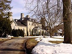
- Clermont Estate (1751)
- Dearmont Hall (1850)
- Fairfield (1765)
- Soldier's Rest (1769)
- Buck Marsh Church (1772)
- Norwood (1780)
- Burwell-Morgan Mill (1782)
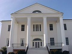
- Holy Cross Abbey (1784)
- Audley Estate (1794)
- Bel Voi (1803)
- Long Branch Plantation (1811)
- Rosemont Estate (1811)
- Clay Hill (1816)
- Smithfield Farm (1816)
- Clifton (1833)
- Clarke County Courthouse (1837)
- Stone's Chapel (1848)
- Glendale Farm (1850)
- Site of Mosby's Raid (1863)
Geography of Clarke County
Clarke County covers a total area of about 178 square miles. Most of this area, about 176 square miles, is land. The remaining 2.2 square miles (or 1.2%) is water. This makes it the third-smallest county in Virginia by total area.
Counties Nearby
Clarke County shares its borders with several other counties:
- Loudoun County, Virginia – To the East
- Warren County, Virginia – To the Southwest
- Fauquier County, Virginia – To the Southeast
- Frederick County, Virginia – To the West
- Jefferson County, West Virginia – To the North
Demographics
| Historical population | |||
|---|---|---|---|
| Census | Pop. | %± | |
| 1840 | 6,353 | — | |
| 1850 | 7,352 | 15.7% | |
| 1860 | 7,146 | −2.8% | |
| 1870 | 6,670 | −6.7% | |
| 1880 | 7,682 | 15.2% | |
| 1890 | 8,071 | 5.1% | |
| 1900 | 7,927 | −1.8% | |
| 1910 | 7,468 | −5.8% | |
| 1920 | 7,165 | −4.1% | |
| 1930 | 7,167 | 0.0% | |
| 1940 | 7,159 | −0.1% | |
| 1950 | 7,074 | −1.2% | |
| 1960 | 7,942 | 12.3% | |
| 1970 | 8,102 | 2.0% | |
| 1980 | 9,965 | 23.0% | |
| 1990 | 12,101 | 21.4% | |
| 2000 | 12,652 | 4.6% | |
| 2010 | 14,034 | 10.9% | |
| 2020 | 14,783 | 5.3% | |
| U.S. Decennial Census 1790–1960 1900–1990 1990–2000 2010 2020 |
|||
Population in 2020
The 2020 census showed the different groups of people living in Clarke County.
| Race / Ethnicity (NH = Non-Hispanic) | Pop 2010 | Pop 2020 | % 2010 | % 2020 |
|---|---|---|---|---|
| White alone (NH) | 12,387 | 12,309 | 88.26% | 83.26% |
| Black or African American alone (NH) | 742 | 564 | 5.29% | 3.82% |
| Native American or Alaska Native alone (NH) | 35 | 33 | 0.25% | 0.22% |
| Asian alone (NH) | 121 | 210 | 0.86% | 1.42% |
| Pacific Islander alone (NH) | 5 | 15 | 0.04% | 0.10% |
| Some Other Race alone (NH) | 15 | 89 | 0.11% | 0.60% |
| Mixed Race or Multi-Racial (NH) | 239 | 676 | 1.70% | 4.57% |
| Hispanic or Latino (any race) | 490 | 887 | 3.49% | 6.00% |
| Total | 14,034 | 14,783 | 100.00% | 100.00% |
Transportation
_from_the_overpass_for_Virginia_State_Route_7_(Harry_Byrd_Highway-Berryville_Bypass)_in_Stringtown,_Clarke_County,_Virginia.jpg)
Main Roads
Several important roads run through Clarke County:
 SR 7
SR 7 US 17
US 17 US 50
US 50 US 340
 SR 277
The Norfolk Southern Railway also has a train line, called the H-Line, that goes around the edge of Clarke County.
Services
- Handley Regional Library System provides library services to the county.
Communities
Clarke County has several towns and smaller communities.
Towns
Census-designated place
Other Communities
These are smaller, unincorporated communities in the county:
- Berrys
- Bethel
- Briggs
- Care Free Acres
- Castlemans Ferry
- Double Tollgate
- Frogtown
- Gaylord
- Greenway Court
- Lewisville
- Millwood
- Pigeon Hill
- Pine Grove
- Saratoga
- Swimley
- Wadesville
- Waterloo
- Webbtown
- White Post
- Wickliffe
Gallery
-
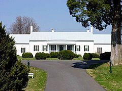
Fairfield Estate (1765)
-
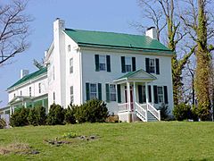
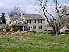
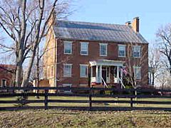
Soldier's Rest (1769)
-
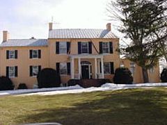
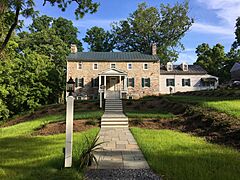
Norwood Estate (1780)
-
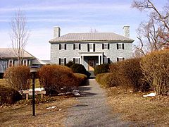
Holy Cross Abbey (1784)
-
Audley Estate (1794)
-
Bel Voi (1803)
-
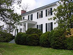
Rosemont Estate (1811)
-
Clay Hill (1816)
-
Clifton (1833)
-
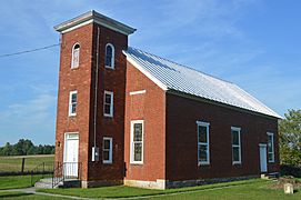
Stone's Chapel (1848)
-
Glendale Farm (1850)
-
The River House (c. 1790)


See also
 In Spanish: Condado de Clarke (Virginia) para niños
