Shumatuscacant River facts for kids
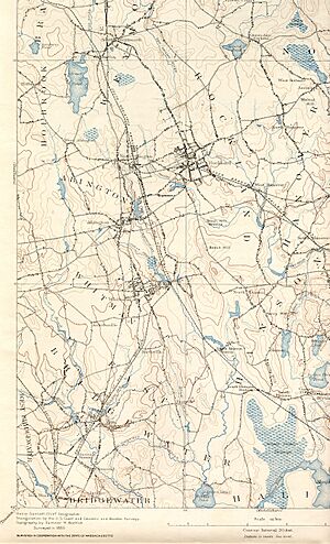
The Shumatuscacant River is a small river in Massachusetts. It is about 8.8 miles (14.2 kilometers) long. This river flows through the towns of Abington and Whitman, Massachusetts. It is an important part of the larger Taunton River Watershed.
Contents
What is the Shumatuscacant River?
The Shumatuscacant River begins in a wet, marshy area. This spot is just west of Vineyard Road in Abington. From there, the river flows into another stream called Poor Meadow Brook. This brook is located in Hanson.
Where Does the River Go?
Poor Meadow Brook then flows southwest into Robbins Pond. This pond is like a starting point for another river, the Satucket River. The Satucket River winds its way west. It eventually joins the Matfield River in East Bridgewater. Finally, the Matfield River flows into the main Taunton River. So, the Shumatuscacant River is a small but connected part of this bigger river system.
How Was Island Grove Pond Formed?
In the 1700s, people built a dam on the Shumatuscacant River. This dam created a pond known as Island Grove Pond. Dams are built to control water flow or create reservoirs. This pond has been a part of the river's history for hundreds of years.
Why Are Rivers Important?
Rivers like the Shumatuscacant are very important. They provide water for plants and animals. They also help shape the land around them. Rivers can be home to many different kinds of fish, birds, and other wildlife.
What is a Watershed?
A watershed is like a giant bowl. All the rain and snow that falls into this "bowl" eventually flows into one main river or lake. The Shumatuscacant River is part of the Taunton River Watershed. This means all the water from the Shumatuscacant and its smaller streams ends up in the Taunton River. Protecting watersheds helps keep our water clean.
 | William M. Jackson |
 | Juan E. Gilbert |
 | Neil deGrasse Tyson |


