Satucket River facts for kids
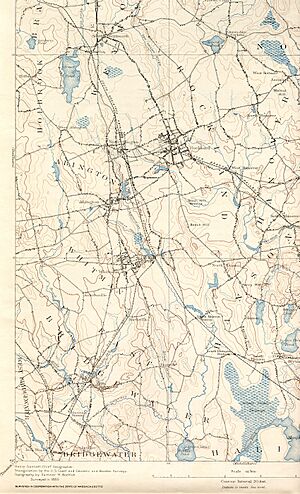
The Satucket River is a river in southeastern Massachusetts. It's about 5.5 miles (8.9 km) long and is part of the larger Taunton River Watershed. The river starts at Robbins Pond in East Bridgewater. From there, it flows west and eventually joins the Matfield River.
The Satucket River collects water from an area of about 34.9 square miles. This area includes parts of towns like Abington, Whitman, Hanson, East Bridgewater, and Halifax. The river's water often looks like tea because it has a lot of iron. It usually moves slowly and is quite shallow, reaching a depth of only about 8 feet (2.4 meters) in its deepest spots.
The river gets water from Poor Meadow Brook, which itself collects water from the Shumatuscacant River. Poor Meadow Brook then meets the Satucket River just below Robbins Pond. Robbins Pond is a 124-acre (50-hectare) pond in East Bridgewater. It's mostly shallow with a sandy bottom. Above Robbins Pond is Stump Brook, which flows from Monponsett Pond in Halifax. Stump Brook forms Robbins Pond, and then the Satucket River flows out of Robbins Pond.
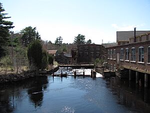
The Satucket River is very winding, meaning it has many twists and turns. It doesn't freeze in winter. Because it's not maintained, many fallen trees block the river, making it hard to travel by boat. The river doesn't have any dams working today, but it used to have one at the Murray Carver Mill. This small dam helped power a cotton gin by using a water wheel to make electricity. Because this old dam is no longer used, fish like river herring can't swim up 4.4 miles (7.1 km) of the river to Robbins Pond. This is a problem because the river and pond are good places for these fish to lay their eggs.
Contents
What Rivers Flow Into the Satucket?
The Satucket River has several smaller streams that flow into it. These are called tributaries.
- Poor Meadow Brook
- Stoney Brook
- Black Brook
History of the Satucket River
The path of water from Monponsett Pond, through Stump Brook, and into the Satucket River was once a very important travel route for the Wampanoag people. This waterway was part of their historic Canoe Passage and was used for many years. The Wampanoag could travel up the Taunton River from Mount Hope Bay, then cross over to the Satucket River, and finally reach the North River watershed, which led to Massachusetts Bay.
Later, in the early 1900s, the Satucket River played a big role in the local economy, especially for the Carver Cotton Gin Mill.
Amazing Wildlife of the Satucket River
The Satucket River is home to many different kinds of fish and other animals.
Fish Species
Some of the common fish you might find in the Satucket River include:
- Largemouth Bass
- Brook Trout
- Brown Trout
- Sun Fish
- Blue Gills
- Perch
- Catfish
- Pickerel
Sometimes, fish from the ocean, like stripers, swim upstream into the Satucket River. You might also see otters and other animals living near the river.
River Herring and Their Life Cycle
The Satucket River is part of the Taunton River Watershed, which is known for having many different fish species. The Taunton and Nemasket Rivers, for example, have 45 types of fish and support the largest group of alewife (a type of river herring) in Massachusetts.
In the past, the Satucket River was full of alewives. These fish would swim upstream from the ocean to lay their eggs in the river's slow-moving waters. Until the 1950s, alewives regularly came to the Satucket. However, because of changes in the environment over the years, they are not found in the Satucket waters anymore.
The Wampanoag people used alewives as a main food source. They built many "fish weirs" in the river to catch these fish. Some of these weirs still exist today. A weir is like a small dam made of rocks shaped like a "V" that points upstream. The Wampanoag would wait on the rocks. Fish would swim through the weir, and the only opening was at the tip of the "V," making it easy for the Native Americans to spear them.
 | Delilah Pierce |
 | Gordon Parks |
 | Augusta Savage |
 | Charles Ethan Porter |


