Sierra de San Carlos facts for kids
Quick facts for kids Sierra de San Carlos |
|
|---|---|
| Sierra Chiquita | |
| Geography | |
| Location | Tamaulipas, Mexico |
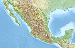
| Range coordinates | 24°20′N 99°02′W / 24.34°N 99.04°W |

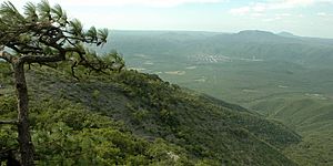
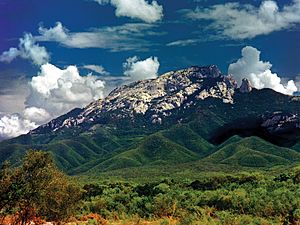
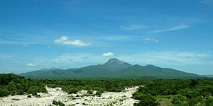
The Sierra de San Carlos, also known as the Sierra Chiquita (which means "Little Mountain Range"), is a group of mountains in the state of Tamaulipas, Mexico. It's a bit like an island of mountains, standing alone from other ranges. The weather here is mostly dry, which we call semi-arid.
The tallest point in this range is a peak called Cerro El Hongo. It stands at about 1,786 meters (5,859 feet) high. However, most of the Sierra de San Carlos is much lower, usually between 600 to 800 meters (2,000 to 2,600 feet) tall.
Contents
Where is the Sierra de San Carlos?
The Sierra de San Carlos is located southeast of the city of Linares, Mexico. It stretches about 80 kilometers (50 miles) from east to west and 32 kilometers (20 miles) from north to south. In total, it covers a large area of about 2,320 square kilometers (896 square miles).
You won't find any big highways or major rivers cutting through these mountains. There are also no large towns or cities directly within the Sierra. Most people living here either live in the countryside or in small villages.
Plants and Animals of the Sierra
The Sierra de San Carlos is home to five main types of plant life.
- Desert thorn shrubs are common in the driest areas. These plants are typical for northeastern Mexico and grow up to about 500 meters (1,600 feet) high.
- As you go a bit higher, between 365 to 610 meters (1,200 to 2,000 feet), you'll find a mix of thorn forests and grasslands.
- On the hillsides, at elevations from 520 to 915 meters (1,700 to 3,000 feet), there's a low deciduous forest. The trees here are usually about 7.6 meters (25 feet) tall.
- In the cooler, higher parts of the Sierra, above 800 meters (2,600 feet), you'll see oak-pine forests. These forests, made up of oak and pine trees, cover about 13% of the total area.
- Along streams and near water reservoirs, there are small areas of riparian forests. These are forests that grow near water. They have tall grasses and trees like hickory (Carya palmeri), which are more common in the United States.
Most of the forests in the Sierra are still in good condition. This is because the trees aren't usually good enough for cutting down and selling, so they remain untouched.
What is the Climate Like?
The Sierra de San Carlos has a semi-arid climate. This means it's quite dry, with hot summers and mild winters. On average, the Sierra gets about 700 millimeters (28 inches) of rain each year.
Most of the rain falls during the summer, from May to October. However, the winters here are not as dry as in many other parts of Mexico.
The weather in a small village called San Nicolás is a good example of the climate in the higher, cooler parts of the Sierra. According to climate experts, the higher areas have a "sub-tropical, humid, hot summers" climate. Lower areas are considered "semi-arid steppe with hot summers," which means they are dry grasslands with very hot summers.
| Climate data for San Nicolás, Tamaulipas. 24 41 36N, 98 49 46W. Elevation: 2,615 ft (797 m)(1950-2010) | |||||||||||||
|---|---|---|---|---|---|---|---|---|---|---|---|---|---|
| Month | Jan | Feb | Mar | Apr | May | Jun | Jul | Aug | Sep | Oct | Nov | Dec | Year |
| Record high °C (°F) | 38.0 (100.4) |
39.0 (102.2) |
43.0 (109.4) |
45.0 (113.0) |
42.0 (107.6) |
47.0 (116.6) |
42.0 (107.6) |
40.0 (104.0) |
39.0 (102.2) |
38.0 (100.4) |
37.0 (98.6) |
38.0 (100.4) |
47.0 (116.6) |
| Mean daily maximum °C (°F) | 19.8 (67.6) |
22.3 (72.1) |
25.2 (77.4) |
29.2 (84.6) |
31.2 (88.2) |
31.9 (89.4) |
32.1 (89.8) |
31.9 (89.4) |
29.5 (85.1) |
26.6 (79.9) |
23.8 (74.8) |
20.4 (68.7) |
27.0 (80.6) |
| Daily mean °C (°F) | 13.8 (56.8) |
15.7 (60.3) |
19.0 (66.2) |
22.1 (71.8) |
24.8 (76.6) |
25.9 (78.6) |
26.1 (79.0) |
26.0 (78.8) |
23.9 (75.0) |
21.0 (69.8) |
17.7 (63.9) |
14.6 (58.3) |
20.9 (69.6) |
| Mean daily minimum °C (°F) | 7.8 (46.0) |
9.1 (48.4) |
12.1 (53.8) |
15.1 (59.2) |
18.3 (64.9) |
19.9 (67.8) |
20.2 (68.4) |
20.0 (68.0) |
18.3 (64.9) |
15.3 (59.5) |
11.7 (53.1) |
8.8 (47.8) |
14.7 (58.5) |
| Record low °C (°F) | −5 (23) |
−7 (19) |
−1 (30) |
— | — | — | — | — | — | 2.0 (35.6) |
−2.0 (28.4) |
−7.0 (19.4) |
−5.0 (23.0) |
| Average precipitation mm (inches) | 35.0 (1.38) |
16.0 (0.63) |
19.0 (0.75) |
37.0 (1.46) |
79.0 (3.11) |
76.0 (2.99) |
72.0 (2.83) |
82.0 (3.23) |
149.0 (5.87) |
77.0 (3.03) |
28.0 (1.10) |
29.0 (1.14) |
700.0 (27.56) |
| Average precipitation days (≥ 0.1 mm) | 3.9 | 2.9 | 1.8 | 3.0 | 4.5 | 4.38 | 3.7 | 4.6 | 7.0 | 4.1 | 2.9 | 3.1 | 45.8 |
| Source: Weatherbase: San Nicolas, Tamaulipas | |||||||||||||
See also
 In Spanish: Sierra de San Carlos para niños
 | Kyle Baker |
 | Joseph Yoakum |
 | Laura Wheeler Waring |
 | Henry Ossawa Tanner |


